
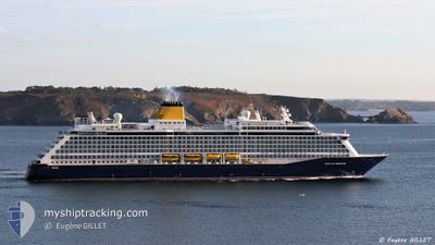
SPIRIT OF ADVENTURE
Not available
Current Trip
| Time Travelled | 20 h, 52 mins |
|---|---|
| Remaining Time | 2 days |
| Distance Travelled | 293.11 nm |
| Remaining Distance | 858.07 nm |
| AVG Speed | 13.9 Knopen |
| MAX Speed | 15 Knopen |
| AVG Wind | 10.7 knots |
| MAX Wind | 17 knots |
| MIN Temp | 13.7°C / 56.66°F |
| MAX Temp | 15.7°C / 60.26°F |
| Diepgang | 7.3 M |
| Positie ontvangen | 1 m geleden |
Current Position
| Lengtegraad | -9.88504° |
|---|---|
| Breedtegraat | 39.21836° |
| Status | Under way using engine |
| Snelheid | 13.6 Knopen |
| Koers | 1.4° |
| Gebied | North Atlantic Ocean |
| Station | T-AIS |
| Positie ontvangen | 1 m geleden |
Info
Information
The current position of SPIRIT OF ADVENTURE is in North Atlantic Ocean with coordinates 39.21836° / -9.88504° as reported on 2025-02-10 14:29 by AIS to our vessel tracker app. The vessel's current speed is 13.6 Knopen and is heading at the port of SOUTHAMPTON. The estimated time of arrival as calculated by MyShipTracking vessel tracking app is 2025-02-13 02:59 LT
The vessel SPIRIT OF ADVENTURE (IMO: 9818084, MMSI: 232026551) is a Not available It's sailing under the flag of [GB] United Kingdom.
In this page you can find informations about the vessels current position, last detected port calls, and current voyage information. If the vessels is not in coverage by AIS you will find the latest position.
The current position of SPIRIT OF ADVENTURE is detected by our AIS receivers and we are not responsible for the reliability of the data. The last position was recorded while the vessel was in Coverage by the Ais receivers of our vessel tracking app.
The current draught of SPIRIT OF ADVENTURE as reported by AIS is 7.3 meters
Weather
| Temperature | 14.8°C / 58.64°F |
|---|---|
| Wind Speed | 17 knots |
| Direction | 167° SSE |
| Pressure | 1016.4 hPa |
| Humidity | 85.3 % |
| Cloud Coverage | 100 % |
Featured Company
Last Port Calls
| Port | Arrival | Departure | Time In Port |
|---|---|---|---|
| 2025-02-09 06:21 | 2025-02-09 17:39 | 11 h | |
| 2025-02-05 06:42 | 2025-02-05 16:26 | 9 h | |
| 2025-02-03 05:09 | 2025-02-03 15:23 | 10 h | |
| 2025-02-02 05:28 | 2025-02-02 15:27 | 9 h | |
| 2025-02-01 04:25 | 2025-02-01 14:25 | 10 h | |
| 2025-01-30 04:37 | 2025-01-30 18:22 | 13 h | |
| 2025-01-27 06:17 | 2025-01-27 16:19 | 10 h | |
| 2025-01-24 06:27 | 2025-01-24 16:05 | 9 h | |
| 2025-01-20 06:37 | 2025-01-20 18:51 | 12 h | |
| 2025-01-16 06:21 | 2025-01-16 18:14 | 11 h |
Last Trips
| Origin | Departure | Destination | Arrival | Distance | |
|---|---|---|---|---|---|
| 2025-02-05 17:26 | 2025-02-09 07:21 | 1098.52 nm | |||
| 2025-02-03 17:23 | 2025-02-05 07:42 | 630.99 nm | |||
| 2025-02-02 17:27 | 2025-02-03 07:09 | 168.70 nm | |||
| 2025-02-01 17:25 | 2025-02-02 07:28 | 193.95 nm | |||
| 2025-01-30 20:22 | 2025-02-01 07:25 | 246.78 nm | |||
| 2025-01-27 17:19 | 2025-01-30 06:37 | 936.57 nm | |||
| 2025-01-24 17:05 | 2025-01-27 07:17 | 1000.74 nm | |||
| 2025-01-20 18:51 | 2025-01-24 07:27 | 1230.89 nm | |||
| 2025-01-16 19:14 | 2025-01-20 06:37 | 1142.63 nm | |||
| 2025-01-14 16:19 | 2025-01-16 07:21 | 590.32 nm |
Events
| Tijd | Evenement | Details | Positie / Bestemming | Info |
|---|---|---|---|---|
| 2025-02-10 06:23 | Status Changed | Under way using engine Default |
37.39233 / -9.47597
ES CAD > GBSOU
|
Snelheid: 14.1 kn Koers: 346° |
| 2025-02-10 05:31 | Status Changed | Default Under way using engine |
37.19512 / -9.41949
ES CAD > GBSOU
|
Snelheid: 14.1 kn Koers: 345.7° |
| 2025-02-10 05:24 | Status Changed | Under way using engine Default |
37.16591 / -9.41038
ES CAD > GBSOU
|
Snelheid: 14.2 kn Koers: 338° |
| 2025-02-10 05:19 | Binnenbereik |
37.16591 / -9.41038
North Atlantic Ocean
ES CAD > GBSOU
|
Snelheid: 14.1 kn Koers: 345.7° |
|
| 2025-02-10 03:59 | Status Changed | Default Under way using engine |
36.85995 / -9.27429
ES CAD > GBSOU
|
Snelheid: 14.1 kn Koers: 315.9° |
| 2025-02-10 03:51 | Buitenbereik |
36.83693 / -9.24684
North Atlantic Ocean
ES CAD > GBSOU
|
Snelheid: 14.1 kn Koers: 315.9° |
|
| 2025-02-10 03:18 | Status Changed | Under way using engine Default |
36.75306 / -9.13154
ES CAD > GBSOU
|
Snelheid: 13.9 kn Koers: 283° |
| 2025-02-10 03:15 | Status Changed | Default Under way using engine |
36.74934 / -9.11773
ES CAD > GBSOU
|
Snelheid: 13.8 kn Koers: 283.1° |
| 2025-02-10 03:10 | Status Changed | Under way using engine Default |
36.74473 / -9.09135
ES CAD > GBSOU
|
Snelheid: 13.9 kn Koers: 282° |
| 2025-02-10 02:55 | Status Changed | Default Under way using engine |
36.73231 / -9.02427
ES CAD > GBSOU
|
Snelheid: 13.9 kn Koers: 285.3° |