

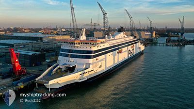
SPIRIT OF FRANCE
Ro-Ro/Passenger Ship

Current Trip
| Trip Time | 1 h, 23 mins |
|---|---|
| Trip Distance | 21.88 nm |
| AVG Speed | 17.7 Knopen |
| MAX Speed | 20 Knopen |
| Diepgang | 6.5 M |
| AVG Wind | 7.4 knots |
| MAX Wind | 9.2 knots |
| MIN Temp | 8.5°C / 47.3°F |
| MAX Temp | 9°C / 48.2°F |
| Positie ontvangen | 2 m geleden |
Current Position
| Lengtegraad | 1.86389° |
|---|---|
| Breedtegraat | 50.97051° |
| Status | Under way using engine |
| Snelheid | |
| Koers | 72° |
| Gebied | English Channel |
| Station | T-AIS |
| Positie ontvangen | 2 m geleden |
Information
The current position of SPIRIT OF FRANCE is in English Channel with coordinates 50.97051° / 1.86389° as reported on 2025-04-10 21:43 by AIS to our vessel tracker app. The vessel's current speed is 0 Knopen and is currently inside the port of CALAIS.
The vessel SPIRIT OF FRANCE (IMO: 9533816, MMSI: 209490000) is a Ro-Ro/Passenger Ship that was built in 2011 ( 14 Jaar oud ). It's sailing under the flag of [CY] Cyprus.
In this page you can find informations about the vessels current position, last detected port calls, and current voyage information. If the vessels is not in coverage by AIS you will find the latest position.
The current position of SPIRIT OF FRANCE is detected by our AIS receivers and we are not responsible for the reliability of the data. The last position was recorded while the vessel was in Coverage by the Ais receivers of our vessel tracking app.
The current draught of SPIRIT OF FRANCE as reported by AIS is 6.5 meters
Weather
| Temperature | 8.4°C / 47.12°F |
|---|---|
| Wind Speed | 4 knots |
| Direction | 60° ENE |
| Pressure | 1028.2 hPa |
| Humidity | 82.2 % |
| Cloud Coverage | 6 % |


Featured Company
Last Port Calls
| Port | Arrival | Departure | Time In Port |
|---|---|---|---|
| 2025-04-10 19:21 | |||
| 2025-04-10 16:09 | 2025-04-10 16:58 | 48 m | |
| 2025-04-10 10:33 | 2025-04-10 12:02 | 1 h | |
| 2025-04-10 08:54 | 2025-04-10 10:18 | 1 h | |
| 2025-04-10 05:05 | 2025-04-10 06:21 | 1 h | |
| 2025-04-09 19:40 | 2025-04-10 04:45 | 9 h | |
| 2025-04-09 15:39 | 2025-04-09 16:53 | 1 h | |
| 2025-04-09 10:29 | 2025-04-09 11:54 | 1 h | |
| 2025-04-09 08:54 | 2025-04-09 10:06 | 1 h | |
| 2025-04-09 05:03 | 2025-04-09 06:18 | 1 h |
Last Trips
| Origin | Departure | Destination | Arrival | Distance | |
|---|---|---|---|---|---|
| 2025-04-10 16:58 | 2025-04-10 19:21 | 21.88 nm | |||
| 2025-04-10 12:02 | 2025-04-10 16:09 | 44.84 nm | |||
| 2025-04-10 10:18 | 2025-04-10 10:33 | 20.64 nm | |||
| 2025-04-10 06:21 | 2025-04-10 08:54 | 24.11 nm | |||
| 2025-04-10 04:45 | 2025-04-10 05:05 | 21.31 nm | |||
| 2025-04-09 16:53 | 2025-04-09 19:40 | 21.97 nm | |||
| 2025-04-09 11:54 | 2025-04-09 15:39 | 45.21 nm | |||
| 2025-04-09 10:06 | 2025-04-09 10:29 | 21.22 nm | |||
| 2025-04-09 06:18 | 2025-04-09 08:54 | 21.93 nm | |||
| 2025-04-09 04:38 | 2025-04-09 05:03 | 21.25 nm |
Events
| Tijd | Evenement | Details | Positie / Bestemming | Info |
|---|---|---|---|---|
| 2025-04-10 21:36 | Status Changed | Under way using engine Default |
50.97051 / 1.86389
[FR] CALAIS
|
Snelheid: Koers: 72° |
| 2025-04-10 21:32 | Binnenbereik |
50.97051 / 1.86389
English Channel
[FR] CALAIS
|
Snelheid: Koers: 336° |
|
| 2025-04-10 17:26 | Stop beweging |
50.96737 / 1.85721
[FR] CALAIS
|
Snelheid: Koers: 107° |
|
| 2025-04-10 17:21 | Aankomsthaven |
|
50.96767 / 1.85611
[FR] CALAIS
|
Snelheid: 12.3 kn Koers: 99° |
| 2025-04-10 16:18 | Status Changed | Default Under way using engine |
51.07011 / 1.45857
DOVER>CALAIS>DOVER
|
Snelheid: 18.9 kn Koers: 126.8° |
| 2025-04-10 16:17 | Status Changed | Under way using engine Default |
51.07167 / 1.45519
DOVER>CALAIS>DOVER
|
Snelheid: 18.1 kn Koers: 126° |
| 2025-04-10 16:17 | Buitenbereik |
51.07167 / 1.45519
English Channel
|
Snelheid: 18.9 kn Koers: 126.8° |
|
| 2025-04-10 16:02 | Start beweging | 1.2 nm, South East of DOVER |
51.11248 / 1.35725
DOVER>CALAIS>DOVER
|
Snelheid: 15.2 kn Koers: 122° |
| 2025-04-10 16:02 | Binnenbereik |
51.07167 / 1.45519
English Channel
|
Snelheid: 18.9 kn Koers: 126.8° |
|
| 2025-04-10 15:58 | Vertrekhaven |
|
51.11248 / 1.35725
DOVER>CALAIS>DOVER
|
Snelheid: Koers: 138° |