

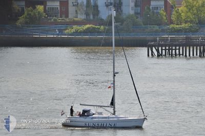
SUNSHINE
Sailing

Current Trip
SUNSHINE is out of coverage. Learn how you can join the community and extend the coverage to your area by clicking here!
Unknown
Destination Port
ETA*
---
| Time Travelled | 21 h, 11 mins |
|---|---|
| Remaining Time | --- |
| Distance Travelled | --- |
| Remaining Distance | --- |
| AVG Speed | --- |
| MAX Speed | --- |
| AVG Wind | --- |
| MAX Wind | --- |
| MIN Temp | --- |
| MAX Temp | --- |
| Diepgang | --- |
| Positie ontvangen | 20 h, 27 m geleden |
Current Position
| Lengtegraad | 5.36545° |
|---|---|
| Breedtegraat | 52.70100° |
| Status | Default |
| Snelheid | 3.2 Knopen |
| Koers | 289.3° |
| Gebied | North Sea |
| Station | T-AIS |
| Positie ontvangen | 20 h, 27 m geleden |
Information
The current position of SUNSHINE is in North Sea with coordinates 52.70100° / 5.36545° as reported on 2025-05-24 02:17 by AIS to our vessel tracker app. The vessel's current speed is 3.2 Knopen
The vessel SUNSHINE (MMSI: 244026103) is a Sailing It's sailing under the flag of [NL] Netherlands.
In this page you can find informations about the vessels current position, last detected port calls, and current voyage information. If the vessels is not in coverage by AIS you will find the latest position.
The current position of SUNSHINE is detected by our AIS receivers and we are not responsible for the reliability of the data. The last position was recorded while the vessel was in Coverage by the Ais receivers of our vessel tracking app.
Weather
| Temperature | 10.3°C / 50.54°F |
|---|---|
| Wind Speed | 14 knots |
| Direction | 205° SSW |
| Pressure | 1014.5 hPa |
| Humidity | 82.2 % |
| Cloud Coverage | 100 % |


Featured Company
Limited time offer - Install a base station receiver to your area and list your company on MyShipTracking Free forever!
Events
| Tijd | Evenement | Details | Positie / Bestemming | Info |
|---|---|---|---|---|
| 2025-05-24 02:17 | Buitenbereik |
52.70100 / 5.36545
North Sea
|
Snelheid: 3.2 kn Koers: 289.3° |
|
| 2025-05-24 02:17 | Binnenbereik |
52.70100 / 5.36545
North Sea
|
Snelheid: 3.2 kn Koers: 289.3° |
|
| 2025-05-24 01:33 | Vertrekhaven |
|
52.70100 / 5.36545
|
Snelheid: Koers: 511° |
| 2025-05-23 17:38 | Buitenbereik |
52.70495 / 5.30164
North Sea
[NL] ENKHUIZEN
|
Snelheid: Koers: 511° |
|
| 2025-05-23 17:36 | Binnenbereik |
52.70495 / 5.30167
North Sea
[NL] ENKHUIZEN
|
Snelheid: 0.1 kn Koers: 511° |
|
| 2025-05-23 17:36 | Aankomsthaven |
|
52.70495 / 5.30167
[NL] ENKHUIZEN
|
Snelheid: 1.7 kn Koers: 511° |
| 2025-05-23 14:17 | Buitenbereik |
52.70490 / 5.30208
North Sea
|
Snelheid: 1.7 kn Koers: 48.4° |
|
| 2025-05-23 08:08 | Start beweging | 0.76 nm, South of LEMMER |
52.83623 / 5.70288
|
Snelheid: 3.7 kn Koers: 257.8° |
| 2025-05-23 08:08 | Vertrekhaven |
|
52.83623 / 5.70288
|
Snelheid: 3.7 kn Koers: 271.2° |
| 2025-05-23 07:59 | Binnenbereik |
52.83746 / 5.70611
North Sea
[NL] LEMMER
|
Snelheid: 0.2 kn Koers: 511° |