

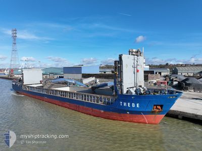
THEBE
General Cargo

Current Trip
| Time Travelled | 1 day |
|---|---|
| Remaining Time | 1 day |
| Distance Travelled | 403.10 nm |
| Remaining Distance | 348.88 nm |
| AVG Speed | 9.6 Knopen |
| MAX Speed | 11.1 Knopen |
| AVG Wind | 17.3 knots |
| MAX Wind | 33 knots |
| MIN Temp | 7.4°C / 45.32°F |
| MAX Temp | 12°C / 53.6°F |
| Diepgang | 4.6 M |
| Positie ontvangen | 13 h, 48 m geleden |
Current Position
| Lengtegraad | 5.48993° |
|---|---|
| Breedtegraat | 57.14991° |
| Status | Under way using engine |
| Snelheid | 9.7 Knopen |
| Koers | 153.5° |
| Gebied | North Sea |
| Station | T-AIS |
| Positie ontvangen | 13 h, 48 m geleden |
Information
The current position of THEBE is in North Sea with coordinates 57.14991° / 5.48993° as reported on 2025-05-24 21:55 by AIS to our vessel tracker app. The vessel's current speed is 9.7 Knopen and is heading at the port of DORDRECHT. The estimated time of arrival as calculated by MyShipTracking vessel tracking app is 2025-05-26 13:57 LT
The vessel THEBE (IMO: 9199696, MMSI: 304011026) is a General Cargo that was built in 2000 ( 25 Jaar oud ). It's sailing under the flag of [AG] Antigua Barbuda.
In this page you can find informations about the vessels current position, last detected port calls, and current voyage information. If the vessels is not in coverage by AIS you will find the latest position.
The current position of THEBE is detected by our AIS receivers and we are not responsible for the reliability of the data. The last position was recorded while the vessel was in Coverage by the Ais receivers of our vessel tracking app.
The current draught of THEBE as reported by AIS is 4.6 meters
Weather
| Temperature | 11.9°C / 53.42°F |
|---|---|
| Wind Speed | 21 knots |
| Direction | 216° SW |
| Pressure | 999.6 hPa |
| Humidity | 97.3 % |
| Cloud Coverage | 100 % |


Featured Company
Last Port Calls
| Port | Arrival | Departure | Time In Port |
|---|---|---|---|
| 2025-05-22 17:25 | 2025-05-23 16:27 | 23 h | |
| 2025-05-21 02:54 | 2025-05-21 17:57 | 15 h | |
| 2025-05-16 17:22 | 2025-05-17 09:26 | 16 h | |
| 2025-05-12 01:53 | 2025-05-14 21:33 | 2 d | |
| 2025-05-06 22:51 | 2025-05-07 17:03 | 18 h | |
| 2025-05-02 23:56 | 2025-05-03 15:02 | 15 h | |
| 2025-05-02 07:40 | 2025-05-02 18:16 | 10 h | |
| 2025-04-27 01:24 | 2025-04-27 10:43 | 9 h | |
| 2025-04-22 18:18 | 2025-04-22 20:22 | 2 h | |
| 2025-04-20 11:50 | 2025-04-22 17:27 | 2 d |
Last Trips
| Origin | Departure | Destination | Arrival | Distance | |
|---|---|---|---|---|---|
| 2025-05-21 17:57 | 2025-05-22 17:25 | 232.74 nm | |||
| 2025-05-17 09:26 | 2025-05-21 02:54 | 849.76 nm | |||
| 2025-05-14 21:33 | 2025-05-16 17:22 | 125.54 nm | |||
| 2025-05-07 17:03 | 2025-05-12 01:53 | 887.02 nm | |||
| 2025-05-03 15:02 | 2025-05-06 22:51 | 721.61 nm | |||
| 2025-05-02 18:16 | 2025-05-02 23:56 | 50.91 nm | |||
| 2025-04-27 10:43 | 2025-05-02 07:40 | 724.73 nm | |||
| 2025-04-22 20:22 | 2025-04-27 01:24 | 862.35 nm | |||
| 2025-04-22 17:27 | 2025-04-22 18:18 | 5.20 nm | |||
| 2025-04-20 11:22 | 2025-04-20 11:50 | 2.70 nm |
Events
| Tijd | Evenement | Details | Positie / Bestemming | Info |
|---|---|---|---|---|
| 2025-05-24 21:55 | Buitenbereik |
57.14991 / 5.48993
North Sea
NLDOR
|
Snelheid: 9.7 kn Koers: 153.5° |
|
| 2025-05-24 20:32 | Status Changed | Under way using engine Default |
57.35572 / 5.35578
NLDOR
|
Snelheid: 9.3 kn Koers: 156° |
| 2025-05-24 20:30 | Status Changed | Default Under way using engine |
57.36097 / 5.35166
NLDOR
|
Snelheid: 9.2 kn Koers: 155.8° |
| 2025-05-24 20:15 | Status Changed | Under way using engine Default |
57.39560 / 5.32319
NLDOR
|
Snelheid: 9.3 kn Koers: 156° |
| 2025-05-24 20:13 | Status Changed | Default Under way using engine |
57.40158 / 5.31820
NLDOR
|
Snelheid: 9.2 kn Koers: 155.9° |
| 2025-05-24 18:35 | Status Changed | Under way using engine Default |
57.62653 / 5.14317
NLDOR
|
Snelheid: 8.7 kn Koers: 161° |
| 2025-05-24 18:33 | Status Changed | Default Under way using engine |
57.63115 / 5.14017
NLDOR
|
Snelheid: 8.8 kn Koers: 166.1° |
| 2025-05-24 18:00 | ETA Changed | 2025/05/26 14:00 2025/05/26 13:00 |
57.71189 / 5.10560
NLDOR
|
Snelheid: 8.8 kn Koers: 167.5° |
| 2025-05-24 12:52 | Status Changed | Under way using engine Default |
58.45633 / 4.82963
NLDOR
|
Snelheid: 9.6 kn Koers: 174° |
| 2025-05-24 12:50 | Status Changed | Default Under way using engine |
58.46173 / 4.82866
NLDOR
|
Snelheid: 9.6 kn Koers: 174.7° |