
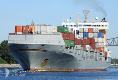
THETIS D
Container Ship
Current Trip
| Time Travelled | 11 mins |
|---|---|
| Remaining Time | 9 h, 33 mins |
| Distance Travelled | 1.75 nm |
| Remaining Distance | 101.21 nm |
| AVG Speed | --- |
| MAX Speed | --- |
| AVG Wind | 18 knots |
| MAX Wind | 22 knots |
| MIN Temp | 2.3°C / 36.14°F |
| MAX Temp | 2.8°C / 37.04°F |
| Diepgang | 8 M |
| Positie ontvangen | 2 m geleden |
Current Position
| Lengtegraad | 10.19133° |
|---|---|
| Breedtegraat | 54.38167° |
| Status | Under way using engine |
| Snelheid | 10.1 Knopen |
| Koers | 33° |
| Gebied | North Sea |
| Station | T-AIS |
| Positie ontvangen | 2 m geleden |
Info
Information
The current position of THETIS D is in North Sea with coordinates 54.38167° / 10.19133° as reported on 2025-02-11 12:15 by AIS to our vessel tracker app. The vessel's current speed is 10.1 Knopen and is heading at the port of KALUNDBORG. The estimated time of arrival as calculated by MyShipTracking vessel tracking app is 2025-02-11 21:51 LT
The vessel THETIS D (IMO: 9372274, MMSI: 209543000) is a Container Ship that was built in 2009 ( 16 Jaar oud ). It's sailing under the flag of [CY] Cyprus.
In this page you can find informations about the vessels current position, last detected port calls, and current voyage information. If the vessels is not in coverage by AIS you will find the latest position.
The current position of THETIS D is detected by our AIS receivers and we are not responsible for the reliability of the data. The last position was recorded while the vessel was in Coverage by the Ais receivers of our vessel tracking app.
The current draught of THETIS D as reported by AIS is 8 meters
Weather
| Temperature | 2.3°C / 36.14°F |
|---|---|
| Wind Speed | 22 knots |
| Direction | 103° ESE |
| Pressure | 1029 hPa |
| Humidity | 63.4 % |
| Cloud Coverage | 5 % |
Featured Company
Last Port Calls
| Port | Arrival | Departure | Time In Port |
|---|---|---|---|
| 2025-02-11 12:04 | 2025-02-11 12:07 | 3 m | |
| 2025-02-10 13:23 | 2025-02-10 21:21 | 7 h | |
| 2025-02-08 14:30 | 2025-02-10 05:21 | 1 d | |
| 2025-02-08 07:54 | 2025-02-08 09:10 | 1 h | |
| 2025-02-04 15:08 | 2025-02-05 22:51 | 1 d | |
| 2025-02-02 07:06 | 2025-02-02 07:10 | 3 m | |
| 2025-01-31 12:45 | 2025-02-01 18:31 | 1 d | |
| 2025-01-30 11:21 | 2025-01-31 04:33 | 17 h | |
| 2025-01-23 21:25 | 2025-01-29 10:31 | 5 d | |
| 2025-01-22 08:30 | 2025-01-23 11:31 | 1 d |
Most Visited Ports (Last year)
| Port | Arrivals | |
|---|---|---|
| 40 | ||
| 34 | ||
| 25 | ||
| 12 | ||
| 12 | ||
| 8 |
Last Trips
| Origin | Departure | Destination | Arrival | Distance | |
|---|---|---|---|---|---|
| 2025-02-10 22:21 | 2025-02-11 13:04 | 91.93 nm | |||
| 2025-02-10 06:21 | 2025-02-10 14:23 | 116.38 nm | |||
| 2025-02-08 10:10 | 2025-02-08 15:30 | 82.38 nm | |||
| 2025-02-06 00:51 | 2025-02-08 08:54 | 700.21 nm | |||
| 2025-02-02 08:10 | 2025-02-04 17:08 | 648.03 nm | |||
| 2025-02-01 19:31 | 2025-02-02 08:06 | 90.72 nm | |||
| 2025-01-31 05:33 | 2025-01-31 13:45 | 114.96 nm | |||
| 2025-01-29 11:31 | 2025-01-30 12:21 | 61.31 nm | |||
| 2025-01-23 12:31 | 2025-01-23 22:25 | 118.26 nm | |||
| 2025-01-22 06:01 | 2025-01-22 09:30 | 36.76 nm |
Events
| Tijd | Evenement | Details | Positie / Bestemming | Info |
|---|---|---|---|---|
| 2025-02-11 12:07 | Vertrekhaven |
|
54.36420 / 10.16886
DKKAL
|
Snelheid: 10.5 kn Koers: 61° |
| 2025-02-11 12:04 | Aankomsthaven |
|
54.36383 / 10.15350
[DE] KIEL
|
Snelheid: 9.8 kn Koers: 103° |
| 2025-02-11 12:01 | Start beweging | 1.32 nm, South West of STICKENHΟRN SPORT |
54.36580 / 10.14408
DKKAL
|
Snelheid: 3.2 kn Koers: 107° |
| 2025-02-11 11:29 | Stop beweging | 1.37 nm, South West of STICKENHΟRN SPORT |
54.36630 / 10.14106
DKKAL
|
Snelheid: 0.2 kn Koers: 105° |
| 2025-02-11 07:53 | Start beweging | 4.05 nm, South West of RENDSBURG |
54.26205 / 9.62309
DKKAL
|
Snelheid: 6.5 kn Koers: 21° |
| 2025-02-11 07:15 | Stop beweging | 4.16 nm, South West of RENDSBURG |
54.26009 / 9.62218
DKKAL
|
Snelheid: 0.3 kn Koers: 24° |
| 2025-02-11 02:03 | Start beweging | 0.62 nm, South West of BRUNSBUETTEL |
53.89523 / 9.14824
DKKAL
|
Snelheid: 3.2 kn Koers: 43° |
| 2025-02-11 01:26 | Stop beweging | 0.78 nm, South West of BRUNSBUETTEL |
53.89346 / 9.14487
DKKAL
|
Snelheid: 0.3 kn Koers: 45° |
| 2025-02-10 21:21 | Vertrekhaven |
|
53.54548 / 9.85574
DKKAL
|
Snelheid: 7.8 kn Koers: 287° |
| 2025-02-10 21:06 | Start beweging |
53.54014 / 9.91040
[DE] HAMBURG
|
Snelheid: 5.5 kn Koers: 286° |