
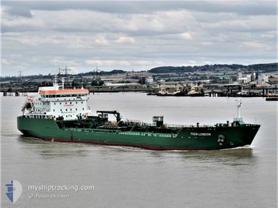
THUN LONDON
Tanker
Current Trip
| Time Travelled | 8 h, 40 mins |
|---|---|
| Remaining Time | 2 h, 46 mins |
| Distance Travelled | 69.23 nm |
| Remaining Distance | 50.53 nm |
| AVG Speed | 9.1 Knopen |
| MAX Speed | 11.8 Knopen |
| AVG Wind | 11.4 knots |
| MAX Wind | 14 knots |
| MIN Temp | 4.1°C / 39.38°F |
| MAX Temp | 7.2°C / 44.96°F |
| Diepgang | 6.5 M |
| Positie ontvangen | 3 h, 59 m geleden |
Current Position
| Lengtegraad | -5.79185° |
|---|---|
| Breedtegraat | 52.71287° |
| Status | Under way using engine |
| Snelheid | 10.6 Knopen |
| Koers | 166.7° |
| Gebied | Irish Sea and St. George's Channel |
| Station | T-AIS |
| Positie ontvangen | 3 h, 59 m geleden |
Info
Information
The current position of THUN LONDON is in Irish Sea and St. George's Channel with coordinates 52.71287° / -5.79185° as reported on 2025-02-13 00:08 by AIS to our vessel tracker app. The vessel's current speed is 10.6 Knopen and is heading at the port of PEMBROKE. The estimated time of arrival as calculated by MyShipTracking vessel tracking app is 2025-02-13 06:53 LT
The vessel THUN LONDON (IMO: 9828986, MMSI: 244056000) is a Tanker It's sailing under the flag of [NL] Netherlands.
In this page you can find informations about the vessels current position, last detected port calls, and current voyage information. If the vessels is not in coverage by AIS you will find the latest position.
The current position of THUN LONDON is detected by our AIS receivers and we are not responsible for the reliability of the data. The last position was recorded while the vessel was in Coverage by the Ais receivers of our vessel tracking app.
The current draught of THUN LONDON as reported by AIS is 6.5 meters
Weather
| Temperature | 6.5°C / 43.7°F |
|---|---|
| Wind Speed | 13 knots |
| Direction | 117° ESE |
| Pressure | 1021.9 hPa |
| Humidity | 66.4 % |
| Cloud Coverage | 93 % |
Featured Company
Last Port Calls
| Port | Arrival | Departure | Time In Port |
|---|---|---|---|
| 2025-02-11 20:36 | 2025-02-12 19:27 | 22 h | |
| 2025-02-10 00:45 | 2025-02-11 03:39 | 1 d | |
| 2025-02-08 14:31 | 2025-02-09 15:44 | 1 d | |
| 2025-02-07 00:31 | 2025-02-08 01:34 | 1 d | |
| 2025-02-05 15:41 | 2025-02-06 14:02 | 22 h | |
| 2025-02-02 23:21 | 2025-02-03 23:27 | 1 d | |
| 2025-02-01 00:26 | 2025-02-02 04:14 | 1 d | |
| 2025-01-17 11:01 | 2025-01-19 07:38 | 1 d | |
| 2025-01-15 04:42 | 2025-01-16 12:18 | 1 d | |
| 2025-01-12 16:55 | 2025-01-13 20:12 | 1 d |
Last Trips
| Origin | Departure | Destination | Arrival | Distance | |
|---|---|---|---|---|---|
| 2025-02-11 03:39 | 2025-02-11 20:36 | 135.09 nm | |||
| 2025-02-09 15:44 | 2025-02-10 00:45 | 93.60 nm | |||
| 2025-02-08 01:34 | 2025-02-08 14:31 | 46.31 nm | |||
| 2025-02-06 14:02 | 2025-02-07 00:31 | 106.23 nm | |||
| 2025-02-03 23:27 | 2025-02-05 15:41 | 152.40 nm | |||
| 2025-02-02 04:14 | 2025-02-02 23:21 | 135.62 nm | |||
| 2025-01-19 07:38 | 2025-02-01 00:26 | 244.81 nm | |||
| 2025-01-16 12:18 | 2025-01-17 11:01 | 232.80 nm | |||
| 2025-01-13 20:12 | 2025-01-15 04:42 | 113.49 nm | |||
| 2025-01-12 08:11 | 2025-01-12 16:55 | 105.19 nm |
Events
| Tijd | Evenement | Details | Positie / Bestemming | Info |
|---|---|---|---|---|
| 2025-02-13 00:11 | Status Changed | Default Under way using engine |
52.70281 / -5.78801
GB PEM
|
Snelheid: 10.6 kn Koers: 166.7° |
| 2025-02-13 00:08 | Buitenbereik |
52.71287 / -5.79185
Irish Sea and St. George's Channel
GB PEM
|
Snelheid: 10.6 kn Koers: 166.7° |
|
| 2025-02-13 00:05 | Status Changed | Under way using engine Default |
52.72145 / -5.79519
GB PEM
|
Snelheid: 10.5 kn Koers: 167° |
| 2025-02-12 23:59 | Status Changed | Default Under way using engine |
52.73711 / -5.80127
GB PEM
|
Snelheid: 10.6 kn Koers: 166.3° |
| 2025-02-12 19:27 | Vertrekhaven |
|
53.34380 / -6.17451
GB PEM
|
Snelheid: 8.3 kn Koers: 89° |
| 2025-02-12 19:17 | Start beweging |
53.34403 / -6.20479
[IE] DUBLIN
|
Snelheid: 3.8 kn Koers: 95° |
|
| 2025-02-12 19:06 | Status Changed | Under way using engine Default |
53.34471 / -6.20737
[IE] DUBLIN
|
Snelheid: 1.1 kn Koers: 174° |
| 2025-02-12 18:53 | Draught Changed | 6.5 8.5 |
53.34637 / -6.20695
[IE] DUBLIN
|
Snelheid: Koers: 184° |
| 2025-02-12 18:53 | Destination Changed | GB PEM IE DUB |
53.34637 / -6.20695
[IE] DUBLIN
|
Snelheid: Koers: 184° |
| 2025-02-12 18:53 | ETA Changed | 2025/02/13 07:00 2025/02/11 15:00 |
53.34637 / -6.20695
[IE] DUBLIN
|
Snelheid: Koers: 184° |