
TIDE NAVIGATOR
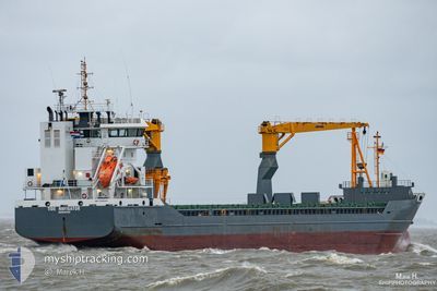
General Cargo
Current Trip
| Time Travelled | 1 day |
|---|---|
| Remaining Time | --- |
| Distance Travelled | 62.38 nm |
| Remaining Distance | --- |
| AVG Speed | 9.7 Knopen |
| MAX Speed | 13.1 Knopen |
| AVG Wind | 11.4 knots |
| MAX Wind | 15 knots |
| MIN Temp | -13.6°C / 7.52°F |
| MAX Temp | -9°C / 15.8°F |
| Diepgang | 5 M |
| Positie ontvangen | 3 d geleden |
Current Position
| Lengtegraad | 21.06182° |
|---|---|
| Breedtegraat | 61.36677° |
| Status | Under way using engine |
| Snelheid | 11.1 Knopen |
| Koers | 349° |
| Gebied | Gulf of Bothnia |
| Station | T-AIS |
| Positie ontvangen | 3 d geleden |
Info
Information
The current position of TIDE NAVIGATOR is in Gulf of Bothnia with coordinates 61.36677° / 21.06182° as reported on 2025-02-12 16:21 by AIS to our vessel tracker app. The vessel's current speed is 11.1 Knopen and is heading at the port of RAUMA. The estimated time of arrival as calculated by MyShipTracking vessel tracking app is 2025-02-13 22:00 LT
The vessel TIDE NAVIGATOR (IMO: 9526083, MMSI: 245086000) is a General Cargo that was built in 2011 ( 14 Jaar oud ). It's sailing under the flag of [NL] Netherlands.
In this page you can find informations about the vessels current position, last detected port calls, and current voyage information. If the vessels is not in coverage by AIS you will find the latest position.
The current position of TIDE NAVIGATOR is detected by our AIS receivers and we are not responsible for the reliability of the data. The last position was recorded while the vessel was in Coverage by the Ais receivers of our vessel tracking app.
The current draught of TIDE NAVIGATOR as reported by AIS is 5 meters
Weather
| Temperature | -8.4°C / 16.88°F |
|---|---|
| Wind Speed | 7 knots |
| Direction | 315° NW |
| Pressure | 1018.2 hPa |
| Humidity | 94.1 % |
| Cloud Coverage | 100 % |
Featured Company
Last Port Calls
| Port | Arrival | Departure | Time In Port |
|---|---|---|---|
| 2025-02-14 01:21 | 2025-02-15 00:41 | 23 h | |
| 2025-02-12 04:57 | 2025-02-12 16:25 | 11 h | |
| 2025-02-08 10:05 | 2025-02-10 22:53 | 2 d | |
| 2025-01-15 17:41 | 2025-01-17 19:08 | 2 d | |
| 2024-12-25 18:01 | 2024-12-30 08:55 | 4 d | |
| 2024-12-07 22:21 | 2024-12-08 11:26 | 13 h |
Most Visited Ports (Last year)
| Port | Arrivals | |
|---|---|---|
| 5 | ||
| 4 | ||
| 2 | ||
| 2 | ||
| 2 | ||
| 2 |
Last Trips
| Origin | Departure | Destination | Arrival | Distance | |
|---|---|---|---|---|---|
| 2025-02-12 16:25 | 2025-02-14 01:21 | 330.69 nm | |||
| 2025-02-10 22:53 | 2025-02-12 04:57 | 291.71 nm | |||
| 2025-01-17 19:08 | 2025-02-08 10:05 | 5184.03 nm | |||
| 2024-12-30 08:55 | 2025-01-15 17:41 | 3041.59 nm | |||
| 2024-12-08 11:26 | 2024-12-25 18:01 | 4696.59 nm | |||
| 2024-11-30 13:29 | 2024-12-07 22:21 | 1900.30 nm |
Events
| Tijd | Evenement | Details | Positie / Bestemming | Info |
|---|---|---|---|---|
| 2025-02-15 10:21 | Stop beweging |
65.78903 / 23.28263
FI RAU
|
Snelheid: 0.3 kn Koers: 21° |
|
| 2025-02-15 09:53 | Start beweging | 20.65 nm, West of ROYTTA |
65.76080 / 23.32371
FI RAU
|
Snelheid: 8.1 kn Koers: 337° |
| 2025-02-15 07:37 | Stop beweging | 20.33 nm, West of ROYTTA |
65.74775 / 23.33626
FI RAU
|
Snelheid: 0.1 kn Koers: 339° |
| 2025-02-15 03:26 | Start beweging | 15.71 nm, South West of AJOS |
65.43264 / 24.20405
FI RAU
|
Snelheid: 4.1 kn Koers: 235° |
| 2025-02-15 02:01 | Stop beweging | 15.2 nm, South West of AJOS |
65.43987 / 24.21499
FI RAU
|
Snelheid: 0.1 kn Koers: 228° |
| 2025-02-15 01:57 | Start beweging | 14.86 nm, South West of AJOS |
65.44392 / 24.22527
FI RAU
|
Snelheid: 5.7 kn Koers: 225° |
| 2025-02-15 01:49 | Stop beweging | 14.58 nm, South West of AJOS |
65.44718 / 24.23404
FI RAU
|
Snelheid: 0.2 kn Koers: 227° |
| 2025-02-15 01:45 | Start beweging | 14.53 nm, South West of AJOS |
65.44790 / 24.23558
FI RAU
|
Snelheid: 4.2 kn Koers: 224° |
| 2025-02-15 00:33 | Stop beweging | 14.24 nm, South West of AJOS |
65.45100 / 24.24567
FI RAU
|
Snelheid: Koers: 228° |
| 2025-02-14 23:37 | Start beweging | 7.09 nm, South of AJOS |
65.54692 / 24.43539
FI RAU
|
Snelheid: 6 kn Koers: 205° |