

TIM
Wing in ground

Current Trip
ARA - BAZEL
Unknown Port
ETA*
---
| Time Travelled | 4 h, 30 mins |
|---|---|
| Remaining Time | --- |
| Distance Travelled | 15.71 nm |
| Remaining Distance | --- |
| AVG Speed | 3.8 Knopen |
| MAX Speed | 7.1 Knopen |
| AVG Wind | 2.2 knots |
| MAX Wind | 6.2 knots |
| MIN Temp | 12.2°C / 53.96°F |
| MAX Temp | 19.4°C / 66.92°F |
| Diepgang | 0 M |
| Positie ontvangen | 1 m geleden |
Current Position
| Lengtegraad | 8.08017° |
|---|---|
| Breedtegraat | 48.79715° |
| Status | Under way using engine |
| Snelheid | 7 Knopen |
| Koers | 227.5° |
| Gebied | North Sea |
| Station | T-AIS |
| Positie ontvangen | 1 m geleden |
Information
The current position of TIM is in North Sea with coordinates 48.79715° / 8.08017° as reported on 2025-05-13 10:47 by AIS to our vessel tracker app. The vessel's current speed is 7 Knopen
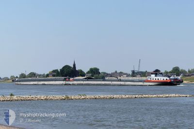
The vessel TIM (MMSI: 244700399) is a Wing in ground It's sailing under the flag of [NL] Netherlands.
In this page you can find informations about the vessels current position, last detected port calls, and current voyage information. If the vessels is not in coverage by AIS you will find the latest position.
The current position of TIM is detected by our AIS receivers and we are not responsible for the reliability of the data. The last position was recorded while the vessel was in Coverage by the Ais receivers of our vessel tracking app.
Weather
| Temperature | 18.5°C / 65.3°F |
|---|---|
| Wind Speed | 5 knots |
| Direction | --- N |
| Pressure | 1016.2 hPa |
| Humidity | 60.7 % |
| Cloud Coverage | 26 % |


Featured Company
Limited time offer - Install a base station receiver to your area and list your company on MyShipTracking Free forever!
Last Port Calls
| Port | Arrival | Departure | Time In Port |
|---|---|---|---|
| 2025-05-12 19:46 | 2025-05-13 08:19 | 12 h | |
| 2025-05-10 00:15 | 2025-05-10 01:01 | 46 m | |
| 2025-05-09 22:27 | 2025-05-09 22:55 | 27 m | |
| 2025-05-09 12:05 | 2025-05-09 20:07 | 8 h | |
| 2025-05-08 15:26 | 2025-05-09 11:57 | 20 h | |
| 2025-05-08 14:40 | 2025-05-08 15:17 | 37 m | |
| 2025-05-08 11:31 | 2025-05-08 12:06 | 35 m | |
| 2025-05-08 09:50 | 2025-05-08 10:17 | 26 m | |
| 2025-05-07 23:20 | 2025-05-08 00:01 | 41 m | |
| 2025-05-04 18:20 | 2025-05-05 02:07 | 7 h |
Most Visited Ports (Last year)
| Port | Arrivals | |
|---|---|---|
| 56 | ||
| 34 | ||
| 27 | ||
| 22 | ||
| 14 | ||
| 8 |
Last Trips
| Origin | Departure | Destination | Arrival | Distance | |
|---|---|---|---|---|---|
| 2025-05-10 01:01 | 2025-05-12 19:46 | 286.02 nm | |||
| 2025-05-09 22:55 | 2025-05-10 00:15 | 9.02 nm | |||
| 2025-05-09 20:07 | 2025-05-09 22:27 | 17.77 nm | |||
| 2025-05-09 11:57 | 2025-05-09 12:05 | 1.04 nm | |||
| 2025-05-08 15:17 | 2025-05-08 15:26 | 0.83 nm | |||
| 2025-05-08 12:06 | 2025-05-08 14:40 | 17.34 nm | |||
| 2025-05-08 10:17 | 2025-05-08 11:31 | 8.21 nm | |||
| 2025-05-08 00:01 | 2025-05-08 09:50 | 71.64 nm | |||
| 2025-05-05 02:07 | 2025-05-07 23:20 | 253.15 nm | |||
| 2025-05-02 04:04 | 2025-05-04 18:20 | 282.90 nm |
Events
| Tijd | Evenement | Details | Positie / Bestemming | Info |
|---|---|---|---|---|
| 2025-05-13 10:28 | Start beweging | 5.56 nm, South of MUNCHHAUSEN |
48.82839 / 8.11230
ARA - BAZEL
|
Snelheid: 6.5 kn Koers: 196.5° |
| 2025-05-13 10:26 | Status Changed | Under way using engine Default |
48.83121 / 8.11316
ARA - BAZEL
|
Snelheid: Koers: -1° |
| 2025-05-13 10:21 | Status Changed | Default Under way using engine |
48.83192 / 8.11343
ARA - BAZEL
|
Snelheid: 3.6 kn Koers: 180.8° |
| 2025-05-13 10:21 | Stop beweging | 5.34 nm, South of MUNCHHAUSEN |
48.83192 / 8.11343
ARA - BAZEL
|
Snelheid: Koers: -1° |
| 2025-05-13 06:19 | Vertrekhaven |
|
49.00978 / 8.29654
ARA - BAZEL
|
Snelheid: 3.9 kn Koers: 202.9° |
| 2025-05-13 06:13 | Start beweging |
49.01598 / 8.29936
[DE] KARLSRUHE
|
Snelheid: 3.1 kn Koers: 195.6° |
|
| 2025-05-13 06:09 | Status Changed | Under way using engine Moored |
49.01850 / 8.30016
[DE] KARLSRUHE
|
Snelheid: 1.3 kn Koers: 511° |
| 2025-05-13 06:08 | Status Changed | Moored Under way using engine |
49.01874 / 8.30030
[DE] KARLSRUHE
|
Snelheid: 0.1 kn Koers: 511° |
| 2025-05-13 06:08 | Stop beweging |
49.01880 / 8.30031
[DE] KARLSRUHE
|
Snelheid: 0.1 kn Koers: 511° |
|
| 2025-05-13 06:06 | Start beweging |
49.01765 / 8.30016
[DE] KARLSRUHE
|
Snelheid: 3.1 kn Koers: 353.2° |