
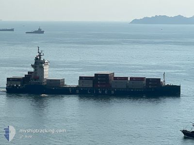
TS HAKATA
Cargo D
Current Trip
| Trip Time | 3 days |
|---|---|
| Trip Distance | 1155.77 nm |
| AVG Speed | 12.4 Knopen |
| MAX Speed | 17.6 Knopen |
| Diepgang | 8.6 M |
| AVG Wind | 17.2 knots |
| MAX Wind | 34 knots |
| MIN Temp | -1°C / 30.2°F |
| MAX Temp | 18°C / 64.4°F |
| Positie ontvangen | 12 h, 50 m geleden |
Current Position
| Lengtegraad | 121.74359° |
|---|---|
| Breedtegraat | 25.18514° |
| Status | Under way using engine |
| Snelheid | 9.3 Knopen |
| Koers | 166.7° |
| Gebied | Eastern China Sea |
| Station | T-AIS |
| Positie ontvangen | 12 h, 50 m geleden |
Info
Information
The current position of TS HAKATA is in Eastern China Sea with coordinates 25.18514° / 121.74359° as reported on 2025-02-10 12:23 by AIS to our vessel tracker app. The vessel's current speed is 9.3 Knopen and is currently inside the port of KEELUNG.
The vessel TS HAKATA (IMO: 9947665, MMSI: 538010559) is a Cargo D It's sailing under the flag of [MH] Marshall Is.
In this page you can find informations about the vessels current position, last detected port calls, and current voyage information. If the vessels is not in coverage by AIS you will find the latest position.
The current position of TS HAKATA is detected by our AIS receivers and we are not responsible for the reliability of the data. The last position was recorded while the vessel was in Coverage by the Ais receivers of our vessel tracking app.
The current draught of TS HAKATA as reported by AIS is 8.6 meters
Weather
| Temperature | 19.5°C / 67.1°F |
|---|---|
| Wind Speed | 21 knots |
| Direction | 143° SE |
| Pressure | 1021.6 hPa |
| Humidity | 75.1 % |
| Cloud Coverage | 64 % |
Featured Company
Last Port Calls
| Port | Arrival | Departure | Time In Port |
|---|---|---|---|
| 2025-02-10 12:37 | |||
| 2025-02-06 09:07 | 2025-02-06 19:20 | 10 h | |
| 2025-02-04 21:59 | 2025-02-06 07:38 | 1 d | |
| 2025-01-27 05:26 | 2025-01-27 15:32 | 10 h | |
| 2025-01-26 10:45 | 2025-01-26 22:06 | 11 h | |
| 2025-01-23 13:37 | 2025-01-24 19:53 | 1 d | |
| 2025-01-20 04:09 | 2025-01-20 17:13 | 13 h | |
| 2025-01-19 07:45 | 2025-01-19 19:22 | 11 h | |
| 2025-01-17 16:30 | 2025-01-18 08:11 | 15 h | |
| 2025-01-16 21:45 | 2025-01-17 04:01 | 6 h |
Last Trips
| Origin | Departure | Destination | Arrival | Distance | |
|---|---|---|---|---|---|
| 2025-02-07 04:20 | 2025-02-10 20:37 | 1155.77 nm | |||
| 2025-02-06 16:38 | 2025-02-06 18:07 | 15.05 nm | |||
| 2025-01-27 23:32 | 2025-02-05 06:59 | 1700.06 nm | |||
| 2025-01-27 06:06 | 2025-01-27 13:26 | 71.33 nm | |||
| 2025-01-25 02:53 | 2025-01-26 18:45 | 501.99 nm | |||
| 2025-01-21 01:13 | 2025-01-23 20:37 | 598.15 nm | |||
| 2025-01-20 03:22 | 2025-01-20 12:09 | 67.81 nm | |||
| 2025-01-18 16:11 | 2025-01-19 15:45 | 353.01 nm | |||
| 2025-01-17 12:01 | 2025-01-18 00:30 | 135.99 nm | |||
| 2025-01-16 22:08 | 2025-01-17 05:45 | 114.10 nm |
Events
| Tijd | Evenement | Details | Positie / Bestemming | Info |
|---|---|---|---|---|
| 2025-02-10 12:53 | Stop beweging |
25.14945 / 121.75050
[TW] KEELUNG
|
Snelheid: Koers: 241° |
|
| 2025-02-10 12:37 | Aankomsthaven |
|
25.15502 / 121.75573
[TW] KEELUNG
|
Snelheid: 8.7 kn Koers: 152° |
| 2025-02-10 12:29 | Status Changed | Default Under way using engine |
25.17160 / 121.74709
TW KEL
|
Snelheid: 9.3 kn Koers: 166.7° |
| 2025-02-10 12:23 | Buitenbereik |
25.18514 / 121.74359
Eastern China Sea
[TW] KEELUNG
|
Snelheid: 9.3 kn Koers: 166.7° |
|
| 2025-02-10 12:13 | Wijzig zee gebeid | Taiwanese part of the Eastern China Sea Japanese part of the Philippine Sea |
25.21621 / 121.73859
Eastern China Sea
|
Snelheid: 8.6 kn Koers: 189.4° |
| 2025-02-10 12:09 | Status Changed | Under way using engine Default |
25.22345 / 121.74055
TW KEL
|
Snelheid: 5.8 kn Koers: 198° |
| 2025-02-10 12:01 | Binnenbereik |
25.21621 / 121.73859
Eastern China Sea
|
Snelheid: 8.6 kn Koers: 189.4° |
|
| 2025-02-07 09:58 | Status Changed | Default Under way using engine |
34.38284 / 137.21275
TW KEL
|
Snelheid: 13.6 kn Koers: 228.7° |
| 2025-02-07 09:54 | Buitenbereik |
34.39358 / 137.22824
Philippine Sea
TW KEL
|
Snelheid: 13.6 kn Koers: 228.7° |
|
| 2025-02-07 08:04 | ETA Changed | 2025/02/10 04:00 2025/02/10 00:01 |
34.44291 / 137.72749
TW KEL
|
Snelheid: 13.9 kn Koers: 267° |