
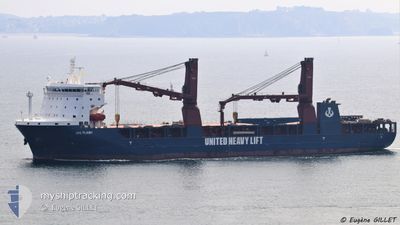
UHL FLASH
Cargo
Current Trip
| Trip Time | 40 days |
|---|---|
| Trip Distance | 10252.64 nm |
| AVG Speed | 12.2 Knopen |
| MAX Speed | 16.3 Knopen |
| Diepgang | 6.9 M |
| AVG Wind | 10.8 knots |
| MAX Wind | 24.7 knots |
| MIN Temp | 12.5°C / 54.5°F |
| MAX Temp | 31°C / 87.8°F |
| Positie ontvangen | 5 d geleden |
Current Position
| Lengtegraad | 104.02737° |
|---|---|
| Breedtegraat | 1.24007° |
| Status | Under way using engine |
| Snelheid | 12.8 Knopen |
| Koers | 81.8° |
| Gebied | Singapore Strait |
| Station | T-AIS |
| Positie ontvangen | 5 d geleden |
Information
The current position of UHL FLASH is in Singapore Strait with coordinates 1.24007° / 104.02737° as reported on 2025-05-31 02:06 by AIS to our vessel tracker app. The vessel's current speed is 12.8 Knopen and is currently inside the port of TAICHUNG.
The vessel UHL FLASH (IMO: 9785407, MMSI: 255806189) is a Cargo It's sailing under the flag of [PT] Portugal.
In this page you can find informations about the vessels current position, last detected port calls, and current voyage information. If the vessels is not in coverage by AIS you will find the latest position.
The current position of UHL FLASH is detected by our AIS receivers and we are not responsible for the reliability of the data. The last position was recorded while the vessel was in Coverage by the Ais receivers of our vessel tracking app.
The current draught of UHL FLASH as reported by AIS is 6.9 meters
Weather
| Temperature | 25.9°C / 78.62°F |
|---|---|
| Wind Speed | 3 knots |
| Direction | 196° SSW |
| Pressure | 1008.2 hPa |
| Humidity | 91 % |
| Cloud Coverage | 95 % |
Featured Company
Last Port Calls
| Port | Arrival | Departure | Time In Port |
|---|---|---|---|
| 2025-06-05 00:42 | |||
| 2025-04-25 11:14 | 2025-04-25 23:48 | 12 h |
Last Trips
| Origin | Departure | Destination | Arrival | Distance | |
|---|---|---|---|---|---|
| 2025-04-26 00:48 | 2025-06-05 08:42 | 10252.64 nm | |||
| 2025-03-19 17:27 | 2025-04-25 12:14 | 2787.03 nm |
Events
| Tijd | Evenement | Details | Positie / Bestemming | Info |
|---|---|---|---|---|
| 2025-06-05 01:19 | Stop beweging |
24.26084 / 120.50992
[TW] TAICHUNG
|
Snelheid: 0.2 kn Koers: 21° |
|
| 2025-06-05 00:42 | Aankomsthaven |
|
24.28870 / 120.50897
[TW] TAICHUNG
|
Snelheid: 8.3 kn Koers: 96° |
| 2025-05-31 02:11 | Status Changed | Default Under way using engine |
1.24244 / 104.04423
TW TXG
|
Snelheid: 12.8 kn Koers: 81.8° |
| 2025-05-31 02:06 | Buitenbereik |
1.24007 / 104.02737
Singapore Strait
TW TXG
|
Snelheid: 12.8 kn Koers: 81.8° |
|
| 2025-05-31 01:34 | Wijzig zee gebeid | Indonesian part of the Singapore Strait Singaporean part of the Singapore Strait |
1.21927 / 103.91554
Singapore Strait
TW TXG
|
Snelheid: 11.1 kn Koers: 77.6° |
| 2025-05-31 00:40 | Start beweging | 1.43 nm, East of SINGAPORE |
1.26283 / 103.87774
TW TXG
|
Snelheid: 3.1 kn Koers: 235° |
| 2025-05-31 00:35 | Status Changed | Under way using engine At anchor |
1.26333 / 103.87958
TW TXG
|
Snelheid: 0.3 kn Koers: 352° |
| 2025-05-31 00:06 | Draught Changed | 6.9 6.5 |
1.26340 / 103.88003
TW TXG
|
Snelheid: Koers: 53° |
| 2025-05-31 00:06 | ETA Changed | 2025/06/05 05:00 2025/05/30 04:00 |
1.26340 / 103.88003
TW TXG
|
Snelheid: Koers: 53° |
| 2025-05-30 23:59 | Destination Changed | TW TXG SG SIN |
1.26343 / 103.87999
TW TXG
|
Snelheid: Koers: 69° |