
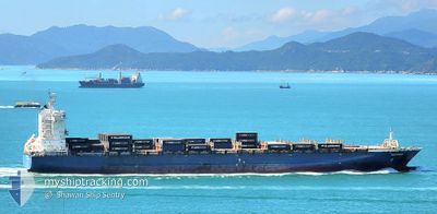
WINDSWEPT
Container Ship
Current Trip
| Time Travelled | 6 h, 36 mins |
|---|---|
| Remaining Time | --- |
| Distance Travelled | 92.20 nm |
| Remaining Distance | --- |
| AVG Speed | 14.1 Knopen |
| MAX Speed | 15.8 Knopen |
| AVG Wind | 19.7 knots |
| MAX Wind | 24 knots |
| MIN Temp | -12.2°C / 10.04°F |
| MAX Temp | -6.7°C / 19.94°F |
| Diepgang | 11 M |
| Positie ontvangen | 2025-01-01 08:58 |
Current Position
| Lengtegraad | -3.53419° |
|---|---|
| Breedtegraat | 49.75904° |
| Status | Under way using engine |
| Snelheid | 6.6 Knopen |
| Koers | 243.7° |
| Gebied | English Channel |
| Station | T-AIS |
| Positie ontvangen | 2025-01-01 08:58 |
Info
Information
The current position of WINDSWEPT is in English Channel with coordinates 49.75904° / -3.53419° as reported on 2025-01-01 08:58 by AIS to our vessel tracker app. The vessel's current speed is 6.6 Knopen and is heading at the port of MAASVLAKTE - ROTTERDAM.
The vessel WINDSWEPT (IMO: 9399806, MMSI: 563169400) is a Container Ship that was built in 2010 ( 15 Jaar oud ). It's sailing under the flag of [SG] Singapore.
In this page you can find informations about the vessels current position, last detected port calls, and current voyage information. If the vessels is not in coverage by AIS you will find the latest position.
The current position of WINDSWEPT is detected by our AIS receivers and we are not responsible for the reliability of the data. The last position was recorded while the vessel was in Coverage by the Ais receivers of our vessel tracking app.
The current draught of WINDSWEPT as reported by AIS is 11 meters
Weather
| Temperature | -8.2°C / 17.24°F |
|---|---|
| Wind Speed | 24 knots |
| Direction | 314° NW |
| Pressure | 1022 hPa |
| Humidity | 77.1 % |
| Cloud Coverage | 95 % |
Featured Company
Last Port Calls
| Port | Arrival | Departure | Time In Port |
|---|---|---|---|
| 2025-02-03 07:55 | 2025-02-05 06:23 | 1 d | |
| 2024-12-30 12:15 | 2024-12-31 05:00 | 16 h | |
| 2024-12-24 16:33 | 2024-12-28 05:28 | 3 d | |
| 2024-12-22 12:59 | 2024-12-23 06:41 | 17 h | |
| 2024-12-20 14:33 | 2024-12-21 02:19 | 11 h | |
| 2024-12-18 20:05 | 2024-12-19 13:00 | 16 h |
Last Trips
| Origin | Departure | Destination | Arrival | Distance | |
|---|---|---|---|---|---|
| 2024-12-31 06:00 | 2025-02-03 03:55 | 3858.00 nm | |||
| 2024-12-28 06:28 | 2024-12-30 13:15 | 135.43 nm | |||
| 2024-12-23 07:41 | 2024-12-24 17:33 | 315.17 nm | |||
| 2024-12-21 03:19 | 2024-12-22 13:59 | 129.07 nm | |||
| 2024-12-19 14:00 | 2024-12-20 15:33 | 341.85 nm | |||
| 2024-11-14 08:44 | 2024-12-18 21:05 | 12334.53 nm |
Events
| Tijd | Evenement | Details | Positie / Bestemming | Info |
|---|---|---|---|---|
| 2025-02-05 06:23 | Vertrekhaven |
|
45.23878 / -66.04479
DEHAM>NLRTM
|
Snelheid: 11.1 kn Koers: 152° |
| 2025-02-05 06:11 | Start beweging |
45.26736 / -66.06504
[CA] SAINT JOHN
|
Snelheid: 3.8 kn Koers: 154° |
|
| 2025-02-03 07:55 | Stop beweging |
45.26664 / -66.06790
[CA] SAINT JOHN
|
Snelheid: 0.1 kn Koers: 312° |
|
| 2025-02-03 07:55 | Aankomsthaven |
|
45.26664 / -66.06790
[CA] SAINT JOHN
|
Snelheid: 0.8 kn Koers: 313° |
| 2025-02-03 04:47 | Start beweging | 2.96 nm, South West of CANAPORT LNG |
45.17872 / -66.03608
DEHAM>NLRTM
|
Snelheid: 4.6 kn Koers: 28° |
| 2025-01-31 22:38 | Stop beweging | 3.43 nm, South West of CANAPORT LNG |
45.17404 / -66.04516
DEHAM>NLRTM
|
Snelheid: 0.3 kn Koers: 99° |
| 2025-01-31 12:51 | Start beweging | 5.14 nm, South of CANAPORT LNG |
45.12481 / -66.01674
DEHAM>NLRTM
|
Snelheid: 5.1 kn Koers: 252° |
| 2025-01-31 11:47 | Stop beweging | 6.16 nm, South West of CANAPORT LNG |
45.11283 / -66.03915
DEHAM>NLRTM
|
Snelheid: 0.3 kn Koers: 229° |
| 2025-01-31 06:07 | Start beweging | 5.9 nm, South of CANAPORT LNG |
45.11310 / -66.02347
DEHAM>NLRTM
|
Snelheid: 3.8 kn Koers: 327° |
| 2025-01-31 05:39 | Stop beweging | 6.09 nm, South of CANAPORT LNG |
45.11015 / -66.02520
DEHAM>NLRTM
|
Snelheid: 0.2 kn Koers: 321° |