
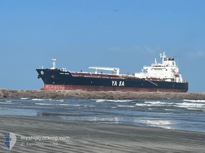
YASA ORION
Tanker
Current Trip
| Time Travelled | 2 days |
|---|---|
| Remaining Time | --- |
| Distance Travelled | 100.00 nm |
| Remaining Distance | --- |
| AVG Speed | 8.8 Knopen |
| MAX Speed | 14.6 Knopen |
| AVG Wind | 4.9 knots |
| MAX Wind | 15 knots |
| MIN Temp | 10.9°C / 51.62°F |
| MAX Temp | 14.4°C / 57.92°F |
| Diepgang | 8.5 M |
| Positie ontvangen | 3 m geleden |
Current Position
| Lengtegraad | 15.30709° |
|---|---|
| Breedtegraat | 38.21994° |
| Status | At anchor |
| Snelheid | |
| Koers | 282° |
| Gebied | Tyrrhenian Sea |
| Station | T-AIS |
| Positie ontvangen | 3 m geleden |
Info
Information
The current position of YASA ORION is in Tyrrhenian Sea with coordinates 38.21994° / 15.30709° as reported on 2025-02-15 22:27 by AIS to our vessel tracker app. The vessel's current speed is 0 Knopen
The vessel YASA ORION (IMO: 9888340, MMSI: 538009347) is a Tanker It's sailing under the flag of [MH] Marshall Is.
In this page you can find informations about the vessels current position, last detected port calls, and current voyage information. If the vessels is not in coverage by AIS you will find the latest position.
The current position of YASA ORION is detected by our AIS receivers and we are not responsible for the reliability of the data. The last position was recorded while the vessel was in Coverage by the Ais receivers of our vessel tracking app.
The current draught of YASA ORION as reported by AIS is 8.5 meters
Weather
| Temperature | 12°C / 53.6°F |
|---|---|
| Wind Speed | 7 knots |
| Direction | 91° E |
| Pressure | 1008 hPa |
| Humidity | 69.2 % |
| Cloud Coverage | 21 % |
Featured Company
Last Port Calls
| Port | Arrival | Departure | Time In Port |
|---|---|---|---|
| 2025-02-12 11:05 | 2025-02-13 21:01 | 1 d | |
| 2025-02-05 17:51 | 2025-02-08 13:27 | 2 d | |
| 2025-01-26 06:36 | 2025-01-27 18:30 | 1 d | |
| 2025-01-19 21:09 | 2025-01-23 12:57 | 3 d | |
| 2025-01-06 06:31 | 2025-01-08 11:01 | 2 d | |
| 2024-12-11 09:57 | 2024-12-13 10:28 | 2 d |
Most Visited Ports (Last year)
| Port | Arrivals | |
|---|---|---|
| 3 | ||
| 2 | ||
| 2 | ||
| 1 | ||
| 1 | ||
| 1 |
Last Trips
| Origin | Departure | Destination | Arrival | Distance | |
|---|---|---|---|---|---|
| 2025-02-08 14:27 | 2025-02-12 12:05 | 792.06 nm | |||
| 2025-01-27 19:30 | 2025-02-05 18:51 | 629.93 nm | |||
| 2025-01-23 13:57 | 2025-01-26 07:36 | 99.33 nm | |||
| 2025-01-08 12:01 | 2025-01-19 22:09 | 1170.53 nm | |||
| 2024-12-13 04:28 | 2025-01-06 07:31 | 6639.52 nm | |||
| 2024-11-19 10:50 | 2024-12-11 03:57 | 4526.30 nm |
Events
| Tijd | Evenement | Details | Positie / Bestemming | Info |
|---|---|---|---|---|
| 2025-02-15 22:27 | Status Changed | At anchor Default |
38.21994 / 15.30709
ITMLZ
|
Snelheid: Koers: 279° |
| 2025-02-15 22:24 | Status Changed | Default At anchor |
38.21997 / 15.30716
ITMLZ
|
Snelheid: 0.1 kn Koers: 275° |
| 2025-02-15 21:03 | Status Changed | At anchor Default |
38.22045 / 15.30734
ITMLZ
|
Snelheid: 0.1 kn Koers: 251° |
| 2025-02-15 21:00 | Status Changed | Default At anchor |
38.22059 / 15.30734
ITMLZ
|
Snelheid: 0.2 kn Koers: 248° |
| 2025-02-15 15:58 | Status Changed | At anchor Default |
38.21904 / 15.30673
ITMLZ
|
Snelheid: Koers: 327° |
| 2025-02-15 15:55 | Status Changed | Default At anchor |
38.21897 / 15.30670
ITMLZ
|
Snelheid: Koers: 330° |
| 2025-02-15 15:22 | Status Changed | At anchor Default |
38.21875 / 15.30623
ITMLZ
|
Snelheid: Koers: 348° |
| 2025-02-15 15:19 | Status Changed | Default At anchor |
38.21875 / 15.30616
ITMLZ
|
Snelheid: Koers: 347° |
| 2025-02-15 15:10 | Status Changed | At anchor Default |
38.21889 / 15.30618
ITMLZ
|
Snelheid: Koers: 336° |
| 2025-02-15 15:07 | Status Changed | Default At anchor |
38.21891 / 15.30625
ITMLZ
|
Snelheid: Koers: 333° |