
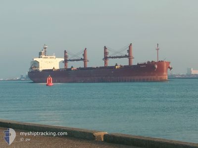
ZANTE
Cargo
Current Trip
| Time Travelled | 21 days |
|---|---|
| Remaining Time | 6 mins |
| Distance Travelled | 5084.89 nm |
| Remaining Distance | 230.02 nm |
| AVG Speed | 9.9 Knopen |
| MAX Speed | 13.6 Knopen |
| AVG Wind | 14 knots |
| MAX Wind | 32 knots |
| MIN Temp | 6.4°C / 43.52°F |
| MAX Temp | 27.5°C / 81.5°F |
| Diepgang | 12.9 M |
| Positie ontvangen | 3 d geleden |
Current Position
| Lengtegraad | 14.54326° |
|---|---|
| Breedtegraat | 36.47995° |
| Status | Under way using engine |
| Snelheid | 10.8 Knopen |
| Koers | 107.5° |
| Gebied | Mediterranean Sea - Eastern Basin |
| Station | T-AIS |
| Positie ontvangen | 3 d geleden |
Info
Information
The current position of ZANTE is in Mediterranean Sea - Eastern Basin with coordinates 36.47995° / 14.54326° as reported on 2025-02-07 20:24 by AIS to our vessel tracker app. The vessel's current speed is 10.8 Knopen and is heading at the port of DAMIETTA. The estimated time of arrival as calculated by MyShipTracking vessel tracking app is 2025-02-11 12:08 LT
The vessel ZANTE (IMO: 9727168, MMSI: 249120000) is a Cargo It's sailing under the flag of [MT] Malta.
In this page you can find informations about the vessels current position, last detected port calls, and current voyage information. If the vessels is not in coverage by AIS you will find the latest position.
The current position of ZANTE is detected by our AIS receivers and we are not responsible for the reliability of the data. The last position was recorded while the vessel was in Coverage by the Ais receivers of our vessel tracking app.
The current draught of ZANTE as reported by AIS is 12.9 meters
Weather
| Temperature | 14.4°C / 57.92°F |
|---|---|
| Wind Speed | 12 knots |
| Direction | 305° NW |
| Pressure | 1019.9 hPa |
| Humidity | 53.6 % |
| Cloud Coverage | 62 % |
Featured Company
Last Trips
| Origin | Departure | Destination | Arrival | Distance | |
|---|---|---|---|---|---|
| 2025-01-04 09:36 | 2025-01-17 04:38 | 3352.85 nm | |||
| 2024-12-27 04:37 | 2024-12-29 19:17 | 541.74 nm | |||
| 2024-12-20 08:53 | 2024-12-24 08:53 | 622.48 nm | |||
| 2024-12-11 06:48 | 2024-12-14 19:04 | 648.39 nm | |||
| 2024-11-26 05:12 | 2024-12-08 14:04 | 1031.06 nm |
Events
| Tijd | Evenement | Details | Positie / Bestemming | Info |
|---|---|---|---|---|
| 2025-02-11 11:14 | Stop beweging | 9.74 nm, North of DAMIETTA |
31.62972 / 31.74514
EG DAM
|
Snelheid: Koers: 305° |
| 2025-02-07 20:32 | Status Changed | Default Under way using engine |
36.47198 / 14.57493
EG DAM
|
Snelheid: 10.8 kn Koers: 107.5° |
| 2025-02-07 20:24 | Buitenbereik |
36.47995 / 14.54326
Mediterranean Sea - Eastern Basin
EG DAM
|
Snelheid: 10.8 kn Koers: 107.5° |
|
| 2025-02-07 20:08 | Status Changed | Under way using engine Default |
36.49361 / 14.48877
EG DAM
|
Snelheid: 11 kn Koers: 108° |
| 2025-02-07 19:54 | Status Changed | Default Under way using engine |
36.50583 / 14.43832
EG DAM
|
Snelheid: 11.1 kn Koers: 106.6° |
| 2025-02-07 19:44 | Gevonden in zee | Italian part of the Mediterranean Sea - Eastern Basin |
36.51543 / 14.39943
Mediterranean Sea - Eastern Basin
EG DAM
|
Snelheid: 11.1 kn Koers: 107.1° |
| 2025-02-07 19:44 | Status Changed | Under way using engine Default |
36.51543 / 14.39943
EG DAM
|
Snelheid: 11.1 kn Koers: 108° |
| 2025-02-07 19:44 | Binnenbereik |
36.51543 / 14.39943
Mediterranean Sea - Eastern Basin
EG DAM
|
Snelheid: 11.1 kn Koers: 107.1° |
|
| 2025-02-05 03:38 | Status Changed | Default Under way using engine |
36.52562 / -.92767
EG DAM
|
Snelheid: 12.1 kn Koers: 76.9° |
| 2025-02-05 03:22 | Buitenbereik |
36.51859 / -.99437
Mediterranean Sea - Western Basin
EG DAM
|
Snelheid: 12.1 kn Koers: 76.9° |