
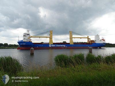
BBC RUBY
Cargo
Current Trip
| Time Travelled | 43 days |
|---|---|
| Remaining Time | --- |
| Distance Travelled | 11898.73 морская миля |
| Remaining Distance | --- |
| AVG Speed | 14.9 Узлы |
| MAX Speed | 19.2 Узлы |
| AVG Wind | 11.7 knots |
| MAX Wind | 33 knots |
| MIN Temp | 4.2°C / 39.56°F |
| MAX Temp | 28.8°C / 83.84°F |
| Осадка | 7.8 м |
| Позиция Получена | 5 h, 33 m тому назад |
Current Position
| Долгота | -17.90025° |
|---|---|
| Широта | 15.36159° |
| Статус | Under way using engine |
| Скорость | 12.6 Узлы |
| Курс | 356.9° |
| Район | North Atlantic Ocean |
| Станция | T-AIS |
| Позиция Получена | 5 h, 33 m тому назад |
Info
Information
The current position of BBC RUBY is in North Atlantic Ocean with coordinates 15.36159° / -17.90025° as reported on 2026-03-06 08:44 by AIS to our vessel tracker app. The vessel's current speed is 12.6 Узлы and is heading at the port of SWINOUJSCIE. The estimated time of arrival as calculated by MyShipTracking vessel tracking app is 2026-03-15 19:00 LT
The vessel BBC RUBY (IMO: 9563744, MMSI: 305908000) is a Cargo It's sailing under the flag of [AG] Antigua Barbuda.
In this page you can find informations about the vessels current position, last detected port calls, and current voyage information. If the vessels is not in coverage by AIS you will find the latest position.
The current position of BBC RUBY is detected by our AIS receivers and we are not responsible for the reliability of the data. The last position was recorded while the vessel was in Coverage by the Ais receivers of our vessel tracking app.
The current draught of BBC RUBY as reported by AIS is 7.8 meters
Weather
| Temperature | 19.4°C / 66.92°F |
|---|---|
| Wind Speed | 15 knots |
| Direction | 27° NNE |
| Pressure | 1013.1 hPa |
| Humidity | 72.7 % |
| Cloud Coverage | 100 % |
Featured Company
Last Trips
| Origin | Departure | Destination | Arrival | Distance | |
|---|---|---|---|---|---|
| 2026-01-19 21:17 | 2026-01-21 17:27 | 588.80 морская миля | |||
| 2025-12-28 10:03 | 2026-01-15 15:21 | 6538.02 морская миля |
Events
| Время | Событие | Детали | Позиция / Направление | Информация |
|---|---|---|---|---|
| 2026-03-06 08:51 | Статус изменился | Default Under way using engine |
15.38522 / -17.90151
PL SWI
|
Скорость: 12.6 kn Курс: 356.9° |
| 2026-03-06 08:44 | Вне покрытия |
15.36159 / -17.90025
North Atlantic Ocean
PL SWI
|
Скорость: 12.6 kn Курс: 356.9° |
|
| 2026-03-05 23:53 | Изменение морского района | Senegalese part of the North Atlantic Ocean Gambian part of the North Atlantic Ocean |
13.59543 / -17.89743
North Atlantic Ocean
PL SWI
|
Скорость: 12.7 kn Курс: 358.9° |
| 2026-03-05 21:17 | Обнаружено в море | Gambian part of the North Atlantic Ocean |
13.06184 / -17.91716
North Atlantic Ocean
PL SWI
|
Скорость: 12 kn Курс: 1.5° |
| 2026-03-05 15:02 | Изменение морского района | Senegalese part of the North Atlantic Ocean Guinea Bissau part of the North Atlantic Ocean |
11.74654 / -17.95031
North Atlantic Ocean
PL SWI
|
Скорость: 12.7 kn Курс: 0.4° |
| 2026-03-05 15:02 | Статус изменился | Under way using engine Default |
11.74654 / -17.95031
PL SWI
|
Скорость: 12.8 kn Курс: 3° |
| 2026-03-05 14:51 | В покрытии |
11.74654 / -17.95031
North Atlantic Ocean
PL SWI
|
Скорость: 12.7 kn Курс: 0.4° |
|
| 2026-03-05 07:48 | Статус изменился | Default Under way using engine |
10.19105 / -17.98395
PL SWI
|
Скорость: 12.3 kn Курс: 2° |
| 2026-03-05 07:42 | Статус изменился | Under way using engine Default |
10.17217 / -17.98472
PL SWI
|
Скорость: 12 kn Курс: 2° |
| 2026-03-05 07:42 | Вне покрытия |
10.17217 / -17.98472
North Atlantic Ocean
PL SWI
|
Скорость: 12.3 kn Курс: 2° |