

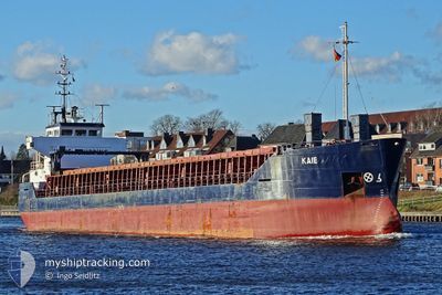
KAIE
General Cargo

Current Trip
| Time Travelled | 1 day |
|---|---|
| Remaining Time | --- |
| Distance Travelled | 51.68 морская миля |
| Remaining Distance | --- |
| AVG Speed | 9 Узлы |
| MAX Speed | 10.4 Узлы |
| AVG Wind | 8.4 knots |
| MAX Wind | 12.6 knots |
| MIN Temp | 8°C / 46.4°F |
| MAX Temp | 17.3°C / 63.14°F |
| Осадка | 4.6 м |
| Позиция Получена | 4 h, 13 m тому назад |
Current Position
| Долгота | 28.47158° |
|---|---|
| Широта | 60.02313° |
| Статус | At anchor |
| Скорость | 0.1 Узлы |
| Курс | 357° |
| Район | Gulf of Finland |
| Станция | T-AIS |
| Позиция Получена | 4 h, 13 m тому назад |
Information
The current position of KAIE is in Gulf of Finland with coordinates 60.02313° / 28.47158° as reported on 2025-05-24 12:55 by AIS to our vessel tracker app. The vessel's current speed is 0.1 Узлы
The vessel KAIE (IMO: 9504102, MMSI: 305036000) is a General Cargo that was built in 2010 ( 15 лет ). It's sailing under the flag of [AG] Antigua Barbuda.
In this page you can find informations about the vessels current position, last detected port calls, and current voyage information. If the vessels is not in coverage by AIS you will find the latest position.
The current position of KAIE is detected by our AIS receivers and we are not responsible for the reliability of the data. The last position was recorded while the vessel was in Coverage by the Ais receivers of our vessel tracking app.
The current draught of KAIE as reported by AIS is 4.6 meters
Weather
| Temperature | 8.9°C / 48.02°F |
|---|---|
| Wind Speed | 10 knots |
| Direction | 357° N |
| Pressure | 1017.4 hPa |
| Humidity | 89.4 % |
| Cloud Coverage | 100 % |
Featured Company
Last Port Calls
| Port | Arrival | Departure | Time In Port |
|---|---|---|---|
| 2025-05-23 07:30 | |||
| 2025-05-09 22:56 | 2025-05-11 13:37 | 1 d | |
| 2025-05-03 19:40 | 2025-05-04 20:50 | 1 d | |
| 2025-04-21 14:04 | 2025-04-22 04:28 | 14 h | |
| 2025-04-20 09:06 | |||
| 2025-04-07 21:32 | |||
| 2025-03-29 18:39 | 2025-04-01 19:31 | 3 d | |
| 2025-03-15 08:49 |
Most Visited Ports (Last year)
| Port | Arrivals | |
|---|---|---|
| 9 | ||
| 4 | ||
| 2 | ||
| 2 | ||
| 2 | ||
| 1 |
Last Trips
| Origin | Departure | Destination | Arrival | Distance | |
|---|---|---|---|---|---|
| 2025-05-04 21:50 | 2025-05-09 23:56 | 388.67 морская миля | |||
| 2025-04-22 07:28 | 2025-05-03 20:40 | 1445.24 морская миля | |||
| 2025-04-20 12:06 | 2025-04-21 17:04 | 344.76 морская миля | |||
| 2025-03-15 11:49 | 2025-03-29 18:39 | 1971.07 морская миля |
Events
| Время | Событие | Детали | Позиция / Направление | Информация |
|---|---|---|---|---|
| 2025-05-24 12:55 | Вне покрытия |
60.02313 / 28.47158
Gulf of Finland
|
Скорость: 0.1 kn Курс: 256.3° |
|
| 2025-05-24 12:55 | Статус изменился | At anchor Default |
60.02313 / 28.47158
RUULU
|
Скорость: 0.5 kn Курс: 345° |
| 2025-05-24 12:07 | Статус изменился | Default At anchor |
60.02317 / 28.47213
RUULU
|
Скорость: Курс: 344° |
| 2025-05-24 12:03 | В покрытии |
60.02322 / 28.47203
Gulf of Finland
|
Скорость: Курс: 66.2° |
|
| 2025-05-24 05:39 | Статус изменился | Default At anchor |
60.02343 / 28.47003
RUULU
|
Скорость: 0.6 kn Курс: 7° |
| 2025-05-24 05:04 | Вне покрытия |
60.02327 / 28.47135
Gulf of Finland
|
Скорость: 0.6 kn Курс: 332.3° |
|
| 2025-05-24 04:47 | Статус изменился | At anchor Default |
60.02328 / 28.47216
RUULU
|
Скорость: 0.4 kn Курс: 338° |
| 2025-05-24 04:46 | В покрытии |
60.02327 / 28.47202
Gulf of Finland
|
Скорость: 0.4 kn Курс: 261.4° |
|
| 2025-05-23 17:59 | Статус изменился | Default At anchor |
60.02355 / 28.47298
RUULU
|
Скорость: 0.9 kn Курс: 319° |
| 2025-05-23 17:56 | Вне покрытия |
60.02357 / 28.47310
Gulf of Finland
RUULU
|
Скорость: 0.9 kn Курс: 222.2° |