
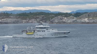
KV TOR
Patrol Vessel
Current Trip
COASTGUARD PATROL
| Time Travelled | 6 days |
|---|---|
| Remaining Time | --- |
| Distance Travelled | 329.05 морская миля |
| Remaining Distance | --- |
| AVG Speed | 9.2 Узлы |
| MAX Speed | 12.7 Узлы |
| AVG Wind | 5.2 knots |
| MAX Wind | 19.2 knots |
| MIN Temp | -6.1°C / 21.02°F |
| MAX Temp | 6.5°C / 43.7°F |
| Осадка | 4 м |
| Позиция Получена | 3 m тому назад |
Current Position
| Долгота | 5.02006° |
|---|---|
| Широта | 61.61375° |
| Статус | At anchor |
| Скорость | |
| Курс | 89° |
| Район | Norwegian Sea |
| Станция | T-AIS |
| Позиция Получена | 3 m тому назад |
Info
Information
The current position of KV TOR is in Norwegian Sea with coordinates 61.61375° / 5.02006° as reported on 2025-02-12 01:56 by AIS to our vessel tracker app. The vessel's current speed is 0 Узлы
The vessel KV TOR (IMO: 9353369, MMSI: 257083200) is a Patrol Vessel that was built in 2007 ( 18 лет ). It's sailing under the flag of [NO] Norway.
In this page you can find informations about the vessels current position, last detected port calls, and current voyage information. If the vessels is not in coverage by AIS you will find the latest position.
The current position of KV TOR is detected by our AIS receivers and we are not responsible for the reliability of the data. The last position was recorded while the vessel was in Coverage by the Ais receivers of our vessel tracking app.
The current draught of KV TOR as reported by AIS is 4 meters
Weather
| Temperature | 2°C / 35.6°F |
|---|---|
| Wind Speed | 6 knots |
| Direction | 112° ESE |
| Pressure | 1033.2 hPa |
| Humidity | 51.1 % |
| Cloud Coverage | --- |
Featured Company
Last Port Calls
| Port | Arrival | Departure | Time In Port |
|---|---|---|---|
| 2025-02-05 10:11 | 2025-02-05 10:22 | 10 m | |
| 2025-02-05 08:47 | 2025-02-05 09:02 | 15 m | |
| 2025-02-04 12:37 | 2025-02-04 12:51 | 14 m | |
| 2025-02-04 11:20 | 2025-02-04 12:06 | 46 m | |
| 2025-02-04 10:14 | 2025-02-04 10:17 | 2 m | |
| 2025-02-04 09:40 | 2025-02-04 09:44 | 3 m | |
| 2025-02-04 08:42 | 2025-02-04 09:09 | 26 m | |
| 2025-02-04 07:54 | 2025-02-04 07:58 | 4 m | |
| 2025-02-03 21:36 | 2025-02-04 07:21 | 9 h | |
| 2025-02-03 12:48 | 2025-02-03 12:56 | 8 m |
Last Trips
| Origin | Departure | Destination | Arrival | Distance | |
|---|---|---|---|---|---|
| 2025-02-05 10:02 | 2025-02-05 11:11 | 12.00 морская миля | |||
| 2025-02-04 13:51 | 2025-02-05 09:47 | 51.26 морская миля | |||
| 2025-02-04 13:06 | 2025-02-04 13:37 | 5.86 морская миля | |||
| 2025-02-04 11:17 | 2025-02-04 12:20 | 9.54 морская миля | |||
| 2025-02-04 10:44 | 2025-02-04 11:14 | 5.06 морская миля | |||
| 2025-02-04 10:09 | 2025-02-04 10:40 | 5.32 морская миля | |||
| 2025-02-04 08:58 | 2025-02-04 09:42 | 8.08 морская миля | |||
| 2025-02-04 08:21 | 2025-02-04 08:54 | 5.81 морская миля | |||
| 2025-02-03 13:56 | 2025-02-03 22:36 | 93.76 морская миля | |||
| 2025-02-03 13:13 | 2025-02-03 13:48 | 5.26 морская миля |
Events
| Время | Событие | Детали | Позиция / Направление | Информация |
|---|---|---|---|---|
| 2025-02-11 18:08 | Статус изменился | At anchor Under way using engine |
61.61374 / 5.02027
COASTGUARD PATROL
|
Скорость: 0.1 kn Курс: 104° |
| 2025-02-11 17:56 | Окончание движения | 0.76 nm, North of FLORO |
61.61385 / 5.01996
COASTGUARD PATROL
|
Скорость: Курс: 89° |
| 2025-02-11 13:42 | Изменение морского района | Norwegian part of the Norwegian Sea Norwegian part of the North Sea |
61.00375 / 4.90418
Norwegian Sea
|
Скорость: 10.9 kn Курс: 295.1° |
| 2025-02-11 12:36 | Начало движения | 0.71 nm, North of FONNES |
60.82166 / 4.97046
COASTGUARD PATROL
|
Скорость: 6.8 kn Курс: 327.7° |
| 2025-02-11 12:21 | Статус изменился | Under way using engine At anchor |
60.81786 / 4.97161
COASTGUARD PATROL
|
Скорость: 0.1 kn Курс: 108° |
| 2025-02-10 18:33 | Статус изменился | At anchor Under way using engine |
60.81811 / 4.97171
COASTGUARD PATROL
|
Скорость: 0.3 kn Курс: 120° |
| 2025-02-10 18:31 | Окончание движения | 0.5 nm, North of FONNES |
60.81820 / 4.97137
COASTGUARD PATROL
|
Скорость: 0.3 kn Курс: 120° |
| 2025-02-10 13:11 | Начало движения | 3.27 nm, South East of KNARREVIK |
60.32498 / 5.21944
COASTGUARD PATROL
|
Скорость: 3.1 kn Курс: 271° |
| 2025-02-10 11:41 | Окончание движения | 3.3 nm, South East of KNARREVIK |
60.32592 / 5.22436
COASTGUARD PATROL
|
Скорость: 0.3 kn Курс: 266° |
| 2025-02-10 11:31 | Начало движения | 3.24 nm, South East of KNARREVIK |
60.33253 / 5.23779
COASTGUARD PATROL
|
Скорость: 5.1 kn Курс: 191.1° |