
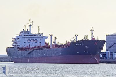
MAGIC STAR
Oil/Chemical Tanker
Current Trip
| Time Travelled | 6 days |
|---|---|
| Remaining Time | --- |
| Distance Travelled | 116.24 морская миля |
| Remaining Distance | 443.91 морская миля |
| AVG Speed | 8.3 Узлы |
| MAX Speed | 11.4 Узлы |
| AVG Wind | 6.8 knots |
| MAX Wind | 17 knots |
| MIN Temp | 20.1°C / 68.18°F |
| MAX Temp | 30.6°C / 87.08°F |
| Осадка | 7 м |
| Позиция Получена | 18 d тому назад |
Current Position
| Долгота | 32.55017° |
|---|---|
| Широта | 29.87083° |
| Статус | Under way using engine |
| Скорость | 8.2 Узлы |
| Курс | 173° |
| Район | Gulf of Suez |
| Станция | T-AIS |
| Позиция Получена | 18 d тому назад |
Info
Information
The current position of MAGIC STAR is in Gulf of Suez with coordinates 29.87083° / 32.55017° as reported on 2025-12-21 14:33 by AIS to our vessel tracker app. The vessel's current speed is 8.2 Узлы and is heading at the port of SOKHNA.
The vessel MAGIC STAR (IMO: 9420253, MMSI: 538003460) is a Oil/Chemical Tanker that was built in 2009 ( 17 лет ). It's sailing under the flag of [MH] Marshall Is.
In this page you can find informations about the vessels current position, last detected port calls, and current voyage information. If the vessels is not in coverage by AIS you will find the latest position.
The current position of MAGIC STAR is detected by our AIS receivers and we are not responsible for the reliability of the data. The last position was recorded while the vessel was in Coverage by the Ais receivers of our vessel tracking app.
The current draught of MAGIC STAR as reported by AIS is 7 meters
Weather
| Temperature | 25°C / 77°F |
|---|---|
| Wind Speed | 6 knots |
| Direction | 310° NW |
| Pressure | 1015.3 hPa |
| Humidity | 69.9 % |
| Cloud Coverage | 68 % |
Featured Company
Last Port Calls
| Port | Arrival | Departure | Time In Port |
|---|---|---|---|
| 2026-01-01 15:39 | 2026-01-02 22:33 | 1 d | |
| 2025-12-29 18:12 | 2025-12-30 21:29 | 1 d | |
| 2025-12-21 06:42 | 2025-12-21 15:46 | 9 h | |
| 2025-12-10 13:53 | 2025-12-12 14:13 | 2 d | |
| 2025-11-04 21:12 | 2025-11-06 20:55 | 1 d | |
| 2025-11-01 06:04 |
Most Visited Ports (Last year)
| Port | Arrivals | |
|---|---|---|
| 5 | ||
| 5 | ||
| 3 | ||
| 2 | ||
| 2 | ||
| 2 |
Last Trips
| Origin | Departure | Destination | Arrival | Distance | |
|---|---|---|---|---|---|
| 2025-12-30 21:29 | 2026-01-01 15:39 | 206.22 морская миля | |||
| 2025-12-12 14:13 | 2025-12-29 18:12 | 2277.88 морская миля | |||
| 2025-12-12 14:13 | 2025-12-21 06:42 | 1432.69 морская миля | |||
| 2025-11-06 20:55 | 2025-12-10 13:53 | 8226.64 морская миля | |||
| 2025-11-01 06:04 | 2025-11-04 21:12 | 724.00 морская миля |
Events
| Время | Событие | Детали | Позиция / Направление | Информация |
|---|---|---|---|---|
| 2026-01-08 17:39 | Окончание движения |
23.95667 / 37.58667
AIN SUKHNA
|
Скорость: Курс: -1° |
|
| 2026-01-07 12:49 | Начало движения | 0.87 nm, South West of YANBU |
23.94150 / 38.19900
AIN SUKHNA
|
Скорость: 3.7 kn Курс: 85° |
| 2026-01-02 19:54 | Окончание движения | 1.11 nm, South West of YANBU |
23.94050 / 38.19400
AIN SUKHNA
|
Скорость: 0.3 kn Курс: 263° |
| 2026-01-02 19:33 | ПОРТ ОТПРАВЛЕНИЯ |
|
23.94317 / 38.20400
AIN SUKHNA
|
Скорость: 6.4 kn Курс: 259° |
| 2026-01-02 19:21 | Начало движения |
23.94533 / 38.22417
[SA] YANBU
|
Скорость: 3.3 kn Курс: 275° |
|
| 2026-01-01 12:39 | Окончание движения |
23.94333 / 38.22500
[SA] YANBU
|
Скорость: Курс: -1° |
|
| 2026-01-01 12:39 | Порт |
|
23.94333 / 38.22500
[SA] YANBU
|
Скорость: 0.9 kn Курс: 305° |
| 2026-01-01 07:53 | Начало движения |
23.20300 / 38.43100
AIN SUKHNA
|
Скорость: 3.7 kn Курс: 99° |
|
| 2025-12-31 06:33 | Окончание движения |
23.37333 / 38.38500
AIN SUKHNA
|
Скорость: Курс: -1° |
|
| 2025-12-30 18:29 | ПОРТ ОТПРАВЛЕНИЯ |
|
21.40933 / 39.12117
AIN SUKHNA
|
Скорость: 9.5 kn Курс: 257° |