
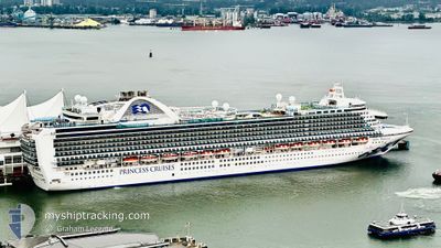
RUBY PRINCESS
Passengers Ship
Current Position
| Долгота | -157.46700° |
|---|---|
| Широта | 21.69085° |
| Статус | Under way using engine |
| Скорость | 16.3 Узлы |
| Курс | 302.7° |
| Район | North Pacific Ocean |
| Станция | T-AIS |
| Позиция Получена | 2 m тому назад |
Info
Information
The current position of RUBY PRINCESS is in North Pacific Ocean with coordinates 21.69085° / -157.46700° as reported on 2026-01-10 09:38 by AIS to our vessel tracker app. The vessel's current speed is 16.3 Узлы
The vessel RUBY PRINCESS (IMO: 9378462, MMSI: 310567000) is a Passengers Ship that was built in 2008 ( 18 лет ). It's sailing under the flag of [BM] Bermuda.
In this page you can find informations about the vessels current position, last detected port calls, and current voyage information. If the vessels is not in coverage by AIS you will find the latest position.
The current position of RUBY PRINCESS is detected by our AIS receivers and we are not responsible for the reliability of the data. The last position was recorded while the vessel was in Coverage by the Ais receivers of our vessel tracking app.
The current draught of RUBY PRINCESS as reported by AIS is 8.8 meters
Weather
| Temperature | 24°C / 75.2°F |
|---|---|
| Wind Speed | 4 knots |
| Direction | 18° NNE |
| Pressure | 1017.1 hPa |
| Humidity | 73.3 % |
| Cloud Coverage | 86 % |
Featured Company
Last Port Calls
| Port | Arrival | Departure | Time In Port |
|---|---|---|---|
| 2026-01-09 07:30 | |||
| 2026-01-08 06:36 | 2026-01-08 22:50 | 16 h | |
| 2026-01-07 07:33 | 2026-01-07 17:30 | 9 h | |
| 2026-01-02 18:03 | 2026-01-02 23:54 | 5 h | |
| 2026-01-02 00:04 | 2026-01-02 11:00 | 10 h | |
| 2025-12-31 07:55 | 2025-12-31 17:23 | 9 h | |
| 2025-12-24 07:06 | 2025-12-24 20:19 | 13 h | |
| 2025-12-23 06:17 | 2025-12-23 23:05 | 16 h | |
| 2025-12-22 07:23 | 2025-12-22 17:22 | 9 h | |
| 2025-12-17 06:06 | 2025-12-17 18:07 | 12 h |
Last Trips
| Origin | Departure | Destination | Arrival | Distance | |
|---|---|---|---|---|---|
| 2026-01-08 22:50 | 2026-01-09 07:30 | 99.72 морская миля | |||
| 2026-01-07 17:30 | 2026-01-08 06:36 | 211.14 морская миля | |||
| 2026-01-02 23:54 | 2026-01-07 07:33 | 2066.34 морская миля | |||
| 2026-01-02 11:00 | 2026-01-02 18:03 | 3.90 морская миля | |||
| 2025-12-31 17:23 | 2026-01-02 00:04 | 564.19 морская миля | |||
| 2025-12-24 20:19 | 2025-12-31 07:55 | 2408.16 морская миля | |||
| 2025-12-23 23:05 | 2025-12-24 07:06 | 98.61 морская миля | |||
| 2025-12-22 17:22 | 2025-12-23 06:17 | 124.87 морская миля | |||
| 2025-12-17 18:07 | 2025-12-22 07:23 | 2132.36 морская миля | |||
| 2025-12-15 16:59 | 2025-12-17 06:06 | 568.64 морская миля |
Events
| Время | Событие | Детали | Позиция / Направление | Информация |
|---|---|---|---|---|
| 2026-01-10 09:21 | Статус изменился | Under way using engine Default |
21.65038 / -157.39754
USOGG
|
Скорость: 16.4 kn Курс: 302° |
| 2026-01-10 09:18 | Статус изменился | Default Under way using engine |
21.64288 / -157.38475
USOGG
|
Скорость: 16.4 kn Курс: 302.5° |
| 2026-01-10 09:09 | Статус изменился | Under way using engine Default |
21.62170 / -157.34855
USOGG
|
Скорость: 16.5 kn Курс: 301° |
| 2026-01-10 09:05 | Статус изменился | Default Under way using engine |
21.61279 / -157.33310
USOGG
|
Скорость: 16.4 kn Курс: 301.1° |
| 2026-01-10 08:58 | Статус изменился | Under way using engine Default |
21.59597 / -157.30323
USOGG
|
Скорость: 17 kn Курс: 299° |
| 2026-01-10 08:50 | В покрытии |
21.59668 / -157.30449
North Pacific Ocean
|
Скорость: 16.4 kn Курс: 301.1° |
|
| 2026-01-09 17:44 | Окончание движения |
20.89667 / -156.46666
[US] KAHULUI
|
Скорость: Курс: -1° |
|
| 2026-01-09 17:30 | Порт |
|
20.89954 / -156.47189
[US] KAHULUI
|
Скорость: 5 kn Курс: 179° |
| 2026-01-09 12:50 | Статус изменился | Default Under way using engine |
21.30804 / -157.09380
USOGG
|
Скорость: 12.5 kn Курс: 82.9° |
| 2026-01-09 12:01 | Вне покрытия |
21.31723 / -157.27541
North Pacific Ocean
USOGG
|
Скорость: 12.5 kn Курс: 82.9° |