

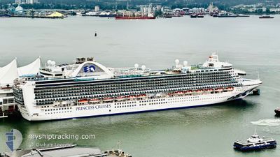
RUBY PRINCESS
Passengers Ship

Current Trip
| Trip Time | 2 days |
|---|---|
| Trip Distance | 1187.68 nm |
| AVG Speed | 17.4 Knop |
| MAX Speed | 21.2 Knop |
| Djupgående | 8.6 m |
| AVG Wind | 11.6 knots |
| MAX Wind | 25 knots |
| MIN Temp | 7.5°C / 45.5°F |
| MAX Temp | 15.9°C / 60.62°F |
| Position mottagen | 10 h, 12 m sen |
Current Position
| Longitud | -131.50799° |
|---|---|
| Latitude | 55.27714° |
| Status | Under way using engine |
| Fart | 11.4 Knop |
| Kurs | 293.9° |
| Område | The Coastal Waters of Southeast Alaska and British Columbia |
| Station | T-AIS |
| Position mottagen | 10 h, 12 m sen |
Information
The current position of RUBY PRINCESS is in The Coastal Waters of Southeast Alaska and British Columbia with coordinates 55.27714° / -131.50799° as reported on 2025-06-09 15:59 by AIS to our vessel tracker app. The vessel's current speed is 11.4 Knop and is currently inside the port of KETCHIKAN.
The vessel RUBY PRINCESS (IMO: 9378462, MMSI: 310567000) is a Passengers Ship that was built in 2008 ( 17 År gammal ). It's sailing under the flag of [BM] Bermuda.
In this page you can find informations about the vessels current position, last detected port calls, and current voyage information. If the vessels is not in coverage by AIS you will find the latest position.
The current position of RUBY PRINCESS is detected by our AIS receivers and we are not responsible for the reliability of the data. The last position was recorded while the vessel was in Coverage by the Ais receivers of our vessel tracking app.
The current draught of RUBY PRINCESS as reported by AIS is 8.6 meters
Weather
| Temperature | 12.3°C / 54.14°F |
|---|---|
| Wind Speed | 11 knots |
| Direction | 331° NNW |
| Pressure | 1024.1 hPa |
| Humidity | 59.5 % |
| Cloud Coverage | 1 % |


Featured Company
Last Port Calls
| Port | Arrival | Departure | Time In Port |
|---|---|---|---|
| 2025-06-09 08:28 | |||
| 2025-06-06 05:12 | 2025-06-06 16:31 | 11 h | |
| 2025-06-03 05:37 | 2025-06-03 14:15 | 8 h | |
| 2025-06-02 08:25 | 2025-06-02 18:04 | 9 h | |
| 2025-05-31 06:12 | 2025-05-31 20:16 | 14 h | |
| 2025-05-30 06:40 | 2025-05-30 21:40 | 14 h | |
| 2025-05-26 06:03 | 2025-05-26 16:28 | 10 h | |
| 2025-05-23 05:56 | 2025-05-23 14:09 | 8 h | |
| 2025-05-23 05:31 | 2025-05-23 05:50 | 18 m | |
| 2025-05-22 08:37 | 2025-05-22 18:04 | 9 h |
Last Trips
| Origin | Departure | Destination | Arrival | Distance | |
|---|---|---|---|---|---|
| 2025-06-06 16:31 | 2025-06-09 08:28 | 1187.68 nm | |||
| 2025-06-03 14:15 | 2025-06-06 05:12 | 1151.67 nm | |||
| 2025-06-02 18:04 | 2025-06-03 05:37 | 127.04 nm | |||
| 2025-05-31 20:16 | 2025-06-02 08:25 | 528.74 nm | |||
| 2025-05-30 21:40 | 2025-05-31 06:12 | 97.67 nm | |||
| 2025-05-26 16:28 | 2025-05-30 06:40 | 1405.95 nm | |||
| 2025-05-23 14:09 | 2025-05-26 06:03 | 1150.01 nm | |||
| 2025-05-23 05:50 | 2025-05-23 05:56 | 0.48 nm | |||
| 2025-05-22 18:04 | 2025-05-23 05:31 | 126.61 nm | |||
| 2025-05-21 17:04 | 2025-05-22 08:37 | 284.78 nm |
Events
| Tid | Event | Detaljer | Position / Dest | Information |
|---|---|---|---|---|
| 2025-06-09 17:01 | STOPPAR förflyttning |
55.34291 / -131.65311
[US] KETCHIKAN
|
Fart: 0.1 kn Kurs: 300° |
|
| 2025-06-09 16:28 | ANLÄNDER HAMN |
|
55.32634 / -131.62058
[US] KETCHIKAN
|
Fart: 7.2 kn Kurs: 314° |
| 2025-06-09 16:01 | Status ändrad | Default Under way using engine |
55.27906 / -131.51563
USKTN
|
Fart: 11.4 kn Kurs: 293.9° |
| 2025-06-09 15:59 | Status ändrad | Under way using engine Default |
55.27714 / -131.50799
USKTN
|
Fart: 11.4 kn Kurs: 301° |
| 2025-06-09 15:59 | UTANFÖR täckningsområde |
55.27714 / -131.50799
The Coastal Waters of Southeast Alaska and British Columbia
[US] KETCHIKAN
|
Fart: 11.4 kn Kurs: 293.9° |
|
| 2025-06-09 15:29 | Status ändrad | Default Under way using engine |
55.21708 / -131.37946
USKTN
|
Fart: 11.3 kn Kurs: 297.2° |
| 2025-06-09 15:13 | Status ändrad | Under way using engine Default |
55.19506 / -131.30331
USKTN
|
Fart: 11.3 kn Kurs: 296° |
| 2025-06-09 15:08 | Status ändrad | Default Under way using engine |
55.18856 / -131.28030
USKTN
|
Fart: 11.6 kn Kurs: 294.3° |
| 2025-06-09 14:49 | Status ändrad | Under way using engine Default |
55.16194 / -131.18559
USKTN
|
Fart: 11.1 kn Kurs: 301° |
| 2025-06-09 14:48 | Status ändrad | Default Under way using engine |
55.16045 / -131.18085
USKTN
|
Fart: 11 kn Kurs: 314.4° |