
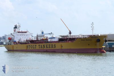
STOLT BASUTO
Oil/Chemical Tanker
Current Trip
| Time Travelled | 19 h, 22 mins |
|---|---|
| Remaining Time | 28 days |
| Distance Travelled | 266.34 морская миля |
| Remaining Distance | 9923.55 морская миля |
| AVG Speed | 13.9 Узлы |
| MAX Speed | 15.1 Узлы |
| AVG Wind | 10.5 knots |
| MAX Wind | 17 knots |
| MIN Temp | 17.1°C / 62.78°F |
| MAX Temp | 18.5°C / 65.3°F |
| Осадка | 10 м |
| Позиция Получена | 15 h, 54 m тому назад |
Current Position
| Долгота | -15.21833° |
|---|---|
| Широта | 27.64228° |
| Статус | Under way using engine |
| Скорость | 13.9 Узлы |
| Курс | 200° |
| Район | North Atlantic Ocean |
| Станция | T-AIS |
| Позиция Получена | 15 h, 54 m тому назад |
Info
Information
The current position of STOLT BASUTO is in North Atlantic Ocean with coordinates 27.64228° / -15.21833° as reported on 2025-02-09 22:31 by AIS to our vessel tracker app. The vessel's current speed is 13.9 Узлы and is heading at the port of SINGAPORE. The estimated time of arrival as calculated by MyShipTracking vessel tracking app is 2025-03-11 19:12 LT
The vessel STOLT BASUTO (IMO: 9351543, MMSI: 636015972) is a Oil/Chemical Tanker that was built in 2006 ( 19 лет ). It's sailing under the flag of [LR] Liberia.
In this page you can find informations about the vessels current position, last detected port calls, and current voyage information. If the vessels is not in coverage by AIS you will find the latest position.
The current position of STOLT BASUTO is detected by our AIS receivers and we are not responsible for the reliability of the data. The last position was recorded while the vessel was in Coverage by the Ais receivers of our vessel tracking app.
The current draught of STOLT BASUTO as reported by AIS is 10 meters
Weather
| Temperature | 18.2°C / 64.76°F |
|---|---|
| Wind Speed | 15 knots |
| Direction | 36° NE |
| Pressure | 1016.9 hPa |
| Humidity | 74.9 % |
| Cloud Coverage | --- |
Featured Company
Last Port Calls
| Port | Arrival | Departure | Time In Port |
|---|---|---|---|
| 2025-02-09 05:51 | 2025-02-09 19:04 | 13 h | |
| 2025-02-04 00:41 | 2025-02-05 08:57 | 1 d | |
| 2025-01-22 17:45 | 2025-01-27 00:44 | 4 d | |
| 2025-01-15 21:02 | 2025-01-21 11:02 | 5 d | |
| 2025-01-11 02:56 | 2025-01-13 11:23 | 2 d | |
| 2025-01-03 21:28 | 2025-01-11 02:42 | 7 d | |
| 2025-01-01 08:56 | 2025-01-03 20:27 | 2 d |
Most Visited Ports (Last year)
| Port | Arrivals | |
|---|---|---|
| 7 | ||
| 5 | ||
| 4 | ||
| 3 | ||
| 3 | ||
| 3 |
Last Trips
| Origin | Departure | Destination | Arrival | Distance | |
|---|---|---|---|---|---|
| 2025-02-05 08:57 | 2025-02-09 05:51 | 1205.37 морская миля | |||
| 2025-01-27 00:44 | 2025-02-04 00:41 | 2054.93 морская миля | |||
| 2025-01-21 11:02 | 2025-01-22 17:45 | 353.26 морская миля | |||
| 2025-01-13 11:23 | 2025-01-15 21:02 | 739.76 морская миля | |||
| 2025-01-11 02:42 | 2025-01-11 02:56 | 0.90 морская миля | |||
| 2025-01-03 20:27 | 2025-01-03 21:28 | 3.53 морская миля | |||
| 2024-11-25 21:07 | 2025-01-01 08:56 | 10231.15 морская миля |
Events
| Время | Событие | Детали | Позиция / Направление | Информация |
|---|---|---|---|---|
| 2025-02-09 22:39 | Статус изменился | Default Under way using engine |
27.61184 / -15.23195
SGSIN
|
Скорость: 13.9 kn Курс: 200° |
| 2025-02-09 22:31 | Статус изменился | Under way using engine Default |
27.64228 / -15.21833
SGSIN
|
Скорость: 13.9 kn Курс: 204° |
| 2025-02-09 22:31 | Вне покрытия |
27.64228 / -15.21833
North Atlantic Ocean
|
Скорость: 13.9 kn Курс: 200° |
|
| 2025-02-09 22:19 | Статус изменился | Default Under way using engine |
27.68359 / -15.20050
SGSIN
|
Скорость: 13.6 kn Курс: 201.6° |
| 2025-02-09 20:04 | Осадка изменилась | 10 10.1 |
28.10931 / -15.19582
SGSIN
|
Скорость: 13.7 kn Курс: 111° |
| 2025-02-09 20:04 | Пункт назначения изменился | SGSIN LAS PALMAS |
28.10931 / -15.19582
SGSIN
|
Скорость: 13.7 kn Курс: 111° |
| 2025-02-09 20:04 | ETA изменился | 2025/03/12 12:30 2025/02/09 05:30 |
28.10931 / -15.19582
SGSIN
|
Скорость: 13.7 kn Курс: 111° |
| 2025-02-09 19:14 | Статус изменился | Under way using engine At anchor |
28.14460 / -15.38547
LAS PALMAS
|
Скорость: 4.3 kn Курс: 106° |
| 2025-02-09 19:05 | Начало движения | 1.47 nm, North East of LAS PALMAS |
28.14404 / -15.39551
LAS PALMAS
|
Скорость: 3.1 kn Курс: 71° |
| 2025-02-09 19:04 | ПОРТ ОТПРАВЛЕНИЯ |
|
28.14392 / -15.39600
LAS PALMAS
|
Скорость: 1.4 kn Курс: 85° |