
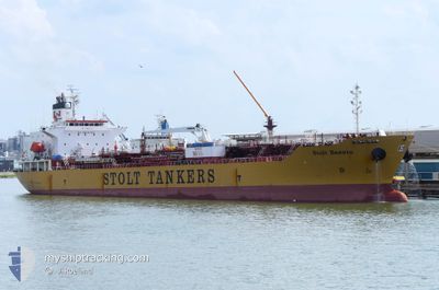
STOLT BASUTO
Oil/Chemical Tanker
Current Trip
| Time Travelled | 4 days |
|---|---|
| Remaining Time | 31 days |
| Distance Travelled | 1409.25 nm |
| Remaining Distance | 10442.92 nm |
| AVG Speed | 11.7 Knots |
| MAX Speed | 14.4 Knots |
| AVG Wind | 15 knots |
| MAX Wind | 29.5 knots |
| MIN Temp | 9°C / 48.2°F |
| MAX Temp | 17.5°C / 63.5°F |
| Draught | 9.2 m |
| Position Received | 3 d ago |
Current Position
| Longitude | -6.47528° |
|---|---|
| Latitude | 48.06476° |
| Status | Under way using engine |
| Speed | 10.8 Knots |
| Course | 212.4° |
| Area | Celtic Sea |
| Station | T-AIS |
| Position Received | 3 d ago |
Info
Information
The current position of STOLT BASUTO is in Celtic Sea with coordinates 48.06476° / -6.47528° as reported on 2025-12-14 20:54 by AIS to our vessel tracker app. The vessel's current speed is 10.8 Knots and is heading at the port of SINGAPORE. The estimated time of arrival as calculated by MyShipTracking vessel tracking app is 2026-01-19 03:11 LT
The vessel STOLT BASUTO (IMO: 9351543, MMSI: 636015972) is a Oil/Chemical Tanker that was built in 2006 ( 19 years old ). It's sailing under the flag of [LR] Liberia.
In this page you can find informations about the vessels current position, last detected port calls, and current voyage information. If the vessels is not in coverage by AIS you will find the latest position.
The current position of STOLT BASUTO is detected by our AIS receivers and we are not responsible for the reliability of the data. The last position was recorded while the vessel was in Coverage by the Ais receivers of our vessel tracking app.
The current draught of STOLT BASUTO as reported by AIS is 9.2 meters
Weather
| Temperature | 17.6°C / 63.68°F |
|---|---|
| Wind Speed | 12 knots |
| Direction | 16° NNE |
| Pressure | 1024.5 hPa |
| Humidity | 66 % |
| Cloud Coverage | 99 % |
Featured Company
Last Port Calls
| Port | Arrival | Departure | Time In Port |
|---|---|---|---|
| 2025-12-09 22:50 | 2025-12-13 00:55 | 3 d | |
| 2025-12-07 12:35 | 2025-12-07 13:23 | 48 m | |
| 2025-12-05 10:40 | 2025-12-07 10:29 | 1 d | |
| 2025-12-05 08:42 | 2025-12-05 09:02 | 19 m | |
| 2025-11-08 08:58 | 2025-11-16 00:03 | 7 d | |
| 2025-11-03 19:01 | 2025-11-05 03:02 | 1 d | |
| 2025-10-29 02:58 | 2025-11-01 07:01 | 3 d | |
| 2025-10-21 13:05 | 2025-10-23 10:56 | 1 d |
Most Visited Ports (Last year)
| Port | Arrivals | |
|---|---|---|
| 5 | ||
| 5 | ||
| 3 | ||
| 2 | ||
| 2 | ||
| 2 |
Last Trips
| Origin | Departure | Destination | Arrival | Distance | |
|---|---|---|---|---|---|
| 2025-12-07 13:23 | 2025-12-09 22:50 | 303.67 nm | |||
| 2025-12-07 10:29 | 2025-12-07 12:35 | 10.16 nm | |||
| 2025-12-05 09:02 | 2025-12-05 10:40 | 7.35 nm | |||
| 2025-11-16 00:03 | 2025-12-05 08:42 | 5026.06 nm | |||
| 2025-11-05 03:02 | 2025-11-08 08:58 | 916.94 nm | |||
| 2025-11-01 07:01 | 2025-11-03 19:01 | 496.84 nm | |||
| 2025-10-23 10:56 | 2025-10-29 02:58 | 1777.07 nm | |||
| 2025-09-11 08:43 | 2025-10-21 13:05 | 12397.63 nm |
Events
| Time | Event | Details | Position / Dest | Info |
|---|---|---|---|---|
| 2025-12-14 21:10 | Status Changed | Default Under way using engine |
48.02252 / -6.51328
SINGAPORE
|
Speed: 10.8 kn Course: 212.4° |
| 2025-12-14 20:54 | OUT of Coverage |
48.06476 / -6.47528
Celtic Sea
|
Speed: 10.8 kn Course: 212.4° |
|
| 2025-12-14 20:47 | Status Changed | Under way using engine Default |
48.08359 / -6.45826
SINGAPORE
|
Speed: 11 kn Course: 210° |
| 2025-12-14 20:25 | Status Changed | Default Under way using engine |
48.13986 / -6.40740
SINGAPORE
|
Speed: 11 kn Course: 210.5° |
| 2025-12-14 20:20 | Status Changed | Under way using engine Default |
48.15364 / -6.39642
SINGAPORE
|
Speed: 11.1 kn Course: 208° |
| 2025-12-14 20:12 | Status Changed | Default Under way using engine |
48.17500 / -6.37957
SINGAPORE
|
Speed: 11 kn Course: 209.6° |
| 2025-12-14 20:00 | Status Changed | Under way using engine Default |
48.20752 / -6.35349
SINGAPORE
|
Speed: 11.3 kn Course: 211° |
| 2025-12-14 19:51 | Status Changed | Default Under way using engine |
48.23177 / -6.33381
SINGAPORE
|
Speed: 11.1 kn Course: 207.8° |
| 2025-12-14 19:48 | Status Changed | Under way using engine Default |
48.23954 / -6.32737
SINGAPORE
|
Speed: 11.2 kn Course: 210° |
| 2025-12-14 19:39 | Status Changed | Default Under way using engine |
48.26532 / -6.30644
SINGAPORE
|
Speed: 11.5 kn Course: 208.9° |