

SWANSEA
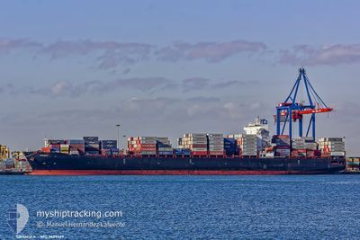
Container Ship

Current Trip
| Time Travelled | 6 h, 7 mins |
|---|---|
| Remaining Time | --- |
| Distance Travelled | 90.59 морская миля |
| Remaining Distance | --- |
| AVG Speed | 15.6 Узлы |
| MAX Speed | 19.6 Узлы |
| AVG Wind | 3.7 knots |
| MAX Wind | 8.6 knots |
| MIN Temp | 22.9°C / 73.22°F |
| MAX Temp | 25.3°C / 77.54°F |
| Осадка | 12.7 м |
| Позиция Получена | 5 h, 47 m тому назад |
Current Position
| Долгота | -89.96549° |
|---|---|
| Широта | 29.68362° |
| Статус | Under way using engine |
| Скорость | 13.6 Узлы |
| Курс | 148.2° |
| Район | Gulf of Mexico |
| Станция | T-AIS |
| Позиция Получена | 5 h, 47 m тому назад |
Information
The current position of SWANSEA is in Gulf of Mexico with coordinates 29.68362° / -89.96549° as reported on 2025-06-01 01:58 by AIS to our vessel tracker app. The vessel's current speed is 13.6 Узлы and is heading at the port of CARTAGENA. The estimated time of arrival as calculated by MyShipTracking vessel tracking app is 2025-06-06 08:00 LT
The vessel SWANSEA (IMO: 9629469, MMSI: 636016231) is a Container Ship that was built in 2014 ( 11 лет ). It's sailing under the flag of [LR] Liberia.
In this page you can find informations about the vessels current position, last detected port calls, and current voyage information. If the vessels is not in coverage by AIS you will find the latest position.
The current position of SWANSEA is detected by our AIS receivers and we are not responsible for the reliability of the data. The last position was recorded while the vessel was in Coverage by the Ais receivers of our vessel tracking app.
The current draught of SWANSEA as reported by AIS is 12.7 meters
Weather
| Temperature | 25.1°C / 77.18°F |
|---|---|
| Wind Speed | --- |
| Direction | 227° SW |
| Pressure | 1012.9 hPa |
| Humidity | 68.3 % |
| Cloud Coverage | 100 % |


Featured Company
Last Port Calls
| Port | Arrival | Departure | Time In Port |
|---|---|---|---|
| 2025-05-31 00:54 | 2025-05-31 20:38 | 19 h | |
| 2025-05-26 11:50 | 2025-05-28 20:47 | 2 d | |
| 2025-05-18 02:16 | 2025-05-19 21:00 | 1 d | |
| 2025-05-15 09:37 | 2025-05-16 18:53 | 1 d | |
| 2025-04-30 03:38 | 2025-05-01 18:55 | 1 d | |
| 2025-04-27 06:51 | 2025-04-27 06:59 | 8 m | |
| 2025-04-23 17:13 | 2025-04-25 05:08 | 1 d | |
| 2025-04-20 23:16 | 2025-04-21 22:24 | 23 h | |
| 2025-04-19 14:54 | 2025-04-20 08:08 | 17 h | |
| 2025-04-17 19:18 | 2025-04-18 17:01 | 21 h |
Most Visited Ports (Last year)
| Port | Arrivals | |
|---|---|---|
| 11 | ||
| 7 | ||
| 7 | ||
| 5 | ||
| 5 | ||
| 4 |
Last Trips
| Origin | Departure | Destination | Arrival | Distance | |
|---|---|---|---|---|---|
| 2025-05-28 20:47 | 2025-05-31 00:54 | 455.36 морская миля | |||
| 2025-05-19 21:00 | 2025-05-26 11:50 | 1888.86 морская миля | |||
| 2025-05-16 18:53 | 2025-05-18 02:16 | 484.96 морская миля | |||
| 2025-05-01 18:55 | 2025-05-15 09:37 | 3438.71 морская миля | |||
| 2025-04-27 06:59 | 2025-04-30 03:38 | 774.76 морская миля | |||
| 2025-04-25 05:08 | 2025-04-27 06:51 | 229.12 морская миля | |||
| 2025-04-21 22:24 | 2025-04-23 17:13 | 291.56 морская миля | |||
| 2025-04-20 08:08 | 2025-04-20 23:16 | 184.19 морская миля | |||
| 2025-04-18 17:01 | 2025-04-19 14:54 | 175.48 морская миля | |||
| 2025-04-06 09:43 | 2025-04-17 19:18 | 4325.00 морская миля |
Events
| Время | Событие | Детали | Позиция / Направление | Информация |
|---|---|---|---|---|
| 2025-06-01 02:05 | Статус изменился | Default Under way using engine |
29.65461 / -89.95725
COCTG
|
Скорость: 13.6 kn Курс: 148.2° |
| 2025-06-01 01:58 | Вне покрытия |
29.68362 / -89.96549
Gulf of Mexico
COCTG
|
Скорость: 13.6 kn Курс: 148.2° |
|
| 2025-06-01 01:53 | Статус изменился | Under way using engine Default |
29.69800 / -89.97580
COCTG
|
Скорость: 14 kn Курс: 153° |
| 2025-06-01 01:53 | Статус изменился | Default Under way using engine |
29.70003 / -89.97709
COCTG
|
Скорость: 14.4 kn Курс: 155.1° |
| 2025-06-01 01:52 | Статус изменился | Under way using engine Default |
29.70287 / -89.97865
COCTG
|
Скорость: 16.4 kn Курс: 156° |
| 2025-06-01 01:45 | Статус изменился | Default Under way using engine |
29.73213 / -89.99729
COCTG
|
Скорость: 17.7 kn Курс: 157.2° |
| 2025-06-01 01:38 | ПОРТ ОТПРАВЛЕНИЯ |
|
29.75460 / -90.02390
COCTG
|
Скорость: 18.3 kn Курс: 162° |
| 2025-06-01 01:36 | Статус изменился | Under way using engine Default |
29.76162 / -90.02505
[US] NEW ORLEANS
|
Скорость: 18.1 kn Курс: 207° |
| 2025-06-01 01:29 | Статус изменился | Default Under way using engine |
29.79748 / -90.00771
[US] NEW ORLEANS
|
Скорость: 13.5 kn Курс: 197° |
| 2025-05-31 23:50 | Осадка изменилась | 12.7 12 |
29.91029 / -90.09988
[US] NEW ORLEANS
|
Скорость: 9.7 kn Курс: 73° |