
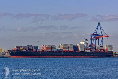
SWANSEA
Container Ship
Current Trip
JMKIN
| Time Travelled | 4 days |
|---|---|
| Remaining Time | --- |
| Distance Travelled | 1353.38 nm |
| Remaining Distance | --- |
| AVG Speed | 16.6 Knots |
| MAX Speed | 19.4 Knots |
| AVG Wind | 9.5 knots |
| MAX Wind | 19 knots |
| MIN Temp | 22.8°C / 73.04°F |
| MAX Temp | 31.6°C / 88.88°F |
| Draught | 13.6 m |
| Position Received | 1 d ago |
Current Position
| Longitude | -96.09191° |
|---|---|
| Latitude | 19.44587° |
| Status | Under way using engine |
| Speed | 1 Knots |
| Course | 341° |
| Area | Gulf of Mexico |
| Station | T-AIS |
| Position Received | 1 d ago |
Information
The current position of SWANSEA is in Gulf of Mexico with coordinates 19.44587° / -96.09191° as reported on 2025-05-23 01:51 by AIS to our vessel tracker app. The vessel's current speed is 1 Knots
The vessel SWANSEA (IMO: 9629469, MMSI: 636016231) is a Container Ship that was built in 2014 ( 11 years old ). It's sailing under the flag of [LR] Liberia.
In this page you can find informations about the vessels current position, last detected port calls, and current voyage information. If the vessels is not in coverage by AIS you will find the latest position.
The current position of SWANSEA is detected by our AIS receivers and we are not responsible for the reliability of the data. The last position was recorded while the vessel was in Coverage by the Ais receivers of our vessel tracking app.
The current draught of SWANSEA as reported by AIS is 13.6 meters
Weather
| Temperature | 28.8°C / 83.84°F |
|---|---|
| Wind Speed | 11 knots |
| Direction | 124° SE |
| Pressure | 1010.7 hPa |
| Humidity | 83.1 % |
| Cloud Coverage | 100 % |
Featured Company
Last Port Calls
| Port | Arrival | Departure | Time In Port |
|---|---|---|---|
| 2025-05-18 07:16 | 2025-05-20 02:00 | 1 d | |
| 2025-05-15 14:37 | 2025-05-16 23:53 | 1 d | |
| 2025-04-30 06:38 | 2025-05-01 21:55 | 1 d | |
| 2025-04-27 09:51 | 2025-04-27 09:59 | 8 m | |
| 2025-04-23 20:13 | 2025-04-25 08:08 | 1 d | |
| 2025-04-21 02:16 | 2025-04-22 01:24 | 23 h | |
| 2025-04-19 17:54 | 2025-04-20 11:08 | 17 h | |
| 2025-04-17 22:18 | 2025-04-18 20:01 | 21 h | |
| 2025-04-04 12:39 | 2025-04-06 14:43 | 2 d | |
| 2025-03-13 05:08 | 2025-03-14 01:40 | 20 h |
Most Visited Ports (Last year)
| Port | Arrivals | |
|---|---|---|
| 11 | ||
| 7 | ||
| 7 | ||
| 5 | ||
| 5 | ||
| 4 |
Last Trips
| Origin | Departure | Destination | Arrival | Distance | |
|---|---|---|---|---|---|
| 2025-05-16 18:53 | 2025-05-18 02:16 | 484.96 nm | |||
| 2025-05-01 18:55 | 2025-05-15 09:37 | 3438.71 nm | |||
| 2025-04-27 06:59 | 2025-04-30 03:38 | 774.76 nm | |||
| 2025-04-25 05:08 | 2025-04-27 06:51 | 229.12 nm | |||
| 2025-04-21 22:24 | 2025-04-23 17:13 | 291.56 nm | |||
| 2025-04-20 08:08 | 2025-04-20 23:16 | 184.19 nm | |||
| 2025-04-18 17:01 | 2025-04-19 14:54 | 175.48 nm | |||
| 2025-04-06 09:43 | 2025-04-17 19:18 | 4325.00 nm | |||
| 2025-03-13 20:40 | 2025-04-04 07:39 | 2394.85 nm | |||
| 2025-03-11 07:59 | 2025-03-13 00:08 | 444.15 nm |
Events
| Time | Event | Details | Position / Dest | Info |
|---|---|---|---|---|
| 2025-05-24 11:47 | START Moving | 2.65 nm, North West of VERACRUZ |
19.22566 / -96.16559
JMKIN
|
Speed: 5.1 kn Course: 161° |
| 2025-05-23 12:20 | STOP Moving | 3.07 nm, North West of VERACRUZ |
19.23373 / -96.16886
JMKIN
|
Speed: 0.1 kn Course: 349° |
| 2025-05-23 10:57 | START Moving | 3.82 nm, North of VERACRUZ |
19.26666 / -96.13039
JMKIN
|
Speed: 4.8 kn Course: 165° |
| 2025-05-23 10:35 | STOP Moving | 4.11 nm, North of VERACRUZ |
19.27114 / -96.13403
JMKIN
|
Speed: 0.3 kn Course: 131° |
| 2025-05-23 05:04 | START Moving | 15.49 nm, North of VERACRUZ |
19.46165 / -96.13988
JMKIN
|
Speed: 3.5 kn Course: 56° |
| 2025-05-23 01:53 | Status Changed | Default Under way using engine |
19.44572 / -96.09257
JMKIN
|
Speed: 1 kn Course: 341° |
| 2025-05-23 01:51 | OUT of Coverage |
19.44587 / -96.09191
Gulf of Mexico
|
Speed: 1 kn Course: 254.2° |
|
| 2025-05-23 01:35 | Detected in Sea | Mexican part of the Gulf of Mexico |
19.44708 / -96.08709
Gulf of Mexico
|
Speed: 1.1 kn Course: 251.6° |
| 2025-05-23 01:35 | Status Changed | Under way using engine Default |
19.44708 / -96.08709
JMKIN
|
Speed: 1 kn Course: 343° |
| 2025-05-23 01:19 | IN Coverage |
19.44708 / -96.08709
Gulf of Mexico
|
Speed: 1.1 kn Course: 251.6° |