

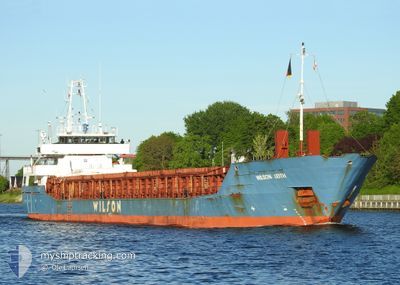
WILSON LEITH
General Cargo

Current Trip
| Time Travelled | 22 h, 2 mins |
|---|---|
| Remaining Time | --- |
| Distance Travelled | 179.42 морская миля |
| Remaining Distance | --- |
| AVG Speed | 7.4 Узлы |
| MAX Speed | 13.8 Узлы |
| AVG Wind | 22.4 knots |
| MAX Wind | 36 knots |
| MIN Temp | 5.3°C / 41.54°F |
| MAX Temp | 9.5°C / 49.1°F |
| Осадка | 5.8 м |
| Позиция Получена | 1 m тому назад |
Current Position
| Долгота | -5.37924° |
|---|---|
| Широта | 53.13040° |
| Статус | Under way using engine |
| Скорость | 8.2 Узлы |
| Курс | 1° |
| Район | Irish Sea and St. George's Channel |
| Станция | T-AIS |
| Позиция Получена | 1 m тому назад |
Information
The current position of WILSON LEITH is in Irish Sea and St. George's Channel with coordinates 53.13040° / -5.37924° as reported on 2025-04-16 18:35 by AIS to our vessel tracker app. The vessel's current speed is 8.2 Узлы and is heading at the port of GRUNDARTANGI. The estimated time of arrival as calculated by MyShipTracking vessel tracking app is 2025-04-20 15:00 LT
The vessel WILSON LEITH (IMO: 9150509, MMSI: 314553000) is a General Cargo that was built in 1997 ( 28 лет ). It's sailing under the flag of [BB] Barbados.
In this page you can find informations about the vessels current position, last detected port calls, and current voyage information. If the vessels is not in coverage by AIS you will find the latest position.
The current position of WILSON LEITH is detected by our AIS receivers and we are not responsible for the reliability of the data. The last position was recorded while the vessel was in Coverage by the Ais receivers of our vessel tracking app.
The current draught of WILSON LEITH as reported by AIS is 5.8 meters
Weather
| Temperature | 7.3°C / 45.14°F |
|---|---|
| Wind Speed | 19 knots |
| Direction | 301° WNW |
| Pressure | 1002.7 hPa |
| Humidity | 86.7 % |
| Cloud Coverage | 100 % |


Featured Company
Last Port Calls
| Port | Arrival | Departure | Time In Port |
|---|---|---|---|
| 2025-04-13 07:27 | 2025-04-15 21:34 | 2 d | |
| 2025-04-11 20:05 | 2025-04-12 19:44 | 23 h | |
| 2025-04-05 02:19 | 2025-04-08 17:03 | 3 d | |
| 2025-04-01 22:35 | 2025-04-03 22:12 | 1 d | |
| 2025-03-27 14:04 | 2025-03-28 08:49 | 18 h | |
| 2025-03-17 12:43 | 2025-03-21 21:13 | 4 d | |
| 2025-03-07 09:40 | 2025-03-13 09:03 | 5 d | |
| 2025-03-04 01:26 | 2025-03-04 19:35 | 18 h | |
| 2025-02-16 13:41 | 2025-02-19 14:39 | 3 d | |
| 2025-02-10 22:26 | 2025-02-11 18:42 | 20 h |
Most Visited Ports (Last year)
| Port | Arrivals | |
|---|---|---|
| 4 | ||
| 4 | ||
| 2 | ||
| 2 | ||
| 2 | ||
| 2 |
Last Trips
| Origin | Departure | Destination | Arrival | Distance | |
|---|---|---|---|---|---|
| 2025-04-12 19:44 | 2025-04-13 07:27 | 43.15 морская миля | |||
| 2025-04-08 17:03 | 2025-04-11 20:05 | 750.39 морская миля | |||
| 2025-04-03 22:12 | 2025-04-05 02:19 | 145.65 морская миля | |||
| 2025-03-28 08:49 | 2025-04-01 22:35 | 963.91 морская миля | |||
| 2025-03-21 21:13 | 2025-03-27 14:04 | 770.53 морская миля | |||
| 2025-03-13 09:03 | 2025-03-17 12:43 | 764.21 морская миля | |||
| 2025-03-04 19:35 | 2025-03-07 09:40 | 537.75 морская миля | |||
| 2025-02-19 14:39 | 2025-03-04 01:26 | 2531.39 морская миля | |||
| 2025-02-11 18:42 | 2025-02-16 13:41 | 513.54 морская миля | |||
| 2025-02-05 02:00 | 2025-02-10 22:26 | 1375.90 морская миля |
Events
| Время | Событие | Детали | Позиция / Направление | Информация |
|---|---|---|---|---|
| 2025-04-16 17:17 | Статус изменился | Under way using engine Default |
52.96148 / -5.38979
ISGRT
|
Скорость: 7 kn Курс: 0° |
| 2025-04-16 17:16 | Статус изменился | Default Under way using engine |
52.95958 / -5.38977
ISGRT
|
Скорость: 7 kn Курс: 1° |
| 2025-04-16 17:16 | Статус изменился | Under way using engine Default |
52.95895 / -5.38977
ISGRT
|
Скорость: 6.7 kn Курс: 0° |
| 2025-04-16 17:08 | Статус изменился | Default Under way using engine |
52.94467 / -5.38937
ISGRT
|
Скорость: 6.5 kn Курс: 0.7° |
| 2025-04-16 16:54 | Статус изменился | Under way using engine Default |
52.91954 / -5.38876
ISGRT
|
Скорость: 5.9 kn Курс: 4° |
| 2025-04-16 16:52 | Статус изменился | Default Under way using engine |
52.91551 / -5.38885
ISGRT
|
Скорость: 6.2 kn Курс: 0.4° |
| 2025-04-16 16:42 | Статус изменился | Under way using engine Default |
52.89865 / -5.38869
ISGRT
|
Скорость: 6.3 kn Курс: 357° |
| 2025-04-16 16:40 | Статус изменился | Default Under way using engine |
52.89451 / -5.38859
ISGRT
|
Скорость: 6.2 kn Курс: 1.7° |
| 2025-04-16 16:33 | Изменение морского района | Irish part of the Irish Sea and St. George's Channel United Kingdom part of the Celtic Sea |
52.88266 / -5.38821
Irish Sea and St. George's Channel
ISGRT
|
Скорость: 6.2 kn Курс: 1.7° |
| 2025-04-16 16:33 | Статус изменился | Under way using engine Default |
52.88266 / -5.38821
ISGRT
|
Скорость: 6.3 kn Курс: 358° |