

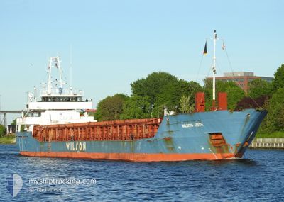
WILSON LEITH
General Cargo

Current Trip
| Time Travelled | 3 days |
|---|---|
| Remaining Time | --- |
| Distance Travelled | 810.52 nm |
| Remaining Distance | --- |
| AVG Speed | 8.8 Knots |
| MAX Speed | 11.5 Knots |
| AVG Wind | 17.6 knots |
| MAX Wind | 28 knots |
| MIN Temp | 0.2°C / 32.36°F |
| MAX Temp | 8.1°C / 46.58°F |
| Draught | 5.5 m |
| Position Received | 1 m ago |
Current Position
| Longitude | 1.22179° |
|---|---|
| Latitude | 55.15847° |
| Status | Under way using engine |
| Speed | 10.8 Knots |
| Course | 196.2° |
| Area | North Sea |
| Station | T-AIS |
| Position Received | 1 m ago |
Information
The current position of WILSON LEITH is in North Sea with coordinates 55.15847° / 1.22179° as reported on 2025-04-01 03:26 by AIS to our vessel tracker app. The vessel's current speed is 10.8 Knots and is heading at the port of GOOLE. The estimated time of arrival as calculated by MyShipTracking vessel tracking app is 2025-04-01 14:00 LT
The vessel WILSON LEITH (IMO: 9150509, MMSI: 314553000) is a General Cargo that was built in 1997 ( 28 years old ). It's sailing under the flag of [BB] Barbados.
In this page you can find informations about the vessels current position, last detected port calls, and current voyage information. If the vessels is not in coverage by AIS you will find the latest position.
The current position of WILSON LEITH is detected by our AIS receivers and we are not responsible for the reliability of the data. The last position was recorded while the vessel was in Coverage by the Ais receivers of our vessel tracking app.
The current draught of WILSON LEITH as reported by AIS is 5.5 meters
Weather
| Temperature | 7.5°C / 45.5°F |
|---|---|
| Wind Speed | 9 knots |
| Direction | 172° S |
| Pressure | 1029.7 hPa |
| Humidity | 78.6 % |
| Cloud Coverage | 100 % |


Featured Company
Last Port Calls
| Port | Arrival | Departure | Time In Port |
|---|---|---|---|
| 2025-03-27 13:04 | 2025-03-28 07:49 | 18 h | |
| 2025-03-17 11:43 | 2025-03-21 20:13 | 4 d | |
| 2025-03-07 08:40 | 2025-03-13 08:03 | 5 d | |
| 2025-03-04 00:26 | 2025-03-04 18:35 | 18 h | |
| 2025-02-16 12:41 | 2025-02-19 13:39 | 3 d | |
| 2025-02-10 21:26 | 2025-02-11 17:42 | 20 h | |
| 2025-02-03 09:11 | 2025-02-05 01:00 | 1 d |
Most Visited Ports (Last year)
| Port | Arrivals | |
|---|---|---|
| 4 | ||
| 4 | ||
| 2 | ||
| 2 | ||
| 2 | ||
| 2 |
Last Trips
| Origin | Departure | Destination | Arrival | Distance | |
|---|---|---|---|---|---|
| 2025-03-21 21:13 | 2025-03-27 14:04 | 770.53 nm | |||
| 2025-03-13 09:03 | 2025-03-17 12:43 | 764.21 nm | |||
| 2025-03-04 19:35 | 2025-03-07 09:40 | 537.75 nm | |||
| 2025-02-19 14:39 | 2025-03-04 01:26 | 2531.39 nm | |||
| 2025-02-11 18:42 | 2025-02-16 13:41 | 513.54 nm | |||
| 2025-02-05 02:00 | 2025-02-10 22:26 | 1375.90 nm | |||
| 2025-01-28 20:22 | 2025-02-03 10:11 | 836.98 nm |
Events
| Time | Event | Details | Position / Dest | Info |
|---|---|---|---|---|
| 2025-04-01 02:41 | Status Changed | Under way using engine Default |
55.28786 / 1.29101
GBGOO
|
Speed: 10.5 kn Course: 197° |
| 2025-04-01 02:33 | IN Coverage |
55.28786 / 1.29101
North Sea
GBGOO
|
Speed: 10.5 kn Course: 197.9° |
|
| 2025-03-31 17:01 | Status Changed | Default Under way using engine |
56.77917 / 2.18022
GBGOO
|
Speed: 10.2 kn Course: 187.5° |
| 2025-03-31 16:54 | OUT of Coverage |
56.79926 / 2.18537
North Sea
GBGOO
|
Speed: 10.2 kn Course: 187.5° |
|
| 2025-03-31 16:48 | Status Changed | Under way using engine Default |
56.81628 / 2.18697
GBGOO
|
Speed: 10.3 kn Course: 200° |
| 2025-03-31 16:48 | IN Coverage |
56.81628 / 2.18697
North Sea
GBGOO
|
Speed: 10.2 kn Course: 180.4° |
|
| 2025-03-31 15:50 | Status Changed | Default Under way using engine |
56.96681 / 2.30013
GBGOO
|
Speed: 10.5 kn Course: 204.7° |
| 2025-03-31 15:39 | OUT of Coverage |
56.99518 / 2.32378
North Sea
GBGOO
|
Speed: 10.5 kn Course: 204.7° |
|
| 2025-03-31 15:20 | Detected in Sea | United Kingdom part of the North Sea |
57.04473 / 2.36687
North Sea
GBGOO
|
Speed: 10.5 kn Course: 204.9° |
| 2025-03-30 13:34 | Change Sea Area | Norwegian part of the North Sea Norwegian part of the Norwegian Sea |
60.99105 / 4.32440
North Sea
GBGOO
|
Speed: 8.9 kn Course: 181° |