
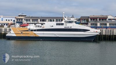
ADLER JET
High speed craft
Current Trip
DEBHV
| Time Travelled | 5 days |
|---|---|
| Remaining Time | --- |
| Distance Travelled | --- |
| Remaining Distance | --- |
| AVG Speed | --- |
| MAX Speed | --- |
| AVG Wind | --- |
| MAX Wind | --- |
| MIN Temp | --- |
| MAX Temp | --- |
| Djupgående | 1.4 m |
| Position mottagen | 2024-10-18 12:10 |
Current Position
| Longitud | 16.47270° |
|---|---|
| Latitude | 43.52750° |
| Status | Under way using engine |
| Fart | |
| Kurs | 101° |
| Område | Adriatic Sea |
| Station | T-AIS |
| Position mottagen | 2024-10-18 12:10 |
Info
Information
The current position of ADLER JET is in Adriatic Sea with coordinates 43.52750° / 16.47270° as reported on 2024-10-18 12:10 by AIS to our vessel tracker app. The vessel's current speed is 0 Knop
The vessel ADLER JET (IMO: 9281061, MMSI: 211835870) is a High speed craft that was built in 2003 ( 22 År gammal ). It's sailing under the flag of [DE] Germany.
In this page you can find informations about the vessels current position, last detected port calls, and current voyage information. If the vessels is not in coverage by AIS you will find the latest position.
The current position of ADLER JET is detected by our AIS receivers and we are not responsible for the reliability of the data. The last position was recorded while the vessel was in Coverage by the Ais receivers of our vessel tracking app.
The current draught of ADLER JET as reported by AIS is 1.4 meters
Weather
| Temperature | 10.9°C / 51.62°F |
|---|---|
| Wind Speed | 16 knots |
| Direction | 116° ESE |
| Pressure | 1023.6 hPa |
| Humidity | 82.7 % |
| Cloud Coverage | 100 % |
Featured Company
Last Port Calls
| Port | Arrival | Departure | Time In Port |
|---|---|---|---|
| 2025-02-07 11:38 |
Last Trips
| Origin | Departure | Destination | Arrival | Distance |
|---|
Events
| Tid | Event | Detaljer | Position / Dest | Information |
|---|---|---|---|---|
| 2025-02-12 09:17 | STARTAR förflyttning | 0.79 nm, South West of TROGIR |
43.50342 / 16.22212
DEBHV
|
Fart: 9.6 kn Kurs: 260° |
| 2025-02-07 12:54 | STOPPAR förflyttning | 0.63 nm, East of TROGIR |
43.51012 / 16.24659
DEBHV
|
Fart: Kurs: 132° |
| 2025-02-07 11:24 | STARTAR förflyttning | 1.75 nm, South West of TROGIR |
43.49801 / 16.19943
DEBHV
|
Fart: 14 kn Kurs: 221° |
| 2025-02-07 10:38 | AVGÅTT HAMN |
|
43.51011 / 16.24661
DEBHV
|
Fart: Kurs: 102° |