
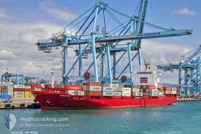
ADRASTOS
Cargo A
Current Trip
| Time Travelled | 1 day |
|---|---|
| Remaining Time | 2 days |
| Distance Travelled | 460.59 nm |
| Remaining Distance | 956.49 nm |
| AVG Speed | 17.4 Knop |
| MAX Speed | 18.5 Knop |
| AVG Wind | 7.4 knots |
| MAX Wind | 10 knots |
| MIN Temp | 11.2°C / 52.16°F |
| MAX Temp | 16.8°C / 62.24°F |
| Djupgående | 7.6 m |
| Position mottagen | 2 h, 52 m sen |
Current Position
| Longitud | -9.84046° |
|---|---|
| Latitude | 40.20555° |
| Status | Under way using engine |
| Fart | 17.1 Knop |
| Kurs | 1.2° |
| Område | North Atlantic Ocean |
| Station | T-AIS |
| Position mottagen | 2 h, 52 m sen |
Info
Information
The current position of ADRASTOS is in North Atlantic Ocean with coordinates 40.20555° / -9.84046° as reported on 2025-02-09 22:23 by AIS to our vessel tracker app. The vessel's current speed is 17.1 Knop and is heading at the port of TILBURY. The estimated time of arrival as calculated by MyShipTracking vessel tracking app is 2025-02-12 05:08 LT
The vessel ADRASTOS (IMO: 9951185, MMSI: 636022178) is a Cargo A It's sailing under the flag of [LR] Liberia.
In this page you can find informations about the vessels current position, last detected port calls, and current voyage information. If the vessels is not in coverage by AIS you will find the latest position.
The current position of ADRASTOS is detected by our AIS receivers and we are not responsible for the reliability of the data. The last position was recorded while the vessel was in Coverage by the Ais receivers of our vessel tracking app.
The current draught of ADRASTOS as reported by AIS is 7.6 meters
Weather
| Temperature | 15°C / 59°F |
|---|---|
| Wind Speed | 9 knots |
| Direction | 171° S |
| Pressure | 1021.1 hPa |
| Humidity | 83.2 % |
| Cloud Coverage | 99 % |
Featured Company
Last Port Calls
| Port | Arrival | Departure | Time In Port |
|---|---|---|---|
| 2025-02-06 13:04 | 2025-02-08 22:33 | 2 d | |
| 2025-02-02 22:50 | 2025-02-03 18:35 | 19 h | |
| 2025-01-31 22:53 | 2025-02-01 07:54 | 9 h | |
| 2025-01-22 10:37 | 2025-01-22 20:09 | 9 h | |
| 2025-01-20 11:38 | 2025-01-21 16:05 | 1 d | |
| 2025-01-18 12:09 | 2025-01-19 01:45 | 13 h | |
| 2025-01-15 04:29 | 2025-01-16 03:10 | 22 h | |
| 2025-01-13 07:40 | 2025-01-14 03:05 | 19 h | |
| 2025-01-10 04:01 | 2025-01-10 21:41 | 17 h | |
| 2025-01-02 21:38 | 2025-01-04 16:08 | 1 d |
Most Visited Ports (Last year)
| Port | Arrivals | |
|---|---|---|
| 15 | ||
| 11 | ||
| 6 | ||
| 4 | ||
| 3 | ||
| 3 |
Last Trips
| Origin | Departure | Destination | Arrival | Distance | |
|---|---|---|---|---|---|
| 2025-02-03 19:35 | 2025-02-06 14:04 | 189.84 nm | |||
| 2025-02-01 08:54 | 2025-02-02 23:50 | 558.02 nm | |||
| 2025-01-22 21:09 | 2025-01-31 23:53 | 793.08 nm | |||
| 2025-01-21 17:05 | 2025-01-22 11:37 | 273.23 nm | |||
| 2025-01-19 02:45 | 2025-01-20 12:38 | 123.40 nm | |||
| 2025-01-16 04:10 | 2025-01-18 13:09 | 409.59 nm | |||
| 2025-01-14 04:05 | 2025-01-15 05:29 | 301.29 nm | |||
| 2025-01-10 21:41 | 2025-01-13 08:40 | 166.92 nm | |||
| 2025-01-04 17:08 | 2025-01-10 04:01 | 1612.84 nm | |||
| 2025-01-02 05:54 | 2025-01-02 22:38 | 282.48 nm |
Events
| Tid | Event | Detaljer | Position / Dest | Information |
|---|---|---|---|---|
| 2025-02-09 22:37 | Status ändrad | Default Under way using engine |
40.27388 / -9.83993
GB TIL
|
Fart: 17.1 kn Kurs: 1.2° |
| 2025-02-09 22:23 | UTANFÖR täckningsområde |
40.20555 / -9.84046
North Atlantic Ocean
GB TIL
|
Fart: 17.1 kn Kurs: 1.2° |
|
| 2025-02-09 12:59 | ETA ändrat | 2025/02/12 03:30 2025/02/11 23:30 |
37.45065 / -9.48851
GB TIL
|
Fart: 18 kn Kurs: 346.6° |
| 2025-02-09 12:46 | Upptäckt i hav | Portuguese part of the North Atlantic Ocean |
37.38881 / -9.47022
North Atlantic Ocean
GB TIL
|
Fart: 17.8 kn Kurs: 345.8° |
| 2025-02-09 12:46 | Status ändrad | Under way using engine Default |
37.38586 / -9.46931
GB TIL
|
Fart: 17.7 kn Kurs: 347° |
| 2025-02-09 12:39 | I täckningsområde |
37.38881 / -9.47022
North Atlantic Ocean
GB TIL
|
Fart: 17.8 kn Kurs: 345.8° |
|
| 2025-02-08 23:41 | Status ändrad | Default Under way using engine |
33.87967 / -7.62958
GB TIL
|
Fart: 17.5 kn Kurs: 343.1° |
| 2025-02-08 23:38 | UTANFÖR täckningsområde |
33.87028 / -7.62615
North Atlantic Ocean
GB TIL
|
Fart: 17.5 kn Kurs: 343.1° |
|
| 2025-02-08 23:03 | Djupgående ändrat | 7.6 9.2 |
33.70868 / -7.56359
GB TIL
|
Fart: 16.2 kn Kurs: 354.3° |
| 2025-02-08 23:03 | ETA ändrat | 2025/02/11 23:30 2025/02/11 23:00 |
33.70868 / -7.56359
GB TIL
|
Fart: 16.2 kn Kurs: 354.3° |