
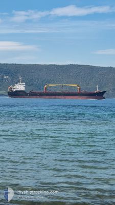
AFINA I
Bulk Carrier
Current Trip
| Time Travelled | 6 days |
|---|---|
| Remaining Time | 1 day |
| Distance Travelled | 540.97 nm |
| Remaining Distance | 292.54 nm |
| AVG Speed | 9.8 Knop |
| MAX Speed | 11.7 Knop |
| AVG Wind | 13.2 knots |
| MAX Wind | 24 knots |
| MIN Temp | 7°C / 44.6°F |
| MAX Temp | 17°C / 62.6°F |
| Djupgående | 5 m |
| Position mottagen | Nu |
Current Position
| Longitud | 28.30398° |
|---|---|
| Latitude | 35.75635° |
| Status | Under way using engine |
| Fart | 10.5 Knop |
| Kurs | 271.8° |
| Område | Mediterranean Sea - Eastern Basin |
| Station | T-AIS |
| Position mottagen | Nu |
Info
Information
The current position of AFINA I is in Mediterranean Sea - Eastern Basin with coordinates 35.75635° / 28.30398° as reported on 2025-02-09 01:28 by AIS to our vessel tracker app. The vessel's current speed is 10.5 Knop and is heading at the port of NEMRUT. The estimated time of arrival as calculated by MyShipTracking vessel tracking app is 2025-02-10 04:11 LT
The vessel AFINA I (IMO: 9585015, MMSI: 248300000) is a Bulk Carrier that was built in 2010 ( 15 År gammal ). It's sailing under the flag of [MT] Malta.
In this page you can find informations about the vessels current position, last detected port calls, and current voyage information. If the vessels is not in coverage by AIS you will find the latest position.
The current position of AFINA I is detected by our AIS receivers and we are not responsible for the reliability of the data. The last position was recorded while the vessel was in Coverage by the Ais receivers of our vessel tracking app.
The current draught of AFINA I as reported by AIS is 5 meters
Weather
| Temperature | 12.5°C / 54.5°F |
|---|---|
| Wind Speed | 6 knots |
| Direction | 318° NW |
| Pressure | 1019.7 hPa |
| Humidity | 47.6 % |
| Cloud Coverage | --- |
Featured Company
Last Port Calls
| Port | Arrival | Departure | Time In Port |
|---|---|---|---|
| 2025-01-30 13:52 | 2025-02-02 08:49 | 2 d | |
| 2025-01-20 20:05 | 2025-01-23 19:37 | 2 d | |
| 2024-12-22 07:37 | 2024-12-30 09:49 | 8 d | |
| 2024-12-13 05:41 |
Last Trips
| Origin | Departure | Destination | Arrival | Distance | |
|---|---|---|---|---|---|
| 2025-01-23 20:37 | 2025-01-30 16:52 | 1522.31 nm | |||
| 2024-12-30 10:49 | 2025-01-20 21:05 | 1786.44 nm | |||
| 2024-12-13 07:41 | 2024-12-22 08:37 | 959.63 nm |
Events
| Tid | Event | Detaljer | Position / Dest | Information |
|---|---|---|---|---|
| 2025-02-08 23:22 | Upptäckt i hav | Greek part of the Mediterranean Sea - Eastern Basin |
35.74730 / 28.77136
Mediterranean Sea - Eastern Basin
TRNEM
|
Fart: 11 kn Kurs: 271.4° |
| 2025-02-08 22:59 | Upptäckt i hav | Turkish part of the Mediterranean Sea - Eastern Basin |
35.74544 / 28.85912
Mediterranean Sea - Eastern Basin
TRNEM
|
Fart: 10.9 kn Kurs: 270.9° |
| 2025-02-08 22:57 | I täckningsområde |
35.74544 / 28.85912
Mediterranean Sea - Eastern Basin
TRNEM
|
Fart: 10.9 kn Kurs: 270.9° |
|
| 2025-02-08 20:01 | Status ändrad | Default Under way using engine |
35.73177 / 29.53085
TRNEM
|
Fart: 11 kn Kurs: 272.3° |
| 2025-02-08 19:49 | UTANFÖR täckningsområde |
35.73038 / 29.57520
Mediterranean Sea - Eastern Basin
TRNEM
|
Fart: 11 kn Kurs: 272.3° |
|
| 2025-02-08 19:18 | Byter havsområde | Greek part of the Mediterranean Sea - Eastern Basin Turkish part of the Mediterranean Sea - Eastern Basin |
35.72881 / 29.68955
Mediterranean Sea - Eastern Basin
TRNEM
|
Fart: 11.1 kn Kurs: 270.6° |
| 2025-02-08 19:18 | Status ändrad | Under way using engine Default |
35.72881 / 29.68955
TRNEM
|
Fart: 11.4 kn Kurs: 270° |
| 2025-02-08 19:18 | I täckningsområde |
35.72881 / 29.68955
Mediterranean Sea - Eastern Basin
TRNEM
|
Fart: 11.1 kn Kurs: 270.6° |
|
| 2025-02-07 17:53 | Status ändrad | Default Under way using engine |
36.33688 / 35.09468
TRNEM
|
Fart: 9.8 kn Kurs: 251.3° |
| 2025-02-07 17:46 | UTANFÖR täckningsområde |
36.34190 / 35.11182
Mediterranean Sea - Eastern Basin
TRNEM
|
Fart: 9.8 kn Kurs: 251.3° |