
AH EVER
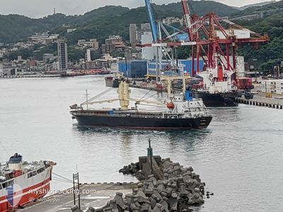
General Cargo
Current Trip
| Trip Time | 9 days |
|---|---|
| Trip Distance | 2249.20 nm |
| AVG Speed | 10.3 Knop |
| MAX Speed | 12.5 Knop |
| Djupgående | 8.2 m |
| AVG Wind | 9.7 knots |
| MAX Wind | 22.2 knots |
| MIN Temp | 7.3°C / 45.14°F |
| MAX Temp | 26.9°C / 80.42°F |
| Position mottagen | 8 d sen |
Current Position
| Longitud | 37.47098° |
|---|---|
| Latitude | 21.97066° |
| Status | Under way using engine |
| Fart | 12.3 Knop |
| Kurs | 159.9° |
| Område | Red Sea |
| Station | T-AIS |
| Position mottagen | 8 d sen |
Info
Information
The current position of AH EVER is in Red Sea with coordinates 21.97066° / 37.47098° as reported on 2025-02-04 13:20 by AIS to our vessel tracker app. The vessel's current speed is 12.3 Knop and is currently inside the port of MASSAWA.
The vessel AH EVER (IMO: 9201712, MMSI: 357587000) is a General Cargo that was built in 1999 ( 26 År gammal ). It's sailing under the flag of [PA] Panama.
In this page you can find informations about the vessels current position, last detected port calls, and current voyage information. If the vessels is not in coverage by AIS you will find the latest position.
The current position of AH EVER is detected by our AIS receivers and we are not responsible for the reliability of the data. The last position was recorded while the vessel was in Coverage by the Ais receivers of our vessel tracking app.
The current draught of AH EVER as reported by AIS is 8.2 meters
Weather
| Temperature | 26.9°C / 80.42°F |
|---|---|
| Wind Speed | 10 knots |
| Direction | 338° NNW |
| Pressure | 1011.1 hPa |
| Humidity | 65.4 % |
| Cloud Coverage | 37 % |
Featured Company
Last Port Calls
| Port | Arrival | Departure | Time In Port |
|---|---|---|---|
| 2025-02-06 05:00 | |||
| 2025-02-02 03:57 | 2025-02-02 13:25 | 9 h | |
| 2025-01-16 13:01 | 2025-01-27 16:41 | 11 d | |
| 2024-12-26 18:23 | 2025-01-04 15:38 | 8 d | |
| 2024-12-15 05:32 | 2024-12-15 15:12 | 9 h |
Most Visited Ports (Last year)
| Port | Arrivals | |
|---|---|---|
| 2 | ||
| 2 | ||
| 2 | ||
| 1 | ||
| 1 | ||
| 1 |
Last Trips
| Origin | Departure | Destination | Arrival | Distance | |
|---|---|---|---|---|---|
| 2025-01-27 19:41 | 2025-02-06 08:00 | 2249.20 nm | |||
| 2025-01-27 19:41 | 2025-02-02 05:57 | 1208.20 nm | |||
| 2025-01-04 16:38 | 2025-01-16 16:01 | 2031.98 nm | |||
| 2024-11-15 12:16 | 2024-12-26 19:23 | 9524.82 nm | |||
| 2024-11-15 12:16 | 2024-12-15 07:32 | 7546.11 nm |
Events
| Tid | Event | Detaljer | Position / Dest | Information |
|---|---|---|---|---|
| 2025-02-06 05:00 | ANLÄNDER HAMN |
|
15.61502 / 39.47935
[ER] MASSAWA
|
Fart: 2.4 kn Kurs: 280° |
| 2025-02-06 03:35 | STOPPAR förflyttning | 3.12 nm, North East of MASSAWA |
15.62727 / 39.50383
MASSAWA
|
Fart: 0.2 kn Kurs: 214° |
| 2025-02-04 13:28 | Status ändrad | Default Under way using engine |
21.94618 / 37.48070
MASSAWA
|
Fart: 12.3 kn Kurs: 159.9° |
| 2025-02-04 13:20 | UTANFÖR täckningsområde |
21.97066 / 37.47098
Red Sea
MASSAWA
|
Fart: 12.3 kn Kurs: 159.9° |
|
| 2025-02-04 13:03 | Status ändrad | Under way using engine Default |
22.02378 / 37.44971
MASSAWA
|
Fart: 12 kn Kurs: 158° |
| 2025-02-04 12:52 | I täckningsområde |
22.02378 / 37.44971
Red Sea
MASSAWA
|
Fart: 12 kn Kurs: 159.6° |
|
| 2025-02-04 11:17 | Status ändrad | Default Under way using engine |
22.34928 / 37.30342
MASSAWA
|
Fart: 11.5 kn Kurs: 156.9° |
| 2025-02-04 11:14 | UTANFÖR täckningsområde |
22.35874 / 37.29916
Red Sea
MASSAWA
|
Fart: 11.5 kn Kurs: 156.9° |
|
| 2025-02-04 10:58 | Upptäckt i hav | Disputed Sudan-Egypt part of the Red Sea |
22.40543 / 37.27830
Red Sea
MASSAWA
|
Fart: 11.4 kn Kurs: 158.8° |
| 2025-02-04 10:58 | Status ändrad | Under way using engine Default |
22.40543 / 37.27830
MASSAWA
|
Fart: 11.3 kn Kurs: 158° |