
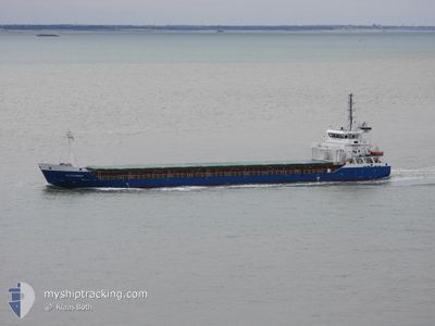
ALEXANDER
General Cargo
Current Trip
| Time Travelled | 3 h, 13 mins |
|---|---|
| Remaining Time | --- |
| Distance Travelled | 34.64 nm |
| Remaining Distance | --- |
| AVG Speed | 11.2 Knop |
| MAX Speed | 12.6 Knop |
| AVG Wind | 5.6 knots |
| MAX Wind | 10 knots |
| MIN Temp | 5.4°C / 41.72°F |
| MAX Temp | 8.3°C / 46.94°F |
| Djupgående | 4.1 m |
| Position mottagen | 2 m sen |
Current Position
| Longitud | -6.93959° |
|---|---|
| Latitude | 55.56090° |
| Status | Under way using engine |
| Fart | 11.8 Knop |
| Kurs | 355° |
| Område | Inner Seas off the West Coast of Scotland |
| Station | T-AIS |
| Position mottagen | 2 m sen |
Info
Information
The current position of ALEXANDER is in Inner Seas off the West Coast of Scotland with coordinates 55.56090° / -6.93959° as reported on 2025-03-19 21:26 by AIS to our vessel tracker app. The vessel's current speed is 11.8 Knop and is heading at the port of GOTEBORG. The estimated time of arrival as calculated by MyShipTracking vessel tracking app is 2025-03-22 22:00 LT
The vessel ALEXANDER (IMO: 9433353, MMSI: 305393000) is a General Cargo that was built in 2009 ( 16 År gammal ). It's sailing under the flag of [AG] Antigua Barbuda.
In this page you can find informations about the vessels current position, last detected port calls, and current voyage information. If the vessels is not in coverage by AIS you will find the latest position.
The current position of ALEXANDER is detected by our AIS receivers and we are not responsible for the reliability of the data. The last position was recorded while the vessel was in Coverage by the Ais receivers of our vessel tracking app.
The current draught of ALEXANDER as reported by AIS is 4.1 meters
Weather
| Temperature | 8.3°C / 46.94°F |
|---|---|
| Wind Speed | 9 knots |
| Direction | 128° SE |
| Pressure | 1020.2 hPa |
| Humidity | 79 % |
| Cloud Coverage | 25 % |
Featured Company
Last Port Calls
| Port | Arrival | Departure | Time In Port |
|---|---|---|---|
| 2025-03-15 23:03 | 2025-03-19 18:16 | 3 d | |
| 2025-03-08 23:06 | 2025-03-11 18:13 | 2 d | |
| 2025-03-07 16:41 | 2025-03-08 11:30 | 18 h | |
| 2025-03-01 22:54 | 2025-03-03 16:48 | 1 d | |
| 2025-02-22 09:35 | 2025-02-26 14:42 | 4 d | |
| 2025-02-19 02:31 | 2025-02-19 11:26 | 8 h | |
| 2025-02-12 09:16 | 2025-02-12 14:11 | 4 h | |
| 2025-01-27 11:25 | 2025-02-03 22:21 | 7 d | |
| 2025-01-20 11:55 | 2025-01-21 15:56 | 1 d | |
| 2025-01-17 08:58 | 2025-01-18 22:55 | 1 d |
Last Trips
| Origin | Departure | Destination | Arrival | Distance | |
|---|---|---|---|---|---|
| 2025-03-11 18:13 | 2025-03-15 23:03 | 760.35 nm | |||
| 2025-03-08 11:30 | 2025-03-08 23:06 | 118.54 nm | |||
| 2025-03-03 16:48 | 2025-03-07 16:41 | 696.17 nm | |||
| 2025-02-26 14:42 | 2025-03-01 22:54 | 436.85 nm | |||
| 2025-02-19 11:26 | 2025-02-22 09:35 | 187.61 nm | |||
| 2025-02-12 14:11 | 2025-02-19 02:31 | 1639.86 nm | |||
| 2025-02-03 22:21 | 2025-02-12 09:16 | 2006.41 nm | |||
| 2025-01-21 15:56 | 2025-01-27 11:25 | 377.23 nm | |||
| 2025-01-18 22:55 | 2025-01-20 11:55 | 66.55 nm | |||
| 2025-01-09 16:47 | 2025-01-17 08:58 | 1824.99 nm |
Events
| Tid | Event | Detaljer | Position / Dest | Information |
|---|---|---|---|---|
| 2025-03-19 19:44 | Djupgående ändrat | 4.1 6.5 |
55.21490 / -6.92916
SEGOT
|
Fart: 10.5 kn Kurs: 43.8° |
| 2025-03-19 19:44 | Destination ändrad | SEGOT GBLDY |
55.21490 / -6.92916
SEGOT
|
Fart: 10.5 kn Kurs: 43.8° |
| 2025-03-19 19:44 | ETA ändrat | 2025/03/22 21:00 2025/03/14 16:00 |
55.21490 / -6.92916
SEGOT
|
Fart: 10.5 kn Kurs: 43.8° |
| 2025-03-19 19:41 | Status ändrad | Under way using engine Default |
55.21028 / -6.93778
GBLDY
|
Fart: 10 kn Kurs: 57° |
| 2025-03-19 19:40 | Status ändrad | Default Under way using engine |
55.20800 / -6.94302
GBLDY
|
Fart: 10.1 kn Kurs: 61.5° |
| 2025-03-19 19:34 | Status ändrad | Under way using engine Default |
55.20085 / -6.96681
GBLDY
|
Fart: 9.2 kn Kurs: 63° |
| 2025-03-19 19:32 | Status ändrad | Default Under way using engine |
55.19773 / -6.97697
GBLDY
|
Fart: 9 kn Kurs: 63.1° |
| 2025-03-19 19:31 | Status ändrad | Under way using engine Default |
55.19713 / -6.97896
GBLDY
|
Fart: 7.5 kn Kurs: 63° |
| 2025-03-19 19:31 | Byter havsområde | Irish part of the Inner Seas off the West Coast of Scotland United Kingdom part of the Inner Seas off the West Coast of Scotland |
55.19713 / -6.97896
Inner Seas off the West Coast of Scotland
|
Fart: 9 kn Kurs: 63.1° |
| 2025-03-19 19:20 | I täckningsområde |
55.19713 / -6.97896
Inner Seas off the West Coast of Scotland
|
Fart: 9 kn Kurs: 63.1° |