
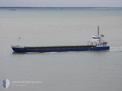
ALEXANDER
General Cargo
Current Trip
| Trip Time | 4 days |
|---|---|
| Trip Distance | 760.35 nm |
| AVG Speed | 9.8 Knots |
| MAX Speed | 14.4 Knots |
| Draught | 6.5 m |
| AVG Wind | 10.2 knots |
| MAX Wind | 20 knots |
| MIN Temp | 1.9°C / 35.42°F |
| MAX Temp | 8°C / 46.4°F |
| Position Received | 4 d ago |
Current Position
| Longitude | -6.82809° |
|---|---|
| Latitude | 55.21229° |
| Status | At anchor |
| Speed | 0.1 Knots |
| Course | 359° |
| Area | Inner Seas off the West Coast of Scotland |
| Station | T-AIS |
| Position Received | 4 d ago |
Info
Information
The current position of ALEXANDER is in Inner Seas off the West Coast of Scotland with coordinates 55.21229° / -6.82809° as reported on 2025-03-15 00:02 by AIS to our vessel tracker app. The vessel's current speed is 0.1 Knots and is currently inside the port of LONDONDERRY.
The vessel ALEXANDER (IMO: 9433353, MMSI: 305393000) is a General Cargo that was built in 2009 ( 16 years old ). It's sailing under the flag of [AG] Antigua Barbuda.
In this page you can find informations about the vessels current position, last detected port calls, and current voyage information. If the vessels is not in coverage by AIS you will find the latest position.
The current position of ALEXANDER is detected by our AIS receivers and we are not responsible for the reliability of the data. The last position was recorded while the vessel was in Coverage by the Ais receivers of our vessel tracking app.
The current draught of ALEXANDER as reported by AIS is 6.5 meters
Weather
| Temperature | 0.4°C / 32.72°F |
|---|---|
| Wind Speed | 2 knots |
| Direction | 102° ESE |
| Pressure | 1020.7 hPa |
| Humidity | 94.5 % |
| Cloud Coverage | --- |
Featured Company
Last Port Calls
| Port | Arrival | Departure | Time In Port |
|---|---|---|---|
| 2025-03-15 23:03 | |||
| 2025-03-08 23:06 | 2025-03-11 18:13 | 2 d | |
| 2025-03-07 16:41 | 2025-03-08 11:30 | 18 h | |
| 2025-03-01 22:54 | 2025-03-03 16:48 | 1 d | |
| 2025-02-22 09:35 | 2025-02-26 14:42 | 4 d | |
| 2025-02-19 02:31 | 2025-02-19 11:26 | 8 h | |
| 2025-02-12 09:16 | 2025-02-12 14:11 | 4 h | |
| 2025-01-27 11:25 | 2025-02-03 22:21 | 7 d | |
| 2025-01-20 11:55 | 2025-01-21 15:56 | 1 d | |
| 2025-01-17 08:58 | 2025-01-18 22:55 | 1 d |
Last Trips
| Origin | Departure | Destination | Arrival | Distance | |
|---|---|---|---|---|---|
| 2025-03-11 18:13 | 2025-03-15 23:03 | 760.35 nm | |||
| 2025-03-08 11:30 | 2025-03-08 23:06 | 118.54 nm | |||
| 2025-03-03 16:48 | 2025-03-07 16:41 | 696.17 nm | |||
| 2025-02-26 14:42 | 2025-03-01 22:54 | 436.85 nm | |||
| 2025-02-19 11:26 | 2025-02-22 09:35 | 187.61 nm | |||
| 2025-02-12 14:11 | 2025-02-19 02:31 | 1639.86 nm | |||
| 2025-02-03 22:21 | 2025-02-12 09:16 | 2006.41 nm | |||
| 2025-01-21 15:56 | 2025-01-27 11:25 | 377.23 nm | |||
| 2025-01-18 22:55 | 2025-01-20 11:55 | 66.55 nm | |||
| 2025-01-09 16:47 | 2025-01-17 08:58 | 1824.99 nm |
Events
| Time | Event | Details | Position / Dest | Info |
|---|---|---|---|---|
| 2025-03-15 23:24 | STOP Moving |
55.04168 / -7.26396
[GB] LONDONDERRY
|
Speed: 0.2 kn Course: 220° |
|
| 2025-03-15 23:03 | PORT ARRIVAL |
|
55.04743 / -7.24907
[GB] LONDONDERRY
|
Speed: 3.6 kn Course: 218° |
| 2025-03-15 20:12 | START Moving | 5.25 nm, East of GREENCASTLE |
55.21759 / -6.83449
GBLDY
|
Speed: 4.9 kn Course: 319° |
| 2025-03-15 00:08 | Status Changed | Default At anchor |
55.21232 / -6.82819
GBLDY
|
Speed: 0.1 kn Course: 359° |
| 2025-03-15 00:02 | Status Changed | At anchor Default |
55.21229 / -6.82809
GBLDY
|
Speed: 0.1 kn Course: 1° |
| 2025-03-15 00:02 | OUT of Coverage |
55.21229 / -6.82809
Inner Seas off the West Coast of Scotland
|
Speed: 0.1 kn Course: 254.5° |
|
| 2025-03-14 23:56 | IN Coverage |
55.21229 / -6.82809
Inner Seas off the West Coast of Scotland
|
Speed: 0.1 kn Course: 254.5° |
|
| 2025-03-14 14:56 | STOP Moving | 5.31 nm, East of GREENCASTLE |
55.21406 / -6.83159
GBLDY
|
Speed: 0.3 kn Course: 85° |
| 2025-03-14 13:40 | Status Changed | Default Under way using engine |
55.28797 / -6.72052
GBLDY
|
Speed: 11.2 kn Course: 244.3° |
| 2025-03-14 13:34 | OUT of Coverage |
55.29590 / -6.69303
Inner Seas off the West Coast of Scotland
GBLDY
|
Speed: 11.2 kn Course: 244.3° |