
ALFRED
Tanker
Current Trip
| Time Travelled | 4 days |
|---|---|
| Remaining Time | 1 day |
| Distance Travelled | 1128.09 nm |
| Remaining Distance | 543.97 nm |
| AVG Speed | 12.1 Knop |
| MAX Speed | 13.1 Knop |
| AVG Wind | 9.6 knots |
| MAX Wind | 22.3 knots |
| MIN Temp | 2.1°C / 35.78°F |
| MAX Temp | 16°C / 60.8°F |
| Djupgående | 12.4 m |
| Position mottagen | 7 h, 15 m sen |
Current Position
| Longitud | 13.93977° |
|---|---|
| Latitude | 36.58141° |
| Status | Under way using engine |
| Fart | 12.8 Knop |
| Kurs | 291.4° |
| Område | Mediterranean Sea - Eastern Basin |
| Station | T-AIS |
| Position mottagen | 7 h, 15 m sen |
Info
Information
The current position of ALFRED is in Mediterranean Sea - Eastern Basin with coordinates 36.58141° / 13.93977° as reported on 2025-02-28 23:47 by AIS to our vessel tracker app. The vessel's current speed is 12.8 Knop and is heading at the port of SAVONA. The estimated time of arrival as calculated by MyShipTracking vessel tracking app is 2025-03-02 18:21 LT
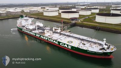
The vessel ALFRED (IMO: 9826897, MMSI: 636018830) is a Tanker It's sailing under the flag of [LR] Liberia.
In this page you can find informations about the vessels current position, last detected port calls, and current voyage information. If the vessels is not in coverage by AIS you will find the latest position.
The current position of ALFRED is detected by our AIS receivers and we are not responsible for the reliability of the data. The last position was recorded while the vessel was in Coverage by the Ais receivers of our vessel tracking app.
The current draught of ALFRED as reported by AIS is 12.4 meters
Weather
| Temperature | 15.3°C / 59.54°F |
|---|---|
| Wind Speed | 17 knots |
| Direction | 139° SE |
| Pressure | 1017.3 hPa |
| Humidity | 82.8 % |
| Cloud Coverage | 100 % |
Featured Company
Last Port Calls
| Port | Arrival | Departure | Time In Port |
|---|---|---|---|
| 2025-02-24 09:05 | 2025-02-25 03:13 | 18 h | |
| 2025-01-15 12:33 | 2025-01-16 22:19 | 1 d | |
| 2025-01-10 09:25 | 2025-01-11 16:39 | 1 d | |
| 2025-01-04 11:18 | 2025-01-06 02:03 | 1 d |
Last Trips
| Origin | Departure | Destination | Arrival | Distance | |
|---|---|---|---|---|---|
| 2025-01-17 01:19 | 2025-02-24 12:05 | 6802.56 nm | |||
| 2025-01-11 17:39 | 2025-01-15 15:33 | 649.87 nm | |||
| 2025-01-06 02:03 | 2025-01-10 10:25 | 1122.18 nm | |||
| 2024-12-23 19:29 | 2025-01-04 11:18 | 800.67 nm |
Events
| Tid | Event | Detaljer | Position / Dest | Information |
|---|---|---|---|---|
| 2025-02-28 23:51 | Status ändrad | Default Under way using engine |
36.58757 / 13.92121
IT SVN
|
Fart: 12.8 kn Kurs: 291.4° |
| 2025-02-28 23:47 | UTANFÖR täckningsområde |
36.58141 / 13.93977
Mediterranean Sea - Eastern Basin
IT SVN
|
Fart: 12.8 kn Kurs: 291.4° |
|
| 2025-02-28 23:38 | Status ändrad | Under way using engine Default |
36.56982 / 13.97727
IT SVN
|
Fart: 12.8 kn Kurs: 291° |
| 2025-02-28 23:18 | Status ändrad | Default Under way using engine |
36.54285 / 14.06150
IT SVN
|
Fart: 12.9 kn Kurs: 292.5° |
| 2025-02-28 23:16 | Status ändrad | Under way using engine Default |
36.54074 / 14.06776
IT SVN
|
Fart: 13 kn Kurs: 293° |
| 2025-02-28 23:09 | Status ändrad | Default Under way using engine |
36.53114 / 14.09602
IT SVN
|
Fart: 13 kn Kurs: 293.4° |
| 2025-02-28 22:54 | Status ändrad | Under way using engine Default |
36.50876 / 14.16055
IT SVN
|
Fart: 13 kn Kurs: 293° |
| 2025-02-28 22:45 | Status ändrad | Default Under way using engine |
36.49657 / 14.19560
IT SVN
|
Fart: 13 kn Kurs: 293.2° |
| 2025-02-28 22:37 | Status ändrad | Under way using engine Default |
36.48484 / 14.22930
IT SVN
|
Fart: 13 kn Kurs: 293° |
| 2025-02-28 22:16 | Status ändrad | Default Under way using engine |
36.45480 / 14.31630
IT SVN
|
Fart: 13 kn Kurs: 292.7° |