
ATHENA CENTURY
Cargo
Current Trip
| Time Travelled | 18 days |
|---|---|
| Remaining Time | 38 mins |
| Distance Travelled | 4367.28 nm |
| Remaining Distance | 50.76 nm |
| AVG Speed | 9.9 Knop |
| MAX Speed | 14.2 Knop |
| AVG Wind | 20 knots |
| MAX Wind | 41 knots |
| MIN Temp | 6.9°C / 44.42°F |
| MAX Temp | 31°C / 87.8°F |
| Djupgående | 11.8 m |
| Position mottagen | 1 m sen |
Current Position
| Longitud | 137.76380° |
|---|---|
| Latitude | 34.41921° |
| Status | Under way using engine |
| Fart | 1.3 Knop |
| Kurs | 2° |
| Område | Philippine Sea |
| Station | T-AIS |
| Position mottagen | 1 m sen |
Info
Information
The current position of ATHENA CENTURY is in Philippine Sea with coordinates 34.41921° / 137.76380° as reported on 2025-02-14 11:27 by AIS to our vessel tracker app. The vessel's current speed is 1.3 Knop and is heading at the port of KINUURA. The estimated time of arrival as calculated by MyShipTracking vessel tracking app is 2025-02-14 12:06 LT
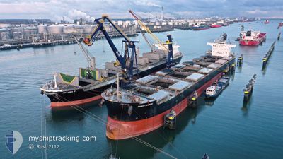
The vessel ATHENA CENTURY (IMO: 9599092, MMSI: 355959000) is a Cargo It's sailing under the flag of [PA] Panama.
In this page you can find informations about the vessels current position, last detected port calls, and current voyage information. If the vessels is not in coverage by AIS you will find the latest position.
The current position of ATHENA CENTURY is detected by our AIS receivers and we are not responsible for the reliability of the data. The last position was recorded while the vessel was in Coverage by the Ais receivers of our vessel tracking app.
The current draught of ATHENA CENTURY as reported by AIS is 11.8 meters
Weather
| Temperature | 9.8°C / 49.64°F |
|---|---|
| Wind Speed | 29 knots |
| Direction | 308° NW |
| Pressure | 1016.2 hPa |
| Humidity | 59.8 % |
| Cloud Coverage | 1 % |
Featured Company
Events
| Tid | Event | Detaljer | Position / Dest | Information |
|---|---|---|---|---|
| 2025-02-14 06:43 | STOPPAR förflyttning | 16.74 nm, South of HAMANA |
34.41344 / 137.65668
JP KNU
|
Fart: 0.3 kn Kurs: 312° |
| 2025-02-14 05:20 | Status ändrad | Under way using engine Default |
34.32833 / 137.83279
JP KNU
|
Fart: 9.3 kn Kurs: 294° |
| 2025-02-14 05:05 | Status ändrad | Default Under way using engine |
34.31249 / 137.87918
JP KNU
|
Fart: 9.4 kn Kurs: 291.5° |
| 2025-02-14 04:58 | Status ändrad | Under way using engine Default |
34.30634 / 137.89814
JP KNU
|
Fart: 9.4 kn Kurs: 292° |
| 2025-02-14 04:49 | I täckningsområde |
34.30634 / 137.89814
Philippine Sea
|
Fart: 9.4 kn Kurs: 291.5° |
|
| 2025-02-14 04:37 | STARTAR förflyttning |
34.29047 / 137.94751
JP KNU
|
Fart: 3.1 kn Kurs: 308° |
|
| 2025-02-14 03:32 | Status ändrad | Default Under way using engine |
34.28607 / 137.93932
JP KNU
|
Fart: 0.5 kn Kurs: 348° |
| 2025-02-14 03:25 | UTANFÖR täckningsområde |
34.28590 / 137.93860
Philippine Sea
|
Fart: 0.5 kn Kurs: 71.2° |
|
| 2025-02-14 03:22 | Status ändrad | Under way using engine Default |
34.28583 / 137.93829
JP KNU
|
Fart: 0.3 kn Kurs: 349° |
| 2025-02-14 02:29 | Status ändrad | Default Under way using engine |
34.28357 / 137.93146
JP KNU
|
Fart: 0.8 kn Kurs: 359° |