
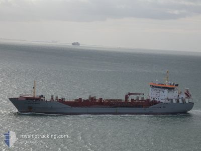
ATLANTIC MATE
Oil/Chemical Tanker
Current Trip
| Time Travelled | 4 days |
|---|---|
| Remaining Time | --- |
| Distance Travelled | 648.02 nm |
| Remaining Distance | --- |
| AVG Speed | 9 Knop |
| MAX Speed | 13.1 Knop |
| AVG Wind | 21 knots |
| MAX Wind | 30 knots |
| MIN Temp | 3.9°C / 39.02°F |
| MAX Temp | 9.8°C / 49.64°F |
| Djupgående | 6.5 m |
| Position mottagen | 1 m sen |
Current Position
| Longitud | 3.59089° |
|---|---|
| Latitude | 51.92624° |
| Status | At anchor |
| Fart | 0.1 Knop |
| Kurs | 35° |
| Område | North Sea |
| Station | T-AIS |
| Position mottagen | 1 m sen |
Info
Information
The current position of ATLANTIC MATE is in North Sea with coordinates 51.92624° / 3.59089° as reported on 2025-02-09 05:39 by AIS to our vessel tracker app. The vessel's current speed is 0.1 Knop
The vessel ATLANTIC MATE (IMO: 9350745, MMSI: 236683000) is a Oil/Chemical Tanker that was built in 2007 ( 18 År gammal ). It's sailing under the flag of [GI] Gibraltar.
In this page you can find informations about the vessels current position, last detected port calls, and current voyage information. If the vessels is not in coverage by AIS you will find the latest position.
The current position of ATLANTIC MATE is detected by our AIS receivers and we are not responsible for the reliability of the data. The last position was recorded while the vessel was in Coverage by the Ais receivers of our vessel tracking app.
The current draught of ATLANTIC MATE as reported by AIS is 6.5 meters
Weather
| Temperature | 6.5°C / 43.7°F |
|---|---|
| Wind Speed | 6 knots |
| Direction | 32° NNE |
| Pressure | 1025.5 hPa |
| Humidity | 84.7 % |
| Cloud Coverage | 100 % |
Featured Company
Last Port Calls
| Port | Arrival | Departure | Time In Port |
|---|---|---|---|
| 2025-02-03 01:03 | 2025-02-04 20:13 | 1 d | |
| 2025-01-28 22:11 | 2025-01-30 03:47 | 1 d | |
| 2025-01-25 03:43 | 2025-01-25 17:55 | 14 h | |
| 2025-01-23 09:42 | 2025-01-24 09:06 | 23 h | |
| 2025-01-16 03:44 | 2025-01-17 18:27 | 1 d | |
| 2025-01-15 04:18 | 2025-01-15 05:14 | 55 m | |
| 2025-01-12 20:42 | 2025-01-15 02:48 | 2 d | |
| 2025-01-01 21:52 | 2025-01-03 01:21 | 1 d | |
| 2024-12-25 13:50 | 2024-12-27 14:31 | 2 d | |
| 2024-12-21 19:55 | 2024-12-23 12:06 | 1 d |
Last Trips
| Origin | Departure | Destination | Arrival | Distance | |
|---|---|---|---|---|---|
| 2025-01-30 03:47 | 2025-02-03 01:03 | 1081.74 nm | |||
| 2025-01-25 17:55 | 2025-01-28 22:11 | 864.11 nm | |||
| 2025-01-24 09:06 | 2025-01-25 03:43 | 211.34 nm | |||
| 2025-01-17 18:27 | 2025-01-23 09:42 | 1409.20 nm | |||
| 2025-01-15 05:14 | 2025-01-16 03:44 | 139.99 nm | |||
| 2025-01-15 02:48 | 2025-01-15 04:18 | 9.18 nm | |||
| 2025-01-03 01:21 | 2025-01-12 20:42 | 409.25 nm | |||
| 2024-12-27 14:31 | 2025-01-01 21:52 | 592.28 nm | |||
| 2024-12-23 12:06 | 2024-12-25 13:50 | 575.20 nm | |||
| 2024-12-19 06:53 | 2024-12-21 19:55 | 372.04 nm |
Events
| Tid | Event | Detaljer | Position / Dest | Information |
|---|---|---|---|---|
| 2025-02-09 05:30 | Status ändrad | At anchor Default |
51.92632 / 3.59084
NL RTM
|
Fart: 0.2 kn Kurs: 35° |
| 2025-02-09 05:27 | Status ändrad | Default At anchor |
51.92628 / 3.59086
NL RTM
|
Fart: Kurs: 34° |
| 2025-02-09 04:12 | Status ändrad | At anchor Default |
51.92625 / 3.59161
NL RTM
|
Fart: Kurs: 12° |
| 2025-02-09 04:03 | Status ändrad | Default At anchor |
51.92627 / 3.59176
NL RTM
|
Fart: 0.1 kn Kurs: 10° |
| 2025-02-09 03:18 | Status ändrad | At anchor Default |
51.92616 / 3.59292
NL RTM
|
Fart: Kurs: 357° |
| 2025-02-09 03:09 | Status ändrad | Default At anchor |
51.92610 / 3.59280
NL RTM
|
Fart: 0.1 kn Kurs: 333° |
| 2025-02-09 02:51 | Status ändrad | At anchor Default |
51.92675 / 3.59417
NL RTM
|
Fart: Kurs: 278° |
| 2025-02-09 02:45 | I täckningsområde |
51.92675 / 3.59417
North Sea
|
Fart: 0.3 kn Kurs: 196.4° |
|
| 2025-02-08 21:45 | Status ändrad | Default At anchor |
51.92833 / 3.59305
NL RTM
|
Fart: Kurs: 189° |
| 2025-02-08 21:36 | UTANFÖR täckningsområde |
51.92835 / 3.59277
North Sea
|
Fart: Kurs: 172.9° |