
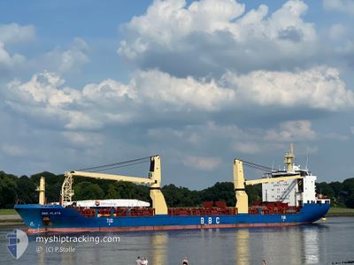
BBC PLATA
General Cargo
Current Trip
CABBU
| Time Travelled | 9 days |
|---|---|
| Remaining Time | --- |
| Distance Travelled | 2033.18 nm |
| Remaining Distance | --- |
| AVG Speed | 8.9 Knop |
| MAX Speed | 14.6 Knop |
| AVG Wind | 22.4 knots |
| MAX Wind | 36.7 knots |
| MIN Temp | -6.3°C / 20.66°F |
| MAX Temp | 17°C / 62.6°F |
| Djupgående | 7.7 m |
| Position mottagen | 9 d sen |
Current Position
| Longitud | -52.23054° |
|---|---|
| Latitude | 47.43008° |
| Status | Under way using engine |
| Fart | 5.6 Knop |
| Kurs | 29.6° |
| Område | North Atlantic Ocean |
| Station | T-AIS |
| Position mottagen | 9 d sen |
Info
Information
The current position of BBC PLATA is in North Atlantic Ocean with coordinates 47.43008° / -52.23054° as reported on 2025-01-30 00:42 by AIS to our vessel tracker app. The vessel's current speed is 5.6 Knop
The vessel BBC PLATA (IMO: 9291975, MMSI: 304746000) is a General Cargo that was built in 2005 ( 20 År gammal ). It's sailing under the flag of [AG] Antigua Barbuda.
In this page you can find informations about the vessels current position, last detected port calls, and current voyage information. If the vessels is not in coverage by AIS you will find the latest position.
The current position of BBC PLATA is detected by our AIS receivers and we are not responsible for the reliability of the data. The last position was recorded while the vessel was in Coverage by the Ais receivers of our vessel tracking app.
The current draught of BBC PLATA as reported by AIS is 7.7 meters
Weather
| Temperature | 10.3°C / 50.54°F |
|---|---|
| Wind Speed | 23 knots |
| Direction | 357° N |
| Pressure | 1020.5 hPa |
| Humidity | 63.6 % |
| Cloud Coverage | 100 % |
Featured Company
Last Port Calls
| Port | Arrival | Departure | Time In Port |
|---|---|---|---|
| 2025-01-27 14:03 | 2025-01-29 17:47 | 2 d | |
| 2025-01-08 17:27 | 2025-01-16 03:12 | 7 d | |
| 2024-12-22 20:35 | 2024-12-27 23:51 | 5 d | |
| 2024-12-19 04:36 | 2024-12-21 07:50 | 2 d | |
| 2024-12-13 19:14 | 2024-12-14 10:37 | 15 h | |
| 2024-12-01 02:45 | 2024-12-01 09:13 | 6 h |
Most Visited Ports (Last year)
| Port | Arrivals | |
|---|---|---|
| 5 | ||
| 4 | ||
| 4 | ||
| 3 | ||
| 2 | ||
| 2 |
Last Trips
| Origin | Departure | Destination | Arrival | Distance | |
|---|---|---|---|---|---|
| 2025-01-15 21:12 | 2025-01-27 10:33 | 3051.22 nm | |||
| 2024-12-27 17:51 | 2025-01-08 11:27 | 980.41 nm | |||
| 2024-12-21 01:50 | 2024-12-22 14:35 | 435.41 nm | |||
| 2024-12-14 04:37 | 2024-12-18 22:36 | 601.76 nm | |||
| 2024-12-01 04:13 | 2024-12-13 13:14 | 2967.28 nm | |||
| 2024-11-29 00:49 | 2024-11-30 21:45 | 518.48 nm |
Events
| Tid | Event | Detaljer | Position / Dest | Information |
|---|---|---|---|---|
| 2025-01-31 19:52 | STARTAR förflyttning |
47.82227 / -50.62236
CABBU
|
Fart: 3.2 kn Kurs: 269° |
|
| 2025-01-31 15:18 | STOPPAR förflyttning |
47.84110 / -50.38779
CABBU
|
Fart: 0.3 kn Kurs: 263° |
|
| 2025-01-30 00:51 | Status ändrad | Default Under way using engine |
47.44199 / -52.22065
CABBU
|
Fart: 5.6 kn Kurs: 29.6° |
| 2025-01-30 00:42 | Status ändrad | Under way using engine Default |
47.43008 / -52.23054
CABBU
|
Fart: 5.6 kn Kurs: 30° |
| 2025-01-30 00:42 | I täckningsområde |
47.43008 / -52.23054
North Atlantic Ocean
|
Fart: 5.6 kn Kurs: 29.6° |
|
| 2025-01-30 00:42 | UTANFÖR täckningsområde |
47.43008 / -52.23054
North Atlantic Ocean
|
Fart: 5.6 kn Kurs: 29.6° |
|
| 2025-01-29 23:46 | Status ändrad | Default Under way using engine |
47.35103 / -52.29758
CABBU
|
Fart: 5.9 kn Kurs: 26.5° |
| 2025-01-29 23:41 | UTANFÖR täckningsområde |
47.34466 / -52.30303
North Atlantic Ocean
|
Fart: 5.9 kn Kurs: 26.5° |
|
| 2025-01-29 23:20 | Status ändrad | Under way using engine Default |
47.31542 / -52.32903
CABBU
|
Fart: 5.8 kn Kurs: 36° |
| 2025-01-29 23:15 | Status ändrad | Default Under way using engine |
47.30820 / -52.33589
CABBU
|
Fart: 5.8 kn Kurs: 31° |