
BOHEME
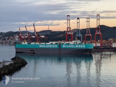
Vehicles Carrier
Current Trip
| Time Travelled | 16 days |
|---|---|
| Remaining Time | --- |
| Distance Travelled | 6273.35 nm |
| Remaining Distance | --- |
| AVG Speed | 16.3 Knop |
| MAX Speed | 19.8 Knop |
| AVG Wind | 12.6 knots |
| MAX Wind | 33 knots |
| MIN Temp | 14.2°C / 57.56°F |
| MAX Temp | 29.2°C / 84.56°F |
| Djupgående | 10.1 m |
| Position mottagen | 9 d sen |
Current Position
| Longitud | 102.08631° |
|---|---|
| Latitude | 2.08906° |
| Status | Under way using engine |
| Fart | 17.1 Knop |
| Kurs | 313° |
| Område | Malacca Strait |
| Station | T-AIS |
| Position mottagen | 9 d sen |
Info
Information
The current position of BOHEME is in Malacca Strait with coordinates 2.08906° / 102.08631° as reported on 2025-12-26 05:56 by AIS to our vessel tracker app. The vessel's current speed is 17.1 Knop and is heading at the port of PORTBURY. The estimated time of arrival as calculated by MyShipTracking vessel tracking app is 2026-01-23 01:00 LT
The vessel BOHEME (IMO: 9176565, MMSI: 563262000) is a Vehicles Carrier that was built in 1999 ( 27 År gammal ). It's sailing under the flag of [SG] Singapore.
In this page you can find informations about the vessels current position, last detected port calls, and current voyage information. If the vessels is not in coverage by AIS you will find the latest position.
The current position of BOHEME is detected by our AIS receivers and we are not responsible for the reliability of the data. The last position was recorded while the vessel was in Coverage by the Ais receivers of our vessel tracking app.
The current draught of BOHEME as reported by AIS is 10.1 meters
Weather
| Temperature | 24.8°C / 76.64°F |
|---|---|
| Wind Speed | 13 knots |
| Direction | 9° N |
| Pressure | 1009.6 hPa |
| Humidity | 87 % |
| Cloud Coverage | 91 % |
Featured Company
Most Visited Ports (Last year)
| Port | Arrivals | |
|---|---|---|
| 4 | ||
| 3 | ||
| 3 | ||
| 2 | ||
| 2 | ||
| 2 |
Last Trips
| Origin | Departure | Destination | Arrival | Distance | |
|---|---|---|---|---|---|
| 2025-12-15 16:37 | 2025-12-19 00:12 | 486.25 nm | |||
| 2025-12-12 23:10 | 2025-12-15 06:22 | 694.95 nm | |||
| 2025-12-10 17:05 | 2025-12-11 18:05 | 219.63 nm | |||
| 2025-11-17 04:06 | 2025-12-10 07:57 | 9506.45 nm | |||
| 2025-10-14 05:17 | 2025-11-14 05:32 | 10567.41 nm |
Events
| Tid | Event | Detaljer | Position / Dest | Information |
|---|---|---|---|---|
| 2025-12-26 06:03 | Status ändrad | Default Under way using engine |
2.11012 / 102.06424
GB BRS
|
Fart: 17.1 kn Kurs: 313° |
| 2025-12-26 05:56 | UTANFÖR täckningsområde |
2.08906 / 102.08631
Malacca Strait
GB BRS
|
Fart: 17.1 kn Kurs: 313° |
|
| 2025-12-26 05:01 | Byter havsområde | Malaysian part of the Malacca Strait Malaysian part of the Singapore Strait |
1.92762 / 102.29227
Malacca Strait
GB BRS
|
Fart: 17 kn Kurs: 293.4° |
| 2025-12-26 05:01 | Status ändrad | Under way using engine Default |
1.92721 / 102.29321
GB BRS
|
Fart: 17.1 kn Kurs: 294° |
| 2025-12-26 04:45 | I täckningsområde |
1.92762 / 102.29227
Malacca Strait
GB BRS
|
Fart: 17 kn Kurs: 293.4° |
|
| 2025-12-26 00:05 | Status ändrad | Default Under way using engine |
1.21500 / 103.51509
GB BRS
|
Fart: 18.1 kn Kurs: 283.2° |
| 2025-12-25 23:59 | UTANFÖR täckningsområde |
1.20886 / 103.54106
Singapore Strait
GB BRS
|
Fart: 18.1 kn Kurs: 283.2° |
|
| 2025-12-25 23:52 | Byter havsområde | Malaysian part of the Singapore Strait Indonesian part of the Singapore Strait |
1.20001 / 103.57888
Singapore Strait
GB BRS
|
Fart: 18.3 kn Kurs: 283° |
| 2025-12-25 23:35 | Byter havsområde | Indonesian part of the Singapore Strait Singaporean part of the Singapore Strait |
1.17881 / 103.66137
Singapore Strait
GB BRS
|
Fart: 16.8 kn Kurs: 282.7° |
| 2025-12-25 21:40 | STARTAR förflyttning | 3.21 nm, East of SINGAPORE |
1.26522 / 103.90747
GB BRS
|
Fart: 3.3 kn Kurs: 86° |