
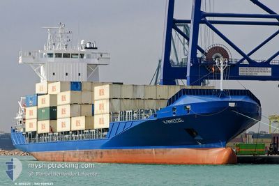
BREEZE
Container Ship
Current Trip
HN PCR > US GPT
| Time Travelled | 3 h, 25 mins |
|---|---|
| Remaining Time | --- |
| Distance Travelled | 41.56 nm |
| Remaining Distance | --- |
| AVG Speed | 14.1 Knop |
| MAX Speed | 15.4 Knop |
| AVG Wind | 8.1 knots |
| MAX Wind | 10 knots |
| MIN Temp | 17.8°C / 64.04°F |
| MAX Temp | 20.9°C / 69.62°F |
| Djupgående | 5.2 m |
| Position mottagen | 9 m sen |
Current Position
| Longitud | -88.37196° |
|---|---|
| Latitude | 29.98717° |
| Status | Under way using engine |
| Fart | 15.3 Knop |
| Kurs | 136.5° |
| Område | Gulf of Mexico |
| Station | T-AIS |
| Position mottagen | 9 m sen |
Info
Information
The current position of BREEZE is in Gulf of Mexico with coordinates 29.98717° / -88.37196° as reported on 2026-01-08 09:25 by AIS to our vessel tracker app. The vessel's current speed is 15.3 Knop
The vessel BREEZE (IMO: 9389423, MMSI: 305291000) is a Container Ship that was built in 2008 ( 18 År gammal ). It's sailing under the flag of [AG] Antigua Barbuda.
In this page you can find informations about the vessels current position, last detected port calls, and current voyage information. If the vessels is not in coverage by AIS you will find the latest position.
The current position of BREEZE is detected by our AIS receivers and we are not responsible for the reliability of the data. The last position was recorded while the vessel was in Coverage by the Ais receivers of our vessel tracking app.
The current draught of BREEZE as reported by AIS is 5.2 meters
Weather
| Temperature | 20.8°C / 69.44°F |
|---|---|
| Wind Speed | 10 knots |
| Direction | 209° SSW |
| Pressure | 1015.6 hPa |
| Humidity | 87.2 % |
| Cloud Coverage | 100 % |
Featured Company
Last Port Calls
| Port | Arrival | Departure | Time In Port |
|---|---|---|---|
| 2026-01-07 14:58 | 2026-01-08 00:10 | 9 h | |
| 2026-01-04 13:19 | 2026-01-04 17:54 | 4 h | |
| 2026-01-03 05:50 | 2026-01-03 16:46 | 10 h | |
| 2025-12-28 19:22 | |||
| 2025-12-24 16:52 | 2025-12-26 07:03 | 1 d | |
| 2025-12-23 11:08 | 2025-12-24 12:24 | 1 d | |
| 2025-12-18 22:22 | 2025-12-19 17:32 | 19 h | |
| 2025-12-15 20:41 | 2025-12-16 07:28 | 10 h | |
| 2025-12-15 02:16 | 2025-12-15 15:03 | 12 h | |
| 2025-12-11 09:06 | 2025-12-11 22:07 | 13 h |
Most Visited Ports (Last year)
| Port | Arrivals | |
|---|---|---|
| 42 | ||
| 39 | ||
| 31 | ||
| 15 | ||
| 8 | ||
| 3 |
Last Trips
| Origin | Departure | Destination | Arrival | Distance | |
|---|---|---|---|---|---|
| 2026-01-04 17:54 | 2026-01-07 14:58 | 928.87 nm | |||
| 2026-01-03 16:46 | 2026-01-04 13:19 | 63.37 nm | |||
| 2025-12-26 07:03 | 2025-12-28 19:22 | 928.35 nm | |||
| 2025-12-24 12:24 | 2025-12-24 16:52 | 61.19 nm | |||
| 2025-12-19 17:32 | 2025-12-23 11:08 | 986.40 nm | |||
| 2025-12-16 07:28 | 2025-12-18 22:22 | 927.98 nm | |||
| 2025-12-15 15:03 | 2025-12-15 20:41 | 62.32 nm | |||
| 2025-12-11 22:07 | 2025-12-15 02:16 | 953.28 nm | |||
| 2025-12-08 16:07 | 2025-12-11 09:06 | 969.43 nm | |||
| 2025-12-07 16:27 | 2025-12-08 01:07 | 62.12 nm |
Events
| Tid | Event | Detaljer | Position / Dest | Information |
|---|---|---|---|---|
| 2026-01-08 09:29 | Status ändrad | Default Under way using engine |
29.97539 / -88.35902
HN PCR > US GPT
|
Fart: 15.3 kn Kurs: 136.5° |
| 2026-01-08 09:25 | Status ändrad | Under way using engine Default |
29.98717 / -88.37196
HN PCR > US GPT
|
Fart: 15.2 kn Kurs: 136° |
| 2026-01-08 08:31 | Status ändrad | Default Under way using engine |
30.07883 / -88.60640
HN PCR > US GPT
|
Fart: 15.2 kn Kurs: 105.6° |
| 2026-01-08 08:30 | Status ändrad | Under way using engine Default |
30.07940 / -88.60882
HN PCR > US GPT
|
Fart: 15.1 kn Kurs: 107° |
| 2026-01-08 08:30 | UTANFÖR täckningsområde |
30.07940 / -88.60882
Gulf of Mexico
|
Fart: 15.2 kn Kurs: 105.6° |
|
| 2026-01-08 08:13 | Status ändrad | Default Under way using engine |
30.10015 / -88.69015
HN PCR > US GPT
|
Fart: 15.3 kn Kurs: 105° |
| 2026-01-08 08:00 | Status ändrad | Under way using engine Default |
30.11481 / -88.75134
HN PCR > US GPT
|
Fart: 15 kn Kurs: 106° |
| 2026-01-08 07:54 | Status ändrad | Default Under way using engine |
30.11953 / -88.78057
HN PCR > US GPT
|
Fart: 15.2 kn Kurs: 100.3° |
| 2026-01-08 07:48 | Status ändrad | Under way using engine Default |
30.12310 / -88.80660
HN PCR > US GPT
|
Fart: 15.2 kn Kurs: 100° |
| 2026-01-08 07:46 | Status ändrad | Default Under way using engine |
30.12486 / -88.81809
HN PCR > US GPT
|
Fart: 14.5 kn Kurs: 99.6° |