
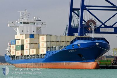
BREEZE
Container Ship
Current Trip
| Time Travelled | 3 days |
|---|---|
| Remaining Time | --- |
| Distance Travelled | 848.50 nm |
| Remaining Distance | 2.64 nm |
| AVG Speed | 11.8 Knots |
| MAX Speed | 16.3 Knots |
| AVG Wind | 11.8 knots |
| MAX Wind | 17.7 knots |
| MIN Temp | 24.1°C / 75.38°F |
| MAX Temp | 28.1°C / 82.58°F |
| Draught | 6.9 m |
| Position Received | 1 m ago |
Current Position
| Longitude | -80.07598° |
|---|---|
| Latitude | 26.11771° |
| Status | At anchor |
| Speed | 0.1 Knots |
| Course | 97° |
| Area | North Atlantic Ocean |
| Station | T-AIS |
| Position Received | 1 m ago |
Info
Information
The current position of BREEZE is in North Atlantic Ocean with coordinates 26.11771° / -80.07598° as reported on 2025-02-14 21:45 by AIS to our vessel tracker app. The vessel's current speed is 0.1 Knots and is heading at the port of PORT EVERGLADES. The estimated time of arrival as calculated by MyShipTracking vessel tracking app is 2025-02-13 18:59 LT
The vessel BREEZE (IMO: 9389423, MMSI: 305291000) is a Container Ship that was built in 2008 ( 17 years old ). It's sailing under the flag of [AG] Antigua Barbuda.
In this page you can find informations about the vessels current position, last detected port calls, and current voyage information. If the vessels is not in coverage by AIS you will find the latest position.
The current position of BREEZE is detected by our AIS receivers and we are not responsible for the reliability of the data. The last position was recorded while the vessel was in Coverage by the Ais receivers of our vessel tracking app.
The current draught of BREEZE as reported by AIS is 6.9 meters
Weather
| Temperature | 24.3°C / 75.74°F |
|---|---|
| Wind Speed | 10 knots |
| Direction | 94° E |
| Pressure | 1023.2 hPa |
| Humidity | 74.5 % |
| Cloud Coverage | --- |
Featured Company
Last Port Calls
| Port | Arrival | Departure | Time In Port |
|---|---|---|---|
| 2025-02-10 12:47 | 2025-02-11 05:40 | 16 h | |
| 2025-02-08 15:41 | 2025-02-08 15:56 | 15 m | |
| 2025-02-07 11:35 | 2025-02-08 11:31 | 23 h | |
| 2025-02-03 17:49 | 2025-02-04 09:44 | 15 h | |
| 2025-01-31 10:20 | 2025-02-01 09:59 | 23 h | |
| 2025-01-30 10:08 | 2025-01-31 06:11 | 20 h | |
| 2025-01-28 07:09 | 2025-01-28 19:35 | 12 h | |
| 2025-01-24 15:10 | 2025-01-25 14:38 | 23 h | |
| 2025-01-21 22:55 | 2025-01-22 23:43 | 1 d | |
| 2025-01-19 19:33 | 2025-01-20 10:53 | 15 h |
Most Visited Ports (Last year)
| Port | Arrivals | |
|---|---|---|
| 46 | ||
| 45 | ||
| 41 | ||
| 4 | ||
| 3 | ||
| 1 |
Last Trips
| Origin | Departure | Destination | Arrival | Distance | |
|---|---|---|---|---|---|
| 2025-02-08 15:56 | 2025-02-10 12:47 | 2.09 nm | |||
| 2025-02-08 11:31 | 2025-02-08 15:41 | 60.20 nm | |||
| 2025-02-04 09:44 | 2025-02-07 11:35 | 861.46 nm | |||
| 2025-02-01 09:59 | 2025-02-03 17:49 | 820.30 nm | |||
| 2025-01-31 06:11 | 2025-01-31 10:20 | 60.44 nm | |||
| 2025-01-28 19:35 | 2025-01-30 10:08 | 598.37 nm | |||
| 2025-01-25 14:38 | 2025-01-28 07:09 | 776.23 nm | |||
| 2025-01-22 23:43 | 2025-01-24 15:10 | 319.66 nm | |||
| 2025-01-20 10:53 | 2025-01-21 22:55 | 314.58 nm | |||
| 2025-01-16 18:06 | 2025-01-19 19:33 | 834.15 nm |
Events
| Time | Event | Details | Position / Dest | Info |
|---|---|---|---|---|
| 2025-02-14 20:54 | Status Changed | At anchor Under way using engine |
26.11769 / -80.07599
US PEF
|
Speed: 2.8 kn Course: 175° |
| 2025-02-14 20:52 | Status Changed | Under way using engine At anchor |
26.11931 / -80.07497
US PEF
|
Speed: 0.1 kn Course: 119° |
| 2025-02-14 19:19 | Status Changed | At anchor Default |
26.11792 / -80.07591
US PEF
|
Speed: 0.1 kn Course: 123° |
| 2025-02-14 19:15 | Status Changed | Default At anchor |
26.11794 / -80.07592
US PEF
|
Speed: Course: 124° |
| 2025-02-14 19:03 | Status Changed | At anchor Default |
26.11799 / -80.07587
US PEF
|
Speed: Course: 120° |
| 2025-02-14 18:57 | Status Changed | Default At anchor |
26.11796 / -80.07589
US PEF
|
Speed: 0.1 kn Course: 122° |
| 2025-02-14 18:54 | Status Changed | At anchor Default |
26.11795 / -80.07591
US PEF
|
Speed: Course: 125° |
| 2025-02-14 18:48 | Status Changed | Default At anchor |
26.11797 / -80.07588
US PEF
|
Speed: Course: 126° |
| 2025-02-14 18:12 | Status Changed | At anchor Under way using engine |
26.11806 / -80.07581
US PEF
|
Speed: 2.8 kn Course: 175° |
| 2025-02-14 18:11 | Status Changed | Under way using engine At anchor |
26.11931 / -80.07497
US PEF
|
Speed: Course: 135° |