
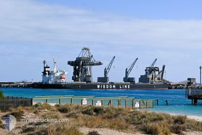
BUNUN XCEL
Cargo
Current Trip
| Time Travelled | 6 days |
|---|---|
| Remaining Time | --- |
| Distance Travelled | 1935.16 nm |
| Remaining Distance | --- |
| AVG Speed | 11.5 Knop |
| MAX Speed | 13.4 Knop |
| AVG Wind | 9.6 knots |
| MAX Wind | 19.8 knots |
| MIN Temp | 18.3°C / 64.94°F |
| MAX Temp | 29.9°C / 85.82°F |
| Djupgående | 10.3 m |
| Position mottagen | 6 d sen |
Current Position
| Longitud | 152.73129° |
|---|---|
| Latitude | -32.41734° |
| Status | Under way using engine |
| Fart | 11.1 Knop |
| Kurs | 34.3° |
| Område | Tasman Sea |
| Station | T-AIS |
| Position mottagen | 6 d sen |
Info
Information
The current position of BUNUN XCEL is in Tasman Sea with coordinates -32.41734° / 152.73129° as reported on 2025-12-29 03:29 by AIS to our vessel tracker app. The vessel's current speed is 11.1 Knop and is heading at the port of HOPING. The estimated time of arrival as calculated by MyShipTracking vessel tracking app is 2026-01-12 13:00 LT
The vessel BUNUN XCEL (IMO: 9959307, MMSI: 636022714) is a Cargo It's sailing under the flag of [LR] Liberia.
In this page you can find informations about the vessels current position, last detected port calls, and current voyage information. If the vessels is not in coverage by AIS you will find the latest position.
The current position of BUNUN XCEL is detected by our AIS receivers and we are not responsible for the reliability of the data. The last position was recorded while the vessel was in Coverage by the Ais receivers of our vessel tracking app.
The current draught of BUNUN XCEL as reported by AIS is 10.3 meters
Weather
| Temperature | 27°C / 80.6°F |
|---|---|
| Wind Speed | 12 knots |
| Direction | 283° WNW |
| Pressure | 1008.3 hPa |
| Humidity | 82.6 % |
| Cloud Coverage | 100 % |
Featured Company
Most Visited Ports (Last year)
| Port | Arrivals | |
|---|---|---|
| 2 | ||
| 2 | ||
| 2 | ||
| 2 | ||
| 1 | ||
| 1 |
Events
| Tid | Event | Detaljer | Position / Dest | Information |
|---|---|---|---|---|
| 2025-12-29 03:35 | Status ändrad | Default Under way using engine |
-32.40165 / 152.74393
TW HOP
|
Fart: 11.1 kn Kurs: 34.3° |
| 2025-12-29 03:29 | UTANFÖR täckningsområde |
-32.41734 / 152.73129
Tasman Sea
TW HOP
|
Fart: 11.1 kn Kurs: 34.3° |
|
| 2025-12-29 02:58 | Status ändrad | Under way using engine Default |
-32.50104 / 152.66945
TW HOP
|
Fart: 11.1 kn Kurs: 28° |
| 2025-12-29 02:47 | Status ändrad | Default Under way using engine |
-32.52835 / 152.65115
TW HOP
|
Fart: 11.1 kn Kurs: 28.8° |
| 2025-12-28 22:22 | Status ändrad | Under way using engine Moored |
-32.94348 / 151.85722
TW HOP
|
Fart: 9.6 kn Kurs: 85.6° |
| 2025-12-28 21:53 | AVGÅTT HAMN |
|
-32.91175 / 151.80587
TW HOP
|
Fart: 8.2 kn Kurs: 87° |
| 2025-12-28 21:32 | STARTAR förflyttning |
-32.91184 / 151.77278
[AU] NEWCASTLE
|
Fart: 3.2 kn Kurs: 164° |
|
| 2025-12-28 21:14 | ETA ändrat | 2026/01/12 05:00 2025/12/26 19:00 |
-32.90508 / 151.77078
[AU] NEWCASTLE
|
Fart: Kurs: 175° |
| 2025-12-28 19:40 | Status ändrad | Moored Default |
-32.90511 / 151.77076
[AU] NEWCASTLE
|
Fart: Kurs: 175° |
| 2025-12-28 19:34 | Status ändrad | Default Moored |
-32.90512 / 151.77077
[AU] NEWCASTLE
|
Fart: Kurs: 175° |