
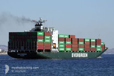
CAIRO PYRAMID
Container Ship
Current Trip
| Time Travelled | 16 days |
|---|---|
| Remaining Time | 17 h, 6 mins |
| Distance Travelled | 5507.06 nm |
| Remaining Distance | 251.88 nm |
| AVG Speed | 14.2 Knop |
| MAX Speed | 18.4 Knop |
| AVG Wind | 9.5 knots |
| MAX Wind | 27 knots |
| MIN Temp | 9°C / 48.2°F |
| MAX Temp | 28.6°C / 83.48°F |
| Djupgående | 8.9 m |
| Position mottagen | 13 m sen |
Current Position
| Longitud | 25.75435° |
|---|---|
| Latitude | 38.61033° |
| Status | Under way using engine |
| Fart | 14.7 Knop |
| Kurs | 357° |
| Område | Aegean Sea |
| Station | T-AIS |
| Position mottagen | 13 m sen |
Info
Information
The current position of CAIRO PYRAMID is in Aegean Sea with coordinates 38.61033° / 25.75435° as reported on 2025-02-25 10:32 by AIS to our vessel tracker app. The vessel's current speed is 14.7 Knop and is heading at the port of ISTANBUL. The estimated time of arrival as calculated by MyShipTracking vessel tracking app is 2025-02-26 03:52 LT
The vessel CAIRO PYRAMID (IMO: 9202170, MMSI: 357962000) is a Container Ship that was built in 2000 ( 25 År gammal ). It's sailing under the flag of [PA] Panama.
In this page you can find informations about the vessels current position, last detected port calls, and current voyage information. If the vessels is not in coverage by AIS you will find the latest position.
The current position of CAIRO PYRAMID is detected by our AIS receivers and we are not responsible for the reliability of the data. The last position was recorded while the vessel was in Coverage by the Ais receivers of our vessel tracking app.
The current draught of CAIRO PYRAMID as reported by AIS is 8.9 meters
Weather
| Temperature | 10.6°C / 51.08°F |
|---|---|
| Wind Speed | 16 knots |
| Direction | 149° SSE |
| Pressure | 1024.3 hPa |
| Humidity | 75 % |
| Cloud Coverage | 100 % |
Featured Company
Last Port Calls
| Port | Arrival | Departure | Time In Port |
|---|---|---|---|
| 2025-02-23 07:09 | 2025-02-23 16:13 | 9 h | |
| 2025-02-08 16:16 | 2025-02-08 21:45 | 5 h | |
| 2025-02-03 06:25 | 2025-02-03 14:01 | 7 h | |
| 2025-01-30 09:54 | 2025-01-30 14:33 | 4 h | |
| 2025-01-27 17:45 | 2025-01-28 04:29 | 10 h | |
| 2025-01-02 03:29 | 2025-01-02 14:14 | 10 h | |
| 2024-12-24 21:49 | 2024-12-25 14:25 | 16 h |
Last Trips
| Origin | Departure | Destination | Arrival | Distance | |
|---|---|---|---|---|---|
| 2025-02-09 05:45 | 2025-02-23 09:09 | 4828.43 nm | |||
| 2025-02-03 22:01 | 2025-02-09 00:16 | 1638.56 nm | |||
| 2025-01-30 22:33 | 2025-02-03 14:25 | 1030.58 nm | |||
| 2025-01-28 12:29 | 2025-01-30 17:54 | 396.41 nm | |||
| 2025-01-02 22:14 | 2025-01-28 01:45 | 975.34 nm | |||
| 2024-12-25 22:25 | 2025-01-02 11:29 | 2043.44 nm | |||
| 2024-11-18 14:35 | 2024-12-25 05:49 | 11471.90 nm |
Events
| Tid | Event | Detaljer | Position / Dest | Information |
|---|---|---|---|---|
| 2025-02-25 10:32 | Status ändrad | Under way using engine Default |
38.60985 / 25.75437
ISTANBUL TURKEY
|
Fart: 14.8 kn Kurs: 357° |
| 2025-02-25 10:21 | I täckningsområde |
38.61033 / 25.75435
Aegean Sea
ISTANBUL TURKEY
|
Fart: 14.7 kn Kurs: 357° |
|
| 2025-02-25 08:20 | Status ändrad | Default Under way using engine |
38.08152 / 25.80850
ISTANBUL TURKEY
|
Fart: 14.4 kn Kurs: 352° |
| 2025-02-25 08:20 | UTANFÖR täckningsområde |
38.08112 / 25.80855
Aegean Sea
ISTANBUL TURKEY
|
Fart: 14.4 kn Kurs: 352° |
|
| 2025-02-24 22:36 | Status ändrad | Under way using engine Default |
36.15577 / 27.26220
ISTANBUL TURKEY
|
Fart: 14.6 kn Kurs: 312° |
| 2025-02-24 22:30 | Status ändrad | Default Under way using engine |
36.14062 / 27.28273
ISTANBUL TURKEY
|
Fart: 14.6 kn Kurs: 314° |
| 2025-02-24 20:38 | Byter havsområde | Greek part of the Aegean Sea Greek part of the Mediterranean Sea - Eastern Basin |
35.83625 / 27.66942
Aegean Sea
ISTANBUL TURKEY
|
Fart: 13.8 kn Kurs: 311° |
| 2025-02-24 17:57 | ETA ändrat | 2025/02/25 21:00 2025/02/25 11:00 |
35.40667 / 28.23642
ISTANBUL TURKEY
|
Fart: 14 kn Kurs: 309° |
| 2025-02-24 17:47 | Byter havsområde | Greek part of the Mediterranean Sea - Eastern Basin Egyptian part of the Mediterranean Sea - Eastern Basin |
35.38207 / 28.27090
Mediterranean Sea - Eastern Basin
ISTANBUL TURKEY
|
Fart: 13.8 kn Kurs: 312° |
| 2025-02-24 17:45 | Status ändrad | Under way using engine Default |
35.37633 / 28.27883
ISTANBUL TURKEY
|
Fart: 14.3 kn Kurs: 314° |