
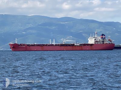
CAPIBARA
Oil/Chemical Tanker
Current Trip
TR CN
| Time Travelled | 4 days |
|---|---|
| Remaining Time | --- |
| Distance Travelled | 1047.08 nm |
| Remaining Distance | --- |
| AVG Speed | 8.9 Knop |
| MAX Speed | 13.6 Knop |
| AVG Wind | 24.6 knots |
| MAX Wind | 32 knots |
| MIN Temp | 11.8°C / 53.24°F |
| MAX Temp | 17.5°C / 63.5°F |
| Djupgående | 8 m |
| Position mottagen | Nu |
Current Position
| Longitud | 26.39857° |
|---|---|
| Latitude | 40.20199° |
| Status | Under way using engine |
| Fart | 11.8 Knop |
| Kurs | 73.2° |
| Område | Sea of Marmara |
| Station | T-AIS |
| Position mottagen | Nu |
Info
Information
The current position of CAPIBARA is in Sea of Marmara with coordinates 40.20199° / 26.39857° as reported on 2026-01-05 22:51 by AIS to our vessel tracker app. The vessel's current speed is 11.8 Knop
The vessel CAPIBARA (IMO: 9267027, MMSI: 525107008) is a Oil/Chemical Tanker that was built in 2004 ( 22 År gammal ). It's sailing under the flag of [ID] Indonesia.
In this page you can find informations about the vessels current position, last detected port calls, and current voyage information. If the vessels is not in coverage by AIS you will find the latest position.
The current position of CAPIBARA is detected by our AIS receivers and we are not responsible for the reliability of the data. The last position was recorded while the vessel was in Coverage by the Ais receivers of our vessel tracking app.
The current draught of CAPIBARA as reported by AIS is 8 meters
Weather
| Temperature | 13.4°C / 56.12°F |
|---|---|
| Wind Speed | 16 knots |
| Direction | 184° S |
| Pressure | 1015.9 hPa |
| Humidity | 73.5 % |
| Cloud Coverage | 100 % |
Featured Company
Last Port Calls
| Port | Arrival | Departure | Time In Port |
|---|---|---|---|
| 2025-12-30 14:45 | 2026-01-01 19:19 | 2 d | |
| 2025-12-25 21:52 | 2025-12-28 19:57 | 2 d | |
| 2025-12-12 18:21 | 2025-12-12 19:37 | 1 h | |
| 2025-11-25 05:32 | 2025-11-25 09:03 | 3 h | |
| 2025-11-23 21:58 | 2025-11-24 12:05 | 14 h | |
| 2025-11-23 21:00 | |||
| 2025-11-23 20:07 | 2025-11-23 20:41 | 34 m | |
| 2025-11-23 19:46 | |||
| 2025-11-23 16:24 | 2025-11-23 19:27 | 3 h | |
| 2025-11-23 08:04 |
Last Trips
| Origin | Departure | Destination | Arrival | Distance | |
|---|---|---|---|---|---|
| 2025-12-28 19:57 | 2025-12-30 14:45 | 363.78 nm | |||
| 2025-12-12 19:37 | 2025-12-25 21:52 | 1006.69 nm | |||
| 2025-11-25 09:03 | 2025-12-12 18:21 | 2677.55 nm | |||
| 2025-11-24 12:05 | 2025-11-25 05:32 | 74.29 nm | |||
| 2025-11-23 19:27 | 2025-11-23 21:58 | 44.27 nm | |||
| 2025-11-23 20:41 | 2025-11-23 21:00 | 0.60 nm | |||
| 2025-11-23 19:46 | 2025-11-23 20:07 | 0.37 nm | |||
| 2025-11-23 19:46 | 2025-11-23 16:24 | 0.37 nm | |||
| 2025-11-23 07:35 | 2025-11-23 08:04 | 7.17 nm | |||
| 2025-11-23 01:42 | 2025-11-23 06:54 | 30.62 nm |
Events
| Tid | Event | Detaljer | Position / Dest | Information |
|---|---|---|---|---|
| 2026-01-05 21:29 | Byter havsområde | Turkish part of the Sea of Marmara Turkish part of the Aegean Sea |
40.02049 / 26.18674
Sea of Marmara
|
Fart: 7.1 kn Kurs: 76.7° |
| 2026-01-05 21:20 | Status ändrad | Under way using engine Default |
40.01651 / 26.16336
TR CN
|
Fart: 5.4 kn Kurs: 81° |
| 2026-01-05 21:17 | Status ändrad | Default Under way using engine |
40.01559 / 26.15432
TR CN
|
Fart: 5 kn Kurs: 81° |
| 2026-01-05 20:39 | Status ändrad | Under way using engine Default |
40.00435 / 26.08930
TR CN
|
Fart: 5 kn Kurs: 70° |
| 2026-01-05 20:27 | Status ändrad | Default Under way using engine |
39.99833 / 26.06667
TR CN
|
Fart: 6.3 kn Kurs: 68.7° |
| 2026-01-05 20:11 | Status ändrad | Under way using engine Default |
39.98864 / 26.03103
TR CN
|
Fart: 7.1 kn Kurs: 66° |
| 2026-01-05 19:43 | Status ändrad | Default Under way using engine |
39.96967 / 25.94648
TR CN
|
Fart: 12.4 kn Kurs: 93.1° |
| 2026-01-05 19:21 | Byter havsområde | Turkish part of the Aegean Sea Greek part of the Aegean Sea |
39.97163 / 25.85068
Aegean Sea
|
Fart: 11.5 kn Kurs: 92.7° |
| 2026-01-05 19:21 | Status ändrad | Under way using engine Default |
39.97169 / 25.84791
TR CN
|
Fart: 6.8 kn Kurs: 80° |
| 2026-01-05 19:21 | I täckningsområde |
39.97163 / 25.85068
Aegean Sea
|
Fart: 11.5 kn Kurs: 92.7° |