

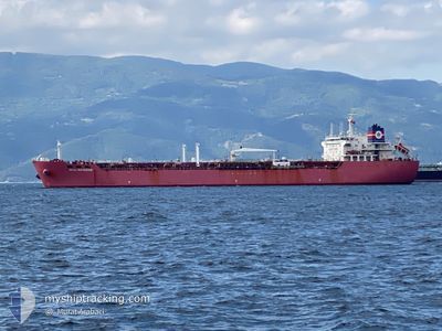
CAPIBARA
Oil/Chemical Tanker

Current Trip
| Time Travelled | 3 days |
|---|---|
| Remaining Time | --- |
| Distance Travelled | 535.24 nm |
| Remaining Distance | 11.92 nm |
| AVG Speed | 10.6 Knopen |
| MAX Speed | 16.6 Knopen |
| AVG Wind | 10.8 knots |
| MAX Wind | 16 knots |
| MIN Temp | 13.2°C / 55.76°F |
| MAX Temp | 19.5°C / 67.1°F |
| Diepgang | 12.1 M |
| Positie ontvangen | Nu |
Current Position
| Lengtegraad | 29.68345° |
|---|---|
| Breedtegraat | 40.76152° |
| Status | Under way using engine |
| Snelheid | 0.1 Knopen |
| Koers | 92° |
| Gebied | Sea of Marmara |
| Station | T-AIS |
| Positie ontvangen | Nu |
Information
The current position of CAPIBARA is in Sea of Marmara with coordinates 40.76152° / 29.68345° as reported on 2025-06-01 05:03 by AIS to our vessel tracker app. The vessel's current speed is 0.1 Knopen and is heading at the port of IZMIT. The estimated time of arrival as calculated by MyShipTracking vessel tracking app is 2025-05-31 00:00 LT
The vessel CAPIBARA (IMO: 9267027, MMSI: 525107008) is a Oil/Chemical Tanker that was built in 2004 ( 21 Jaar oud ). It's sailing under the flag of [ID] Indonesia.
In this page you can find informations about the vessels current position, last detected port calls, and current voyage information. If the vessels is not in coverage by AIS you will find the latest position.
The current position of CAPIBARA is detected by our AIS receivers and we are not responsible for the reliability of the data. The last position was recorded while the vessel was in Coverage by the Ais receivers of our vessel tracking app.
The current draught of CAPIBARA as reported by AIS is 12.1 meters
Weather
| Temperature | 15.7°C / 60.26°F |
|---|---|
| Wind Speed | 3 knots |
| Direction | 66° ENE |
| Pressure | 1017.5 hPa |
| Humidity | 78.8 % |
| Cloud Coverage | 93 % |


Featured Company
Last Port Calls
| Port | Arrival | Departure | Time In Port |
|---|---|---|---|
| 2025-05-27 15:34 | 2025-05-29 01:58 | 1 d | |
| 2025-05-16 17:17 | 2025-05-18 10:35 | 1 d | |
| 2025-05-09 00:23 | 2025-05-10 10:13 | 1 d | |
| 2025-04-25 16:06 | 2025-04-25 17:22 | 1 h | |
| 2025-04-14 18:29 | 2025-04-15 17:18 | 22 h | |
| 2025-04-10 15:38 | 2025-04-11 19:30 | 1 d | |
| 2025-04-03 11:30 |
Most Visited Ports (Last year)
| Port | Arrivals | |
|---|---|---|
| 10 | ||
| 5 | ||
| 5 | ||
| 4 | ||
| 3 | ||
| 3 |
Last Trips
| Origin | Departure | Destination | Arrival | Distance | |
|---|---|---|---|---|---|
| 2025-05-18 10:35 | 2025-05-27 15:34 | 1999.90 nm | |||
| 2025-05-10 10:13 | 2025-05-16 17:17 | 11.22 nm | |||
| 2025-04-25 17:22 | 2025-05-09 00:23 | 734.67 nm | |||
| 2025-04-15 17:18 | 2025-04-25 16:06 | 1452.68 nm | |||
| 2025-04-11 19:30 | 2025-04-14 18:29 | 321.75 nm | |||
| 2025-03-21 02:06 | 2025-04-03 11:30 | 1161.07 nm |
Events
| Tijd | Evenement | Details | Positie / Bestemming | Info |
|---|---|---|---|---|
| 2025-06-01 00:02 | ETA Changed | 2026/05/30 21:00 2025/05/30 21:00 |
40.76051 / 29.68405
TR IZT
|
Snelheid: Koers: 45° |
| 2025-05-31 21:39 | Stop beweging | 1.4 nm, South West of EVYAP |
40.76154 / 29.68449
TR IZT
|
Snelheid: Koers: 82° |
| 2025-05-31 15:10 | Wijzig zee gebeid | Turkish part of the Sea of Marmara Turkish part of the Black Sea |
41.23296 / 29.13116
Sea of Marmara
|
Snelheid: 6.8 kn Koers: 202.8° |
| 2025-05-31 13:42 | Start beweging | 12.98 nm, North West of RUMELI FENERI |
41.42589 / 28.98729
TR IZT
|
Snelheid: 3.2 kn Koers: 130° |
| 2025-05-31 08:09 | Stop beweging | 13.24 nm, North of RUMELI FENERI |
41.44920 / 29.06514
TR IZT
|
Snelheid: 0.3 kn Koers: 49° |
| 2025-05-31 07:07 | Start beweging | 10.3 nm, North West of RUMELI FENERI |
41.38310 / 29.00640
TR IZT
|
Snelheid: 3.2 kn Koers: 48° |
| 2025-05-30 21:02 | Stop beweging | 14.31 nm, North of RUMELI FENERI |
41.45569 / 29.00537
TR IZT
|
Snelheid: 0.3 kn Koers: 30° |
| 2025-05-30 20:22 | Start beweging | 13.11 nm, North of RUMELI FENERI |
41.43467 / 29.00669
TR IZT
|
Snelheid: 3.1 kn Koers: 20° |
| 2025-05-30 12:03 | Stop beweging | 15.3 nm, North of RUMELI FENERI |
41.48574 / 29.14026
TR IZT
|
Snelheid: 0.2 kn Koers: 2° |
| 2025-05-30 10:55 | Status Changed | Under way using engine Default |
41.49989 / 29.25104
TR IZT
|
Snelheid: 11.9 kn Koers: 251° |