
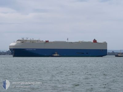
CATTLEYA ACE
Vehicles Carrier
Current Trip
| Time Travelled | 11 days |
|---|---|
| Remaining Time | 1 day |
| Distance Travelled | 5248.62 nm |
| Remaining Distance | 840.52 nm |
| AVG Speed | 18.8 Knop |
| MAX Speed | 20.9 Knop |
| AVG Wind | 13.1 knots |
| MAX Wind | 25.3 knots |
| MIN Temp | 17.1°C / 62.78°F |
| MAX Temp | 27.9°C / 82.22°F |
| Djupgående | 8.7 m |
| Position mottagen | 8 h, 38 m sen |
Current Position
| Longitud | -15.40542° |
|---|---|
| Latitude | 29.19729° |
| Status | Under way using engine |
| Fart | 18.3 Knop |
| Kurs | 21.8° |
| Område | North Atlantic Ocean |
| Station | T-AIS |
| Position mottagen | 8 h, 38 m sen |
Info
Information
The current position of CATTLEYA ACE is in North Atlantic Ocean with coordinates 29.19729° / -15.40542° as reported on 2025-02-04 18:20 by AIS to our vessel tracker app. The vessel's current speed is 18.3 Knop and is heading at the port of VIGO. The estimated time of arrival as calculated by MyShipTracking vessel tracking app is 2025-02-06 16:22 LT
The vessel CATTLEYA ACE (IMO: 9544918, MMSI: 431573000) is a Vehicles Carrier that was built in 2011 ( 14 År gammal ). It's sailing under the flag of [JP] Japan.
In this page you can find informations about the vessels current position, last detected port calls, and current voyage information. If the vessels is not in coverage by AIS you will find the latest position.
The current position of CATTLEYA ACE is detected by our AIS receivers and we are not responsible for the reliability of the data. The last position was recorded while the vessel was in Coverage by the Ais receivers of our vessel tracking app.
The current draught of CATTLEYA ACE as reported by AIS is 8.7 meters
Weather
| Temperature | 17.2°C / 62.96°F |
|---|---|
| Wind Speed | 16 knots |
| Direction | 46° NE |
| Pressure | 1027.6 hPa |
| Humidity | 68.7 % |
| Cloud Coverage | 73 % |
Featured Company
Last Port Calls
| Port | Arrival | Departure | Time In Port |
|---|---|---|---|
| 2025-01-24 05:00 | 2025-01-24 14:13 | 9 h | |
| 2025-01-17 22:55 | 2025-01-21 21:02 | 3 d | |
| 2025-01-09 00:13 | 2025-01-09 08:54 | 8 h | |
| 2024-12-31 04:38 | 2024-12-31 15:40 | 11 h | |
| 2024-12-29 00:47 | 2024-12-29 13:18 | 12 h | |
| 2024-12-26 00:47 | 2024-12-26 13:41 | 12 h | |
| 2024-12-23 10:05 | 2024-12-24 19:01 | 1 d | |
| 2024-12-20 00:40 | 2024-12-20 14:08 | 13 h | |
| 2024-12-13 09:55 | 2024-12-13 20:49 | 10 h | |
| 2024-12-12 01:00 | 2024-12-12 08:22 | 7 h |
Last Trips
| Origin | Departure | Destination | Arrival | Distance | |
|---|---|---|---|---|---|
| 2025-01-21 23:02 | 2025-01-24 07:00 | 394.30 nm | |||
| 2025-01-09 12:54 | 2025-01-18 00:55 | 2139.30 nm | |||
| 2024-12-31 21:10 | 2025-01-09 04:13 | 2643.72 nm | |||
| 2024-12-29 18:48 | 2024-12-31 10:08 | 511.58 nm | |||
| 2024-12-26 19:11 | 2024-12-29 06:17 | 1048.86 nm | |||
| 2024-12-25 00:31 | 2024-12-26 06:17 | 433.74 nm | |||
| 2024-12-20 19:38 | 2024-12-23 15:35 | 345.05 nm | |||
| 2024-12-13 23:49 | 2024-12-20 06:10 | 1579.32 nm | |||
| 2024-12-12 11:22 | 2024-12-13 12:55 | 314.11 nm | |||
| 2024-12-10 11:46 | 2024-12-12 04:00 | 374.71 nm |
Events
| Tid | Event | Detaljer | Position / Dest | Information |
|---|---|---|---|---|
| 2025-02-04 18:27 | Status ändrad | Default Under way using engine |
29.22902 / -15.39076
ES VGO
|
Fart: 18.3 kn Kurs: 21.8° |
| 2025-02-04 18:20 | Status ändrad | Under way using engine Default |
29.19729 / -15.40542
ES VGO
|
Fart: 18.4 kn Kurs: 22° |
| 2025-02-04 18:20 | UTANFÖR täckningsområde |
29.19729 / -15.40542
North Atlantic Ocean
ES VGO
|
Fart: 18.3 kn Kurs: 21.8° |
|
| 2025-02-04 17:59 | Status ändrad | Default Under way using engine |
29.09694 / -15.45155
ES VGO
|
Fart: 18.5 kn Kurs: 20.8° |
| 2025-02-04 13:10 | Djupgående ändrat | 8.7 8 |
27.92741 / -16.27821
ES VGO
|
Fart: 15.8 kn Kurs: 19.6° |
| 2025-02-04 13:10 | ETA ändrat | 2025/02/06 20:00 |
27.92741 / -16.27821
ES VGO
|
Fart: 15.8 kn Kurs: 19.6° |
| 2025-02-04 12:26 | Status ändrad | Under way using engine Default |
27.72326 / -16.34281
ES VGO
|
Fart: 18.6 kn Kurs: 15° |
| 2025-02-04 12:19 | Status ändrad | Default Under way using engine |
27.69075 / -16.35292
ES VGO
|
Fart: 18.4 kn Kurs: 13.7° |
| 2025-02-04 12:12 | Status ändrad | Under way using engine Default |
27.65523 / -16.36313
ES VGO
|
Fart: 18.4 kn Kurs: 14° |
| 2025-02-04 11:59 | I täckningsområde |
27.65523 / -16.36313
North Atlantic Ocean
|
Fart: 18.4 kn Kurs: 13.7° |