
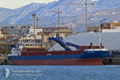
CELTIC SPIRIT
General Cargo
Current Trip
| Time Travelled | 3 days |
|---|---|
| Remaining Time | --- |
| Distance Travelled | 763.96 nm |
| Remaining Distance | --- |
| AVG Speed | 9.7 Knop |
| MAX Speed | 10.8 Knop |
| AVG Wind | 12.1 knots |
| MAX Wind | 27 knots |
| MIN Temp | 8.9°C / 48.02°F |
| MAX Temp | 15.4°C / 59.72°F |
| Djupgående | 5.5 m |
| Position mottagen | 1 m sen |
Current Position
| Longitud | -10.04216° |
|---|---|
| Latitude | 38.93828° |
| Status | Under way using engine |
| Fart | 9.7 Knop |
| Kurs | 203.4° |
| Område | North Atlantic Ocean |
| Station | T-AIS |
| Position mottagen | 1 m sen |
Info
Information
The current position of CELTIC SPIRIT is in North Atlantic Ocean with coordinates 38.93828° / -10.04216° as reported on 2025-02-09 01:00 by AIS to our vessel tracker app. The vessel's current speed is 9.7 Knop and is heading at the port of TENES. The estimated time of arrival as calculated by MyShipTracking vessel tracking app is 2025-02-12 06:00 LT
The vessel CELTIC SPIRIT (IMO: 9365491, MMSI: 304242000) is a General Cargo that was built in 2007 ( 18 År gammal ). It's sailing under the flag of [AG] Antigua Barbuda.
In this page you can find informations about the vessels current position, last detected port calls, and current voyage information. If the vessels is not in coverage by AIS you will find the latest position.
The current position of CELTIC SPIRIT is detected by our AIS receivers and we are not responsible for the reliability of the data. The last position was recorded while the vessel was in Coverage by the Ais receivers of our vessel tracking app.
The current draught of CELTIC SPIRIT as reported by AIS is 5.5 meters
Weather
| Temperature | 15.3°C / 59.54°F |
|---|---|
| Wind Speed | 4 knots |
| Direction | 266° W |
| Pressure | 1025.8 hPa |
| Humidity | 88 % |
| Cloud Coverage | 86 % |
Featured Company
Last Port Calls
| Port | Arrival | Departure | Time In Port |
|---|---|---|---|
| 2025-02-05 10:32 | 2025-02-05 17:26 | 6 h | |
| 2025-01-31 20:03 | 2025-02-02 09:01 | 1 d | |
| 2025-01-28 05:43 | 2025-01-30 02:57 | 1 d | |
| 2025-01-26 06:26 | 2025-01-28 00:54 | 1 d | |
| 2025-01-22 13:14 | 2025-01-25 06:42 | 2 d | |
| 2025-01-18 19:19 | 2025-01-20 20:23 | 2 d | |
| 2025-01-12 16:05 | 2025-01-14 07:18 | 1 d | |
| 2024-12-19 08:45 | 2024-12-23 13:13 | 4 d | |
| 2024-12-13 06:25 | 2024-12-13 15:20 | 8 h | |
| 2024-12-02 22:02 | 2024-12-03 23:06 | 1 d |
Last Trips
| Origin | Departure | Destination | Arrival | Distance | |
|---|---|---|---|---|---|
| 2025-02-02 09:01 | 2025-02-05 10:32 | 97.97 nm | |||
| 2025-01-30 03:57 | 2025-01-31 20:03 | 304.90 nm | |||
| 2025-01-28 01:54 | 2025-01-28 06:43 | 28.34 nm | |||
| 2025-01-25 06:42 | 2025-01-26 07:26 | 220.44 nm | |||
| 2025-01-20 20:23 | 2025-01-22 13:14 | 365.03 nm | |||
| 2025-01-14 08:18 | 2025-01-18 19:19 | 993.04 nm | |||
| 2024-12-23 16:13 | 2025-01-12 17:05 | 3844.39 nm | |||
| 2024-12-13 17:20 | 2024-12-19 11:45 | 566.38 nm | |||
| 2024-12-04 00:06 | 2024-12-13 08:25 | 2132.44 nm | |||
| 2024-11-28 17:26 | 2024-12-02 23:02 | 103.35 nm |
Events
| Tid | Event | Detaljer | Position / Dest | Information |
|---|---|---|---|---|
| 2025-02-08 19:21 | ETA ändrat | 2025/02/12 06:00 2025/02/12 12:00 |
39.80060 / -9.60196
DZ TEN
|
Fart: 10.1 kn Kurs: 188.6° |
| 2025-02-08 18:56 | Status ändrad | Under way using engine Default |
39.87055 / -9.59213
DZ TEN
|
Fart: 9.6 kn Kurs: 186° |
| 2025-02-08 18:55 | Status ändrad | Default Under way using engine |
39.87207 / -9.59193
DZ TEN
|
Fart: 9.8 kn Kurs: 185.3° |
| 2025-02-08 18:43 | Status ändrad | Under way using engine Default |
39.90452 / -9.58742
DZ TEN
|
Fart: 9.9 kn Kurs: 185° |
| 2025-02-08 18:39 | Status ändrad | Default Under way using engine |
39.91539 / -9.58595
DZ TEN
|
Fart: 9.9 kn Kurs: 185.7° |
| 2025-02-08 18:34 | Upptäckt i hav | Portuguese part of the North Atlantic Ocean |
39.92879 / -9.58401
North Atlantic Ocean
DZ TEN
|
Fart: 9.9 kn Kurs: 185.7° |
| 2025-02-08 18:34 | Status ändrad | Under way using engine Default |
39.92879 / -9.58401
DZ TEN
|
Fart: 9.8 kn Kurs: 186° |
| 2025-02-08 18:19 | I täckningsområde |
39.92879 / -9.58401
North Atlantic Ocean
DZ TEN
|
Fart: 9.9 kn Kurs: 185.7° |
|
| 2025-02-06 03:13 | Status ändrad | Default Under way using engine |
49.14005 / -5.66140
DZ TEN
|
Fart: 10.6 kn Kurs: 219° |
| 2025-02-06 02:56 | UTANFÖR täckningsområde |
49.17757 / -5.61367
Celtic Sea
DZ TEN
|
Fart: 10.6 kn Kurs: 219° |