
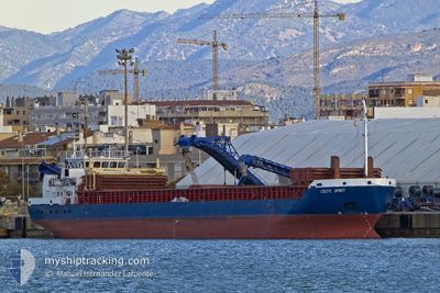
CELTIC SPIRIT
General Cargo
Current Trip
| Time Travelled | 7 days |
|---|---|
| Remaining Time | --- |
| Distance Travelled | 1441.83 nm |
| Remaining Distance | --- |
| AVG Speed | 9.3 Knopen |
| MAX Speed | 10.8 Knopen |
| AVG Wind | 9.1 knots |
| MAX Wind | 27 knots |
| MIN Temp | 8.9°C / 48.02°F |
| MAX Temp | 18.1°C / 64.58°F |
| Diepgang | 5.5 M |
| Positie ontvangen | 1 d geleden |
Current Position
| Lengtegraad | 0.08836° |
|---|---|
| Breedtegraat | 36.48719° |
| Status | Under way using engine |
| Snelheid | 7.6 Knopen |
| Koers | 87.4° |
| Gebied | Mediterranean Sea - Western Basin |
| Station | T-AIS |
| Positie ontvangen | 1 d geleden |
Info
Information
The current position of CELTIC SPIRIT is in Mediterranean Sea - Western Basin with coordinates 36.48719° / 0.08836° as reported on 2025-02-11 22:18 by AIS to our vessel tracker app. The vessel's current speed is 7.6 Knopen and is heading at the port of TENES. The estimated time of arrival as calculated by MyShipTracking vessel tracking app is 2025-02-12 06:00 LT
The vessel CELTIC SPIRIT (IMO: 9365491, MMSI: 304242000) is a General Cargo that was built in 2007 ( 18 Jaar oud ). It's sailing under the flag of [AG] Antigua Barbuda.
In this page you can find informations about the vessels current position, last detected port calls, and current voyage information. If the vessels is not in coverage by AIS you will find the latest position.
The current position of CELTIC SPIRIT is detected by our AIS receivers and we are not responsible for the reliability of the data. The last position was recorded while the vessel was in Coverage by the Ais receivers of our vessel tracking app.
The current draught of CELTIC SPIRIT as reported by AIS is 5.5 meters
Weather
| Temperature | 10.1°C / 50.18°F |
|---|---|
| Wind Speed | 9 knots |
| Direction | 212° SSW |
| Pressure | 1018.6 hPa |
| Humidity | 86.8 % |
| Cloud Coverage | 4 % |
Featured Company
Last Port Calls
| Port | Arrival | Departure | Time In Port |
|---|---|---|---|
| 2025-02-05 10:32 | 2025-02-05 17:26 | 6 h | |
| 2025-01-31 20:03 | 2025-02-02 09:01 | 1 d | |
| 2025-01-28 05:43 | 2025-01-30 02:57 | 1 d | |
| 2025-01-26 06:26 | 2025-01-28 00:54 | 1 d | |
| 2025-01-22 13:14 | 2025-01-25 06:42 | 2 d | |
| 2025-01-18 19:19 | 2025-01-20 20:23 | 2 d | |
| 2025-01-12 16:05 | 2025-01-14 07:18 | 1 d | |
| 2024-12-19 08:45 | 2024-12-23 13:13 | 4 d | |
| 2024-12-13 06:25 | 2024-12-13 15:20 | 8 h | |
| 2024-12-02 22:02 | 2024-12-03 23:06 | 1 d |
Last Trips
| Origin | Departure | Destination | Arrival | Distance | |
|---|---|---|---|---|---|
| 2025-02-02 09:01 | 2025-02-05 10:32 | 97.97 nm | |||
| 2025-01-30 03:57 | 2025-01-31 20:03 | 304.90 nm | |||
| 2025-01-28 01:54 | 2025-01-28 06:43 | 28.34 nm | |||
| 2025-01-25 06:42 | 2025-01-26 07:26 | 220.44 nm | |||
| 2025-01-20 20:23 | 2025-01-22 13:14 | 365.03 nm | |||
| 2025-01-14 08:18 | 2025-01-18 19:19 | 993.04 nm | |||
| 2024-12-23 16:13 | 2025-01-12 17:05 | 3844.39 nm | |||
| 2024-12-13 17:20 | 2024-12-19 11:45 | 566.38 nm | |||
| 2024-12-04 00:06 | 2024-12-13 08:25 | 2132.44 nm | |||
| 2024-11-28 17:26 | 2024-12-02 23:02 | 103.35 nm |
Events
| Tijd | Evenement | Details | Positie / Bestemming | Info |
|---|---|---|---|---|
| 2025-02-12 06:28 | Stop beweging | 1.12 nm, West of TENES |
36.52065 / 1.29579
DZ TEN
|
Snelheid: 0.3 kn Koers: 264° |
| 2025-02-11 22:22 | Status Changed | Default Under way using engine |
36.48757 / .09709
DZ TEN
|
Snelheid: 7.6 kn Koers: 87.4° |
| 2025-02-11 22:18 | Buitenbereik |
36.48719 / .08836
Mediterranean Sea - Western Basin
DZ TEN
|
Snelheid: 7.6 kn Koers: 87.4° |
|
| 2025-02-11 22:13 | Wijzig zee gebeid | Algerian part of the Mediterranean Sea - Western Basin Spanish part of the Alboran Sea |
36.48667 / .07348
Mediterranean Sea - Western Basin
DZ TEN
|
Snelheid: 7.5 kn Koers: 87.3° |
| 2025-02-11 22:11 | Status Changed | Under way using engine Default |
36.48643 / .06832
DZ TEN
|
Snelheid: 7.6 kn Koers: 87° |
| 2025-02-11 22:05 | Binnenbereik |
36.48667 / .07348
Mediterranean Sea - Western Basin
DZ TEN
|
Snelheid: 7.5 kn Koers: 87.3° |
|
| 2025-02-11 00:04 | Status Changed | Default Under way using engine |
36.40170 / -3.54873
DZ TEN
|
Snelheid: 8.1 kn Koers: 90.7° |
| 2025-02-10 23:19 | Status Changed | Under way using engine Default |
36.40516 / -3.67699
DZ TEN
|
Snelheid: 7.9 kn Koers: 92° |
| 2025-02-10 23:19 | Buitenbereik |
36.40516 / -3.67699
Alboran Sea
DZ TEN
|
Snelheid: 8.1 kn Koers: 90.7° |
|
| 2025-02-10 23:02 | Status Changed | Default Under way using engine |
36.40585 / -3.72184
DZ TEN
|
Snelheid: 8 kn Koers: 91.4° |