
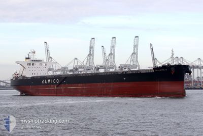
CIELO D'ITALIA
Cargo
Current Trip
| Time Travelled | 4 days |
|---|---|
| Remaining Time | --- |
| Distance Travelled | 668.99 nm |
| Remaining Distance | --- |
| AVG Speed | 10.7 Knop |
| MAX Speed | 12.8 Knop |
| AVG Wind | 15 knots |
| MAX Wind | 31.5 knots |
| MIN Temp | 5°C / 41°F |
| MAX Temp | 13.9°C / 57.02°F |
| Djupgående | 9 m |
| Position mottagen | 4 d sen |
Current Position
| Longitud | 139.75506° |
|---|---|
| Latitude | 35.27615° |
| Status | Under way using engine |
| Fart | 12.2 Knop |
| Kurs | 144.8° |
| Område | North Pacific Ocean |
| Station | T-AIS |
| Position mottagen | 4 d sen |
Info
Information
The current position of CIELO D'ITALIA is in North Pacific Ocean with coordinates 35.27615° / 139.75506° as reported on 2025-02-16 07:11 by AIS to our vessel tracker app. The vessel's current speed is 12.2 Knop
The vessel CIELO D'ITALIA (IMO: 9539274, MMSI: 636019932) is a Cargo It's sailing under the flag of [LR] Liberia.
In this page you can find informations about the vessels current position, last detected port calls, and current voyage information. If the vessels is not in coverage by AIS you will find the latest position.
The current position of CIELO D'ITALIA is detected by our AIS receivers and we are not responsible for the reliability of the data. The last position was recorded while the vessel was in Coverage by the Ais receivers of our vessel tracking app.
The current draught of CIELO D'ITALIA as reported by AIS is 9 meters
Weather
| Temperature | 5.5°C / 41.9°F |
|---|---|
| Wind Speed | 12 knots |
| Direction | 302° WNW |
| Pressure | 1027.4 hPa |
| Humidity | 50.4 % |
| Cloud Coverage | 100 % |
Featured Company
Last Port Calls
| Port | Arrival | Departure | Time In Port |
|---|---|---|---|
| 2025-02-14 10:40 | 2025-02-16 14:47 | 2 d | |
| 2025-01-29 06:25 | 2025-01-30 05:45 | 23 h | |
| 2024-12-13 07:20 | 2024-12-18 09:13 | 5 d |
Most Visited Ports (Last year)
| Port | Arrivals | |
|---|---|---|
| 5 | ||
| 2 | ||
| 1 | ||
| 1 | ||
| 1 | ||
| 1 |
Last Trips
| Origin | Departure | Destination | Arrival | Distance | |
|---|---|---|---|---|---|
| 2025-01-30 05:45 | 2025-02-14 10:40 | 3642.48 nm | |||
| 2024-12-18 09:13 | 2025-01-29 06:25 | 3734.25 nm | |||
| 2024-11-20 23:03 | 2024-12-13 07:20 | 4606.49 nm |
Events
| Tid | Event | Detaljer | Position / Dest | Information |
|---|---|---|---|---|
| 2025-02-20 09:00 | STOPPAR förflyttning | 8.93 nm, South of UBE |
33.78794 / 131.25856
JP TBT
|
Fart: 0.1 kn Kurs: 306° |
| 2025-02-19 05:45 | STARTAR förflyttning |
31.82724 / 132.04862
JP TBT
|
Fart: 4.3 kn Kurs: 321° |
|
| 2025-02-18 08:24 | STOPPAR förflyttning |
32.05833 / 132.39000
JP TBT
|
Fart: Kurs: -1° |
|
| 2025-02-16 07:17 | Status ändrad | Default Under way using engine |
35.25980 / 139.76910
JP TBT
|
Fart: 12.2 kn Kurs: 144.8° |
| 2025-02-16 07:11 | UTANFÖR täckningsområde |
35.27615 / 139.75506
North Pacific Ocean
JP TBT
|
Fart: 12.2 kn Kurs: 144.8° |
|
| 2025-02-16 05:47 | AVGÅTT HAMN |
|
35.38003 / 139.84620
JP TBT
|
Fart: 9.4 kn Kurs: 300° |
| 2025-02-16 05:39 | STARTAR förflyttning |
35.37165 / 139.86480
[JP] KIMITSU
|
Fart: 6.1 kn Kurs: 297° |
|
| 2025-02-16 05:22 | Status ändrad | Under way using engine Moored |
35.36608 / 139.86993
[JP] KIMITSU
|
Fart: Kurs: 110° |
| 2025-02-16 04:40 | Status ändrad | Moored Default |
35.36576 / 139.86980
[JP] KIMITSU
|
Fart: Kurs: 110° |
| 2025-02-16 04:38 | Djupgående ändrat | 9 13.7 |
35.36577 / 139.86980
[JP] KIMITSU
|
Fart: Kurs: 110° |