
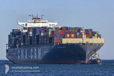
CMA CGM LIBRA
Container Ship
Current Trip
| Time Travelled | 15 days |
|---|---|
| Remaining Time | 3 days |
| Distance Travelled | 5367.03 nm |
| Remaining Distance | 1076.00 nm |
| AVG Speed | 14.5 Knop |
| MAX Speed | 18.2 Knop |
| AVG Wind | 18.5 knots |
| MAX Wind | 38 knots |
| MIN Temp | -3.9°C / 24.98°F |
| MAX Temp | 15.8°C / 60.44°F |
| Djupgående | 15 m |
| Position mottagen | 1 d sen |
Current Position
| Longitud | -129.56418° |
|---|---|
| Latitude | 34.00443° |
| Status | Under way using engine |
| Fart | 12.9 Knop |
| Kurs | 125.1° |
| Område | North Pacific Ocean |
| Station | T-AIS |
| Position mottagen | 1 d sen |
Info
Information
The current position of CMA CGM LIBRA is in North Pacific Ocean with coordinates 34.00443° / -129.56418° as reported on 2025-03-01 12:05 by AIS to our vessel tracker app. The vessel's current speed is 12.9 Knop and is heading at the port of MANZANILLO. The estimated time of arrival as calculated by MyShipTracking vessel tracking app is 2025-03-06 23:36 LT
The vessel CMA CGM LIBRA (IMO: 9399193, MMSI: 249819000) is a Container Ship that was built in 2009 ( 16 År gammal ). It's sailing under the flag of [MT] Malta.
In this page you can find informations about the vessels current position, last detected port calls, and current voyage information. If the vessels is not in coverage by AIS you will find the latest position.
The current position of CMA CGM LIBRA is detected by our AIS receivers and we are not responsible for the reliability of the data. The last position was recorded while the vessel was in Coverage by the Ais receivers of our vessel tracking app.
The current draught of CMA CGM LIBRA as reported by AIS is 15 meters
Weather
| Temperature | 14.7°C / 58.46°F |
|---|---|
| Wind Speed | 18 knots |
| Direction | 345° NNW |
| Pressure | 1024.6 hPa |
| Humidity | 66.3 % |
| Cloud Coverage | 100 % |
Featured Company
Last Port Calls
| Port | Arrival | Departure | Time In Port |
|---|---|---|---|
| 2025-02-14 12:21 | 2025-02-15 15:48 | 1 d | |
| 2025-02-11 00:37 | 2025-02-11 18:41 | 18 h | |
| 2025-02-08 08:36 | 2025-02-08 23:41 | 15 h | |
| 2025-02-04 03:08 | 2025-02-05 00:28 | 21 h | |
| 2025-01-31 19:29 | 2025-02-02 03:41 | 1 d | |
| 2025-01-25 09:59 | 2025-01-26 07:43 | 21 h |
Most Visited Ports (Last year)
| Port | Arrivals | |
|---|---|---|
| 5 | ||
| 4 | ||
| 4 | ||
| 4 | ||
| 4 | ||
| 4 |
Last Trips
| Origin | Departure | Destination | Arrival | Distance | |
|---|---|---|---|---|---|
| 2025-02-12 02:41 | 2025-02-14 21:21 | 547.35 nm | |||
| 2025-02-09 07:41 | 2025-02-11 08:37 | 488.59 nm | |||
| 2025-02-05 08:28 | 2025-02-08 16:36 | 911.21 nm | |||
| 2025-02-02 11:41 | 2025-02-04 11:08 | 23.72 nm | |||
| 2025-01-26 15:43 | 2025-02-01 03:29 | 1520.36 nm | |||
| 2024-12-30 00:52 | 2025-01-25 17:59 | 11568.47 nm |
Events
| Tid | Event | Detaljer | Position / Dest | Information |
|---|---|---|---|---|
| 2025-03-01 12:11 | Status ändrad | Default Under way using engine |
33.99127 / -129.54257
MXZLO
|
Fart: 12.9 kn Kurs: 125.1° |
| 2025-03-01 12:05 | UTANFÖR täckningsområde |
34.00443 / -129.56418
North Pacific Ocean
MXZLO
|
Fart: 12.9 kn Kurs: 125.1° |
|
| 2025-03-01 11:55 | Byter havsområde | High seas of the North Pacific Ocean Japanese part of the North Pacific Ocean |
34.02505 / -129.59778
North Pacific Ocean
MXZLO
|
Fart: 12.8 kn Kurs: 125.2° |
| 2025-03-01 11:54 | Status ändrad | Under way using engine Default |
34.02717 / -129.60125
MXZLO
|
Fart: 12.8 kn Kurs: 126° |
| 2025-03-01 11:49 | I täckningsområde |
34.02505 / -129.59778
North Pacific Ocean
MXZLO
|
Fart: 12.8 kn Kurs: 125.2° |