
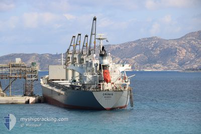
CRINIS
Bulk Carrier
Current Trip
ORDER
| Time Travelled | 3 days |
|---|---|
| Remaining Time | --- |
| Distance Travelled | 655.98 nm |
| Remaining Distance | --- |
| AVG Speed | 5.9 Knop |
| MAX Speed | 13.5 Knop |
| AVG Wind | 19.6 knots |
| MAX Wind | 28 knots |
| MIN Temp | 4.6°C / 40.28°F |
| MAX Temp | 16.7°C / 62.06°F |
| Djupgående | 5.5 m |
| Position mottagen | 16 h, 38 m sen |
Current Position
| Longitud | 18.74626° |
|---|---|
| Latitude | 39.99740° |
| Status | Under way using engine |
| Fart | 6.2 Knop |
| Kurs | 189.9° |
| Område | Adriatic Sea |
| Station | T-AIS |
| Position mottagen | 16 h, 38 m sen |
Info
Information
The current position of CRINIS is in Adriatic Sea with coordinates 39.99740° / 18.74626° as reported on 2026-01-07 17:57 by AIS to our vessel tracker app. The vessel's current speed is 6.2 Knop
The vessel CRINIS (IMO: 9598165, MMSI: 255915781) is a Bulk Carrier that was built in 2011 ( 15 År gammal ). It's sailing under the flag of [PT] Portugal.
In this page you can find informations about the vessels current position, last detected port calls, and current voyage information. If the vessels is not in coverage by AIS you will find the latest position.
The current position of CRINIS is detected by our AIS receivers and we are not responsible for the reliability of the data. The last position was recorded while the vessel was in Coverage by the Ais receivers of our vessel tracking app.
The current draught of CRINIS as reported by AIS is 5.5 meters
Weather
| Temperature | 8.7°C / 47.66°F |
|---|---|
| Wind Speed | 22 knots |
| Direction | 294° WNW |
| Pressure | 1012 hPa |
| Humidity | 68.3 % |
| Cloud Coverage | 30 % |
Featured Company
Last Port Calls
| Port | Arrival | Departure | Time In Port |
|---|---|---|---|
| 2025-12-30 04:08 | 2026-01-04 14:29 | 5 d | |
| 2025-12-21 02:23 | 2025-12-22 14:48 | 1 d | |
| 2025-11-26 13:05 | 2025-12-01 15:09 | 5 d | |
| 2025-11-14 07:30 | 2025-11-16 20:50 | 2 d | |
| 2025-11-07 14:26 | 2025-11-09 21:42 | 2 d | |
| 2025-11-03 22:15 | 2025-11-04 22:02 | 23 h |
Most Visited Ports (Last year)
| Port | Arrivals | |
|---|---|---|
| 6 | ||
| 3 | ||
| 2 | ||
| 1 | ||
| 1 | ||
| 1 |
Last Trips
| Origin | Departure | Destination | Arrival | Distance | |
|---|---|---|---|---|---|
| 2025-12-22 14:48 | 2025-12-30 04:08 | 1950.84 nm | |||
| 2025-12-01 15:09 | 2025-12-21 02:23 | 2114.72 nm | |||
| 2025-11-16 20:50 | 2025-11-26 13:05 | 2548.59 nm | |||
| 2025-11-09 21:42 | 2025-11-14 07:30 | 804.40 nm | |||
| 2025-11-04 22:02 | 2025-11-07 14:26 | 16.18 nm | |||
| 2025-10-19 08:32 | 2025-11-03 22:15 | 3550.08 nm |
Events
| Tid | Event | Detaljer | Position / Dest | Information |
|---|---|---|---|---|
| 2026-01-07 21:12 | STOPPAR förflyttning | 17.79 nm, South East of CASTRO MARINA |
39.86562 / 18.77000
ORDER
|
Fart: 0.3 kn Kurs: 248° |
| 2026-01-07 18:13 | Status ändrad | Default Under way using engine |
39.97111 / 18.74379
ORDER
|
Fart: 6.2 kn Kurs: 189.9° |
| 2026-01-07 17:57 | UTANFÖR täckningsområde |
39.99740 / 18.74626
Adriatic Sea
|
Fart: 6.2 kn Kurs: 189.9° |
|
| 2026-01-07 17:54 | Status ändrad | Under way using engine Default |
40.00191 / 18.74670
ORDER
|
Fart: 6 kn Kurs: 188° |
| 2026-01-07 17:52 | Status ändrad | Default Under way using engine |
40.00527 / 18.74700
ORDER
|
Fart: 6.1 kn Kurs: 182.4° |
| 2026-01-07 17:02 | Status ändrad | Under way using engine Default |
40.09303 / 18.74862
ORDER
|
Fart: 6 kn Kurs: 179° |
| 2026-01-07 17:01 | Status ändrad | Default Under way using engine |
40.09497 / 18.74854
ORDER
|
Fart: 6.1 kn Kurs: 175.7° |
| 2026-01-07 08:13 | Status ändrad | Under way using engine Default |
40.05127 / 18.62801
ORDER
|
Fart: 4.2 kn Kurs: 14° |
| 2026-01-07 08:01 | Status ändrad | Default Under way using engine |
40.03680 / 18.62511
ORDER
|
Fart: 4.6 kn Kurs: 16° |
| 2026-01-07 07:43 | Status ändrad | Under way using engine Default |
40.01618 / 18.61982
ORDER
|
Fart: 4.3 kn Kurs: 15° |