
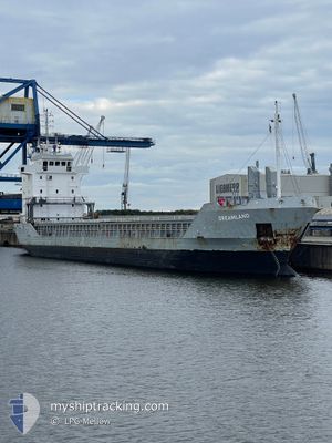
DREAMLAND
General Cargo
Current Trip
| Time Travelled | 7 h, 53 mins |
|---|---|
| Remaining Time | 19 h, 58 mins |
| Distance Travelled | 50.79 nm |
| Remaining Distance | 132.49 nm |
| AVG Speed | 6.5 Knop |
| MAX Speed | 7.2 Knop |
| AVG Wind | 2.3 knots |
| MAX Wind | 6 knots |
| MIN Temp | 2.6°C / 36.68°F |
| MAX Temp | 3.3°C / 37.94°F |
| Djupgående | 5.7 m |
| Position mottagen | Nu |
Current Position
| Longitud | 20.59990° |
|---|---|
| Latitude | 59.65281° |
| Status | Towing Astern |
| Fart | 6.4 Knop |
| Kurs | 126.7° |
| Område | Baltic Sea |
| Station | T-AIS |
| Position mottagen | Nu |
Info
Information
The current position of DREAMLAND is in Baltic Sea with coordinates 59.65281° / 20.59990° as reported on 2025-03-25 21:08 by AIS to our vessel tracker app. The vessel's current speed is 6.4 Knop and is heading at the port of TALLINN OLD HARBOR. The estimated time of arrival as calculated by MyShipTracking vessel tracking app is 2025-03-26 19:07 LT
The vessel DREAMLAND (IMO: 9155872, MMSI: 275546000) is a General Cargo that was built in 1997 ( 28 År gammal ). It's sailing under the flag of [LV] Latvia.
In this page you can find informations about the vessels current position, last detected port calls, and current voyage information. If the vessels is not in coverage by AIS you will find the latest position.
The current position of DREAMLAND is detected by our AIS receivers and we are not responsible for the reliability of the data. The last position was recorded while the vessel was in Coverage by the Ais receivers of our vessel tracking app.
The current draught of DREAMLAND as reported by AIS is 5.7 meters
Weather
| Temperature | 3.3°C / 37.94°F |
|---|---|
| Wind Speed | 6 knots |
| Direction | 32° NNE |
| Pressure | 1008.3 hPa |
| Humidity | 94.3 % |
| Cloud Coverage | 100 % |
Featured Company
Last Port Calls
| Port | Arrival | Departure | Time In Port |
|---|---|---|---|
| 2025-03-11 16:58 | 2025-03-25 15:16 | 13 d | |
| 2025-03-08 14:17 | 2025-03-08 14:22 | 5 m | |
| 2025-03-06 01:14 | 2025-03-07 01:34 | 1 d | |
| 2025-03-04 19:24 | 2025-03-05 23:27 | 1 d | |
| 2025-02-26 19:25 | 2025-02-27 19:42 | 1 d | |
| 2025-02-23 05:22 | 2025-02-23 18:05 | 12 h | |
| 2025-02-17 11:50 | 2025-02-18 20:00 | 1 d | |
| 2025-02-13 06:44 | 2025-02-14 19:26 | 1 d | |
| 2025-02-04 16:32 | 2025-02-06 17:20 | 2 d | |
| 2025-01-30 14:38 | 2025-01-31 11:20 | 20 h |
Last Trips
| Origin | Departure | Destination | Arrival | Distance | |
|---|---|---|---|---|---|
| 2025-03-08 14:22 | 2025-03-11 16:58 | 554.49 nm | |||
| 2025-03-07 01:34 | 2025-03-08 14:17 | 341.17 nm | |||
| 2025-03-05 23:27 | 2025-03-06 01:14 | 16.35 nm | |||
| 2025-02-27 19:42 | 2025-03-04 19:24 | 1108.01 nm | |||
| 2025-02-23 18:05 | 2025-02-26 19:25 | 380.78 nm | |||
| 2025-02-18 20:00 | 2025-02-23 05:22 | 803.29 nm | |||
| 2025-02-14 19:26 | 2025-02-17 11:50 | 299.67 nm | |||
| 2025-02-06 17:20 | 2025-02-13 06:44 | 758.74 nm | |||
| 2025-01-31 11:20 | 2025-02-04 16:32 | 918.65 nm | |||
| 2025-01-28 16:43 | 2025-01-30 14:38 | 399.08 nm |
Events
| Tid | Event | Detaljer | Position / Dest | Information |
|---|---|---|---|---|
| 2025-03-25 16:34 | Byter havsområde | Finnish part of the Baltic Sea Finnish part of the Gulf of Bothnia |
59.79693 / 19.68101
Baltic Sea
EETLL
|
Fart: 6.9 kn Kurs: 174.1° |
| 2025-03-25 13:16 | AVGÅTT HAMN |
|
60.08583 / 19.92741
EETLL
|
Fart: 5.1 kn Kurs: 170° |
| 2025-03-25 13:11 | STARTAR förflyttning |
60.09248 / 19.92570
[FI] MARIEHAMN
|
Fart: 4.3 kn Kurs: 177° |
|
| 2025-03-25 13:07 | Destination ändrad | EETLL FIMHQ |
60.09522 / 19.92498
[FI] MARIEHAMN
|
Fart: 0.8 kn Kurs: 213° |
| 2025-03-25 13:07 | ETA ändrat | 2025/03/27 08:00 2025/03/12 11:30 |
60.09522 / 19.92498
[FI] MARIEHAMN
|
Fart: 0.8 kn Kurs: 213° |
| 2025-03-25 13:01 | Status ändrad | Towing Astern Moored |
60.09493 / 19.92642
[FI] MARIEHAMN
|
Fart: Kurs: 347° |