
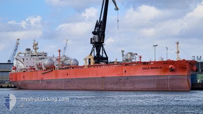
EAGLE BRASILIA
Tanker
Current Trip
| Time Travelled | 16 days |
|---|---|
| Remaining Time | --- |
| Distance Travelled | 1953.03 nm |
| Remaining Distance | --- |
| AVG Speed | 10.6 Knop |
| MAX Speed | 14.4 Knop |
| AVG Wind | 8.2 knots |
| MAX Wind | 29.3 knots |
| MIN Temp | 8.4°C / 47.12°F |
| MAX Temp | 24.6°C / 76.28°F |
| Djupgående | 8.8 m |
| Position mottagen | 14 h, 30 m sen |
Current Position
| Longitud | 10.56080° |
|---|---|
| Latitude | 37.68309° |
| Status | Under way using engine |
| Fart | 13 Knop |
| Kurs | 283.6° |
| Område | Mediterranean Sea - Western Basin |
| Station | T-AIS |
| Position mottagen | 14 h, 30 m sen |
Information
The current position of EAGLE BRASILIA is in Mediterranean Sea - Western Basin with coordinates 37.68309° / 10.56080° as reported on 2025-03-10 15:56 by AIS to our vessel tracker app. The vessel's current speed is 13 Knop and is heading at the port of ES SIDER. The estimated time of arrival as calculated by MyShipTracking vessel tracking app is 2025-03-05 01:00 LT
The vessel EAGLE BRASILIA (IMO: 9795062, MMSI: 563074600) is a Tanker It's sailing under the flag of [SG] Singapore.
In this page you can find informations about the vessels current position, last detected port calls, and current voyage information. If the vessels is not in coverage by AIS you will find the latest position.
The current position of EAGLE BRASILIA is detected by our AIS receivers and we are not responsible for the reliability of the data. The last position was recorded while the vessel was in Coverage by the Ais receivers of our vessel tracking app.
The current draught of EAGLE BRASILIA as reported by AIS is 8.8 meters
Weather
| Temperature | 15.3°C / 59.54°F |
|---|---|
| Wind Speed | 10 knots |
| Direction | 225° SW |
| Pressure | 1007.5 hPa |
| Humidity | 84.4 % |
| Cloud Coverage | 3 % |
Featured Company
Last Port Calls
| Port | Arrival | Departure | Time In Port |
|---|---|---|---|
| 2025-02-21 15:26 | 2025-02-22 18:30 | 1 d | |
| 2025-02-10 00:46 | 2025-02-11 04:57 | 1 d | |
| 2025-02-06 12:04 | 2025-02-07 14:45 | 1 d | |
| 2025-01-30 07:36 | 2025-01-31 11:39 | 1 d | |
| 2025-01-23 17:39 | 2025-01-26 16:36 | 2 d | |
| 2025-01-09 17:58 | 2025-01-11 03:33 | 1 d | |
| 2025-01-04 10:04 | 2025-01-05 13:24 | 1 d |
Most Visited Ports (Last year)
| Port | Arrivals | |
|---|---|---|
| 6 | ||
| 3 | ||
| 2 | ||
| 2 | ||
| 2 | ||
| 2 |
Last Trips
| Origin | Departure | Destination | Arrival | Distance | |
|---|---|---|---|---|---|
| 2025-02-11 05:57 | 2025-02-21 16:26 | 1828.94 nm | |||
| 2025-02-07 15:45 | 2025-02-10 01:46 | 656.22 nm | |||
| 2025-01-31 12:39 | 2025-02-06 13:04 | 1068.18 nm | |||
| 2025-01-26 17:36 | 2025-01-30 08:36 | 939.97 nm | |||
| 2025-01-11 04:33 | 2025-01-23 18:39 | 1080.39 nm | |||
| 2025-01-05 13:24 | 2025-01-09 18:58 | 1047.08 nm | |||
| 2024-12-31 14:23 | 2025-01-04 10:04 | 667.20 nm |
Events
| Tid | Event | Detaljer | Position / Dest | Information |
|---|---|---|---|---|
| 2025-03-10 15:59 | Status ändrad | Default Under way using engine |
37.68585 / 10.54586
ES SIDER
|
Fart: 13 kn Kurs: 283.6° |
| 2025-03-10 15:56 | UTANFÖR täckningsområde |
37.68309 / 10.56080
Mediterranean Sea - Western Basin
|
Fart: 13 kn Kurs: 283.6° |
|
| 2025-03-10 15:55 | Status ändrad | Under way using engine Default |
37.68294 / 10.56161
ES SIDER
|
Fart: 13.1 kn Kurs: 283° |
| 2025-03-10 15:46 | Status ändrad | Default Under way using engine |
37.67546 / 10.60163
ES SIDER
|
Fart: 13 kn Kurs: 283° |
| 2025-03-10 15:40 | Status ändrad | Under way using engine Default |
37.67046 / 10.62884
ES SIDER
|
Fart: 13 kn Kurs: 282° |
| 2025-03-10 15:32 | Status ändrad | Default Under way using engine |
37.66417 / 10.66401
ES SIDER
|
Fart: 12.9 kn Kurs: 282.8° |
| 2025-03-10 15:21 | Status ändrad | Under way using engine Default |
37.65546 / 10.71255
ES SIDER
|
Fart: 12.9 kn Kurs: 283° |
| 2025-03-10 15:15 | Status ändrad | Default Under way using engine |
37.65043 / 10.73966
ES SIDER
|
Fart: 12.9 kn Kurs: 283.6° |
| 2025-03-10 14:46 | Byter havsområde | Tunisian part of the Mediterranean Sea - Western Basin Tunisian part of the Mediterranean Sea - Eastern Basin |
37.60851 / 10.86139
Mediterranean Sea - Western Basin
|
Fart: 13.1 kn Kurs: 300.8° |
| 2025-03-10 14:46 | Status ändrad | Under way using engine Default |
37.60851 / 10.86139
ES SIDER
|
Fart: 13.1 kn Kurs: 300° |